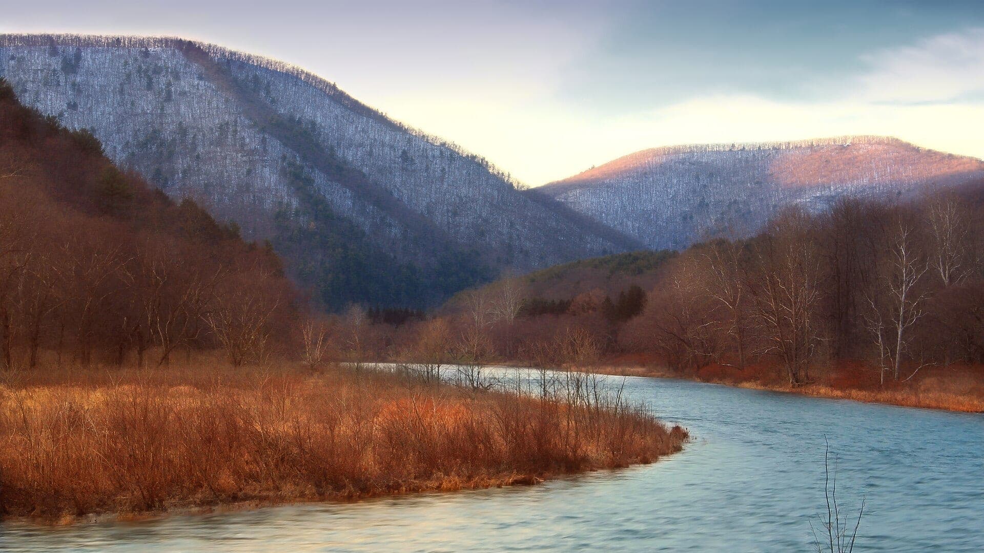
Pine Creek curving through a forested Pennsylvania valley

Official River Sourcebook · Directory generated August 10, 2026

Official sources for 459 fly‑fishing rivers.

Find the agencies, gauges, rules, closure pages, and public-access sources to check for the water you are planning to fish.

459canonical river reports, organized around six questions: flow, weather, access, regulations, closures, and conservation.
Pine Creek is one listed river—not a picture of nationwide coverage.
Photo: Nicholas A. Tonelli · cropped and color-adjusted CC BY 2.0
What this directory covers

These are BlueStreamFly's 459 fly-fishing report routes across 38 states. The list includes trout, steelhead, salmon, and mixed or warmwater destinations. It is not a census of U.S. trout streams, legal advice, or proof that a river is open.

Use it in three steps

Start with the decision—not the dataset.

A link is useful only when you know what it can answer. Source scope, review date, and limitations stay next to the agency link.

01

Choose the river and reach.

Open the matching report first. One route can include several reaches with different access, rules, and conditions.
02

Open the source for your question.

Use a gauge for flow, a forecast for weather, and the issuing agency for rules, closures, or land status.

03

Verify before leaving.

Review dates are transparent. A missing or overdue source stays marked for verification instead of becoming a confident answer.

State authorities

Go straight to the agency that sets the rules.

Regulation and closure links stay separate from BlueStreamFly fishing advice. Dates describe our source review, not a promise that nothing has changed since.

Alaska9 river reportsState source · Checked August 10, 2026

Alaska Department of Fish and Game

state fish wildlife · Checked August 10, 2026 · Review by August 17, 2026

Emergency orders are organized by region and fishery; confirm the affected water and order language directly.

Arizona8 river reportsState source · Verify authority

Arizona Game and Fish Department

state fish wildlife · Verify authority

No dedicated statewide freshwater-closure feed was validated for this release; use the official regulations page and current agency notices, and verify local land-manager restrictions.

Arkansas7 river reportsState source · Checked August 10, 2026

Arkansas Game and Fish Commission

state fish wildlife · Checked August 10, 2026 · Review by September 9, 2026

The statewide regulation authority does not prove that a particular water is open; verify waterbody rules and posted access notices.

California48 river reportsState source · Checked August 10, 2026

California Department of Fish and Wildlife

state fish wildlife · Checked August 10, 2026 · Review by August 17, 2026

The closures page spans multiple fishery and emergency actions; only an entry naming the affected water or reach establishes a closure.

Colorado58 river reportsState source · Checked August 10, 2026

Colorado Parks and Wildlife

state fish wildlife · Checked August 10, 2026 · Review by September 9, 2026

Posted boundaries determine the closed water; do not treat the entire Dream Stream as automatically closed. The brochure and codified rules include permanent and seasonal restrictions; temporary land-manager or county access orders may appear elsewhere and must be checked separately. The official rule supports the recurring date text, but the closure applies only where portions are posted; no active or scheduled whole-reach status is inferred.

Connecticut2 river reportsState source · Checked August 10, 2026

Connecticut Department of Energy and Environmental Protection

state fish wildlife · Checked August 10, 2026 · Review by September 9, 2026

This is the official river-and-stream regulation authority, not an affirmative statewide open-status feed.

Georgia2 river reportsState source · Checked August 10, 2026

Georgia Department of Natural Resources Wildlife Resources Division

state fish wildlife · Checked August 10, 2026 · Review by September 9, 2026

Federal land managers may impose separate access or safety closures on waters within national forests and parks.

Idaho33 river reportsState source · Checked August 10, 2026

Idaho Department of Fish and Game

state fish wildlife · Checked August 10, 2026 · Review by September 9, 2026

Anadromous fisheries can change by emergency action; verify current species- and river-specific season pages in addition to the general rules.

Indiana2 river reportsState source · Checked August 10, 2026

Indiana Department of Natural Resources

state fish wildlife · Checked August 10, 2026 · Review by September 9, 2026

The official guide is a regulation source, not proof of current site access or the absence of a posted local closure.

Kentucky1 river reportState source · Checked August 10, 2026

Kentucky Department of Fish and Wildlife Resources

state fish wildlife · Checked August 10, 2026 · Review by September 9, 2026

Generation hazards, federal facility restrictions, and local access closures require separate official checks.

Maine9 river reportsState source · Checked August 10, 2026

Maine Department of Inland Fisheries and Wildlife

state fish wildlife · Checked August 10, 2026 · Review by September 9, 2026

Special fishing laws are water-specific; the index is an authority entry point and does not establish an open status for every water.

Maryland5 river reportsState source · Checked August 10, 2026

Maryland Department of Natural Resources

state fish wildlife · Checked August 10, 2026 · Review by September 9, 2026

Use the official regulation index and water-specific notices; park, watershed, or federal access orders may be separate.

Massachusetts6 river reportsState source · Verify authority

Massachusetts Division of Fisheries and Wildlife

state fish wildlife · Verify authority

The regulations page does not certify current access, dam-release safety, or the absence of municipal restrictions.

Michigan16 river reportsState source · Verify authority

Michigan Department of Natural Resources

state fish wildlife · Verify authority

Statewide fire and land-access alerts are separate from fishing rules and do not establish a river closure unless the affected place is named.

Minnesota5 river reportsState source · Checked August 10, 2026

Minnesota Department of Natural Resources

state fish wildlife · Checked August 10, 2026 · Review by September 9, 2026

Boundary-water, park, and federal notices may add restrictions beyond the statewide fishing regulation source.

Missouri3 river reportsState source · Checked August 10, 2026

Missouri Department of Conservation

state fish wildlife · Checked August 10, 2026 · Review by September 9, 2026

Trout parks and special waterbodies have specific pages; the statewide authority is not an open-status declaration.

Montana26 river reportsState source · Checked August 10, 2026

Montana Fish, Wildlife and Parks

state fish wildlife · Checked August 10, 2026 · Review by August 13, 2026

FWP names the entire Jefferson River, including the full report corridor. Restriction listings must be matched to the named water and reach; a state page with no matching entry is not represented here as a legal open finding. The affected reach substantially overlaps the Camp Baker-to-Eden report corridor; the restriction remains time-specific. The BlueStreamFly report includes Livingston and Paradise Valley; this notice begins at Livingston and does not apply upstream. The Camp Baker-to-Eden report corridor lies within the named fork-confluence-to-Eden reach. The Darby-to-middle-river report corridor lies within the official mainstem reach. The Deer Lodge report corridor lies within the official Upper Clark Fork origin-to-Flint Creek reach. The Dillon report includes downstream water, but also covers reaches upstream of Highway 41 and Beaverhead Rock. The Goldcreek report corridor lies within the official Upper Clark Fork origin-to-Flint Creek reach. The lower Beaverhead report corridor lies within Highway 41 and Beaverhead Rock to the Big Hole confluence. The notice is a time-of-day restriction, not a statement that fishing is prohibited all day. The report includes lower Blackfoot water, but the construction restriction closes floating only on the named Weigh Station-to-I-90 reach. The report includes Paradise Valley upstream of Livingston; only Livingston downstream is restricted. The restriction applies only to the Upper Clark Fork through the mouth of Flint Creek; it does not reach Missoula or the Lower Clark Fork. The restriction is limited to the named reach and hours; the listing does not establish conditions outside that reach or time. The West Yellowstone report covers the Montana reach from the park boundary toward Hebgen Reservoir. This applies to the mainstem reach named by FWP, not every Bitterroot tributary. This is a floating restriction caused by construction, not a fishing or heat closure; it applies only to the named reach. This route mapping covers the Madison reach near West Yellowstone outside the park; it does not apply the Montana notice to Yellowstone National Park water.

Nevada1 river reportState source · Checked August 10, 2026

Nevada Department of Wildlife

state fish wildlife · Checked August 10, 2026 · Review by September 9, 2026

The biennial regulation document does not prove current river access or the absence of a later commission or land-manager action.

New Hampshire7 river reportsState source · Verify authority

New Hampshire Fish and Game Department

state fish wildlife · Verify authority

Verify waterbody seasons and any land-manager notices; the rules page is not an affirmative open-status feed.

New Jersey5 river reportsState source · Checked August 10, 2026

New Jersey Department of Environmental Protection Fish and Wildlife

state fish wildlife · Checked August 10, 2026 · Review by September 9, 2026

The annual digest contains seasonal and water-specific rules; later official notices and posted closures still control.

New Mexico8 river reportsState source · Checked August 10, 2026

New Mexico Department of Game and Fish

state fish wildlife · Checked August 10, 2026 · Review by September 9, 2026

Fire, forest, tribal, and land-manager closures can be separate from state fishing rules and must be verified for the planned access.

New York17 river reportsState source · Checked August 10, 2026

New York State Department of Environmental Conservation

state fish wildlife · Checked August 10, 2026 · Review by September 9, 2026

Regional special regulations and emergency notices must be checked for the named water; this page is not an affirmative statewide open status.

North Carolina10 river reportsState source · Checked August 10, 2026

North Carolina Wildlife Resources Commission

state fish wildlife · Checked August 10, 2026 · Review by September 9, 2026

Public Mountain Trout Waters classifications and federal or tribal rules can add water-specific restrictions.

Ohio5 river reportsState source · Checked August 10, 2026

Ohio Department of Natural Resources Division of Wildlife

state fish wildlife · Checked August 10, 2026 · Review by September 9, 2026

Local park and access authorities can close facilities independently of statewide fishing regulations.

Oklahoma1 river reportState source · Checked August 10, 2026

Oklahoma Department of Wildlife Conservation

state fish wildlife · Checked August 10, 2026 · Review by September 9, 2026

Verify the Lower Mountain Fork waterbody page, generation safety, and posted access in addition to statewide trout regulations.

Oregon17 river reportsState source · Checked August 10, 2026

Oregon Department of Fish and Wildlife

state fish wildlife · Checked August 10, 2026 · Review by August 17, 2026

Updates are organized by zone and water; match the named water and effective dates and separately verify land-manager access closures.

Pennsylvania22 river reportsState source · Checked August 10, 2026

Pennsylvania Fish and Boat Commission

state fish wildlife · Checked August 10, 2026 · Review by September 9, 2026

Special regulation waters, state-park access, and federal notices require water-specific verification; this registry does not infer open status.

South Carolina6 river reportsState source · Checked August 10, 2026

South Carolina Department of Natural Resources

state fish wildlife · Checked August 10, 2026 · Review by September 9, 2026

National-forest, border-water, and facility access restrictions may be issued outside the statewide fishing information page.

South Dakota13 river reportsState source · Checked August 10, 2026

South Dakota Game, Fish and Parks

state fish wildlife · Checked August 10, 2026 · Review by September 9, 2026

The handbook and regulation page do not establish current trail, fire, or municipal access status.

Tennessee10 river reportsState source · Verify authority

Tennessee Wildlife Resources Agency

state fish wildlife · Verify authority

Tailwater generation, national-park rules, and facility access restrictions require separate official checks.

Texas9 river reportsState source · Checked August 10, 2026

Texas Parks and Wildlife Department

state fish wildlife · Checked August 10, 2026 · Review by September 9, 2026

Municipal, river-authority, and leased-access closures can be separate from statewide freshwater fishing rules.

Utah9 river reportsState source · Checked August 10, 2026

Utah Division of Wildlife Resources

state fish wildlife · Checked August 10, 2026 · Review by August 17, 2026

The guidebook update page is a verification source; only a current entry naming a water or reach establishes a change or closure.

Vermont6 river reportsState source · Verify authority

Vermont Fish and Wildlife Department

state fish wildlife · Verify authority

Confirm water-specific rules and posted access; the regulation page is not represented as proof that all waters are open.

Virginia16 river reportsState source · Checked August 10, 2026

Virginia Department of Wildlife Resources

state fish wildlife · Checked August 10, 2026 · Review by September 9, 2026

Special regulation trout waters, tidal authorities, national parks, and access managers can impose separate rules.

Washington22 river reportsState source · Checked August 10, 2026

Washington Department of Fish and Wildlife

state fish wildlife · Checked August 10, 2026 · Review by August 13, 2026

Emergency rules are water-, species-, and date-specific; a missing matching entry is not converted into an open finding.

West Virginia10 river reportsState source · Checked August 10, 2026

West Virginia Division of Natural Resources

state fish wildlife · Checked August 10, 2026 · Review by September 9, 2026

State-park, national-forest, and access notices can apply independently of statewide fishing regulations.

Wisconsin13 river reportsState source · Checked August 10, 2026

Wisconsin Department of Natural Resources

state fish wildlife · Checked August 10, 2026 · Review by August 24, 2026

The new-regulations page is not a live open-status feed; water-specific emergency or access notices still require direct confirmation.

Wyoming12 river reportsState source · Checked August 10, 2026

Wyoming Game and Fish Department

state fish wildlife · Checked August 10, 2026 · Review by August 13, 2026

The agency notice is voluntary and reach-specific. Its missing agency end is preserved; the operational review deadline removes it from the active view unless reverified. The annual rule supports a 2026 evaluation from the start of October 1 through the end of December 31 in Wyoming local time; the reach remains narrowly scoped. The full Snake River report corridor lies between the park boundary and Palisades Reservoir. The listed advisory begins 4.6 river miles below Fontenelle Dam and is not a statutory whole-river closure. The official fishing-heat page and individual notices must be matched to the exact water, reach, and time; a missing matching item is not an open finding. The Warren Bridge report corridor lies within the forest-boundary-to-Fontenelle reach. This closure does not extend to the full Fontenelle-to-Seedskadee corridor. This is an agency-requested voluntary catch-and-release pause, not a statutory fishing closure; sunrise must be resolved for the local date before time-scoped suppression. This is an agency-requested voluntary catch-and-release pause, not a statutory fishing closure; the named reach includes the Warren Bridge report corridor. WGFD names Flat Creek without a narrower reach, including the report corridor.

River source directory

Find the links to check before you fish.

Search by river, state, agency, or source host. A reviewed link means we checked the source relationship—not that every reach is open or unchanged.

459 rivers · source details load only when requested

The state authorities and complete river-name index are already on this page. Open the detailed directory to search all source records and decision coverage without making a database request.

All river reports

Browse every river without loading the dataset.

Open a state to find its complete canonical report list. These are plain links, so the directory remains useful with JavaScript unavailable.

Alaska9 rivers
Arizona8 rivers
Arkansas7 rivers
California48 rivers
Colorado58 rivers
Connecticut2 rivers
Georgia2 rivers
Idaho33 rivers
Indiana2 rivers
Kentucky1 river
Maine9 rivers
Maryland5 rivers
Massachusetts6 rivers
Michigan16 rivers
Minnesota5 rivers
Missouri3 rivers
Montana26 rivers
Nevada1 river
New Hampshire7 rivers
New Jersey5 rivers
New Mexico8 rivers
New York17 rivers
North Carolina10 rivers
Ohio5 rivers
Oklahoma1 river
Oregon17 rivers
Pennsylvania22 rivers
South Carolina6 rivers
South Dakota13 rivers
Tennessee10 rivers
Texas9 rivers
Utah9 rivers
Vermont6 rivers
Virginia16 rivers
Washington22 rivers
West Virginia10 rivers
Wisconsin13 rivers
Wyoming12 rivers

How to read this directory

The gaps are part of the answer.

Sourcebook v1 keeps official links, decision coverage, freshness, reach limits, and privacy rules visible instead of filling gaps with guesses. Read the research export terms

01

Reviewed does not mean open.

It means the linked source and its relationship to the planning question were reviewed. Always read the agency page.

02

Missing remains missing.

A generic regulation page is not silently promoted into an emergency-closure feed, and a text access note is not an official access source.

03

No access coordinates.

Weather forecast points are never presented as fishing access. Sourcebook v1 publishes no access pins, private spots, photo locations, or private notes.

04

Corrections stay open.

Every river record includes a correction path. Send public-source and reach corrections without sharing private locations.

Ready to plan?

Use the source, then make the fishing decision.

Find a river report