WadeNot advised
Wading is the most sensitive plan today. Use protected edges only, avoid crossings, and downgrade quickly if clarity or current feels wrong.
Fly fishing report · West
A Merced River report for Yosemite-to-Briceburg planning, reach-specific regulations, spring runoff safety, BLM access, hatch timing, and practical flies.
Check flow & weatherCurrent USGS flow is 35 cfs and has been stable for about 6 hours. Today's flow is below the normal seasonal range, which begins near 53 cfs. This is below normal, so edge depth, temperature, and pressure matter.
Compare wading, bank fishing, and floating before choosing how you will fish.
Wading is the most sensitive plan today. Use protected edges only, avoid crossings, and downgrade quickly if clarity or current feels wrong.
Bank and edge fishing is the safer default when water is high, pushy, or not fully verified.
A float can fit better than wading only if launches, shuttle, boat skill, wind, and local rules all check out.
Check before you drive
Look at whether the river is rising or falling, then check wind, rain, and storms. These can change both safety and fishing.
Before you rely on this report
Conditions can change quickly. Check these dates before you decide to fish, and open the official source when safety or rules matter.
High confidence in the current score inputs.
7 sources are listed below for you to open.
4 public access records are listed. Private spots are never shown.
Source checked Jul 30, 2026
Plan your access
These are public parking, launch, trail, or recreation areas—not secret fishing spots. We never show an angler's private pins, notes, or photos here.
Area description
Park rules, seasonal access, and runoff conditions matter. Check NPS before fishing.
Yosemite National Park rules and CDFW rules are not interchangeable.
Briceburg Road and canyon recreation sites can have closures, reservations, or seasonal issues.
Roadside access
Useful for flow and park-reach planning, especially during runoff.
Yosemite National Park rules and CDFW rules are not interchangeable.
Briceburg Road and canyon recreation sites can have closures, reservations, or seasonal issues.
Public land
A major public planning area with campgrounds, road conditions, trails, and heat exposure.
Yosemite National Park rules and CDFW rules are not interchangeable.
Briceburg Road and canyon recreation sites can have closures, reservations, or seasonal issues.
Area description
Rules can be very different from Yosemite trout water. Use CDFW reach boundaries.
Yosemite National Park rules and CDFW rules are not interchangeable.
Briceburg Road and canyon recreation sites can have closures, reservations, or seasonal issues.
How to fish it
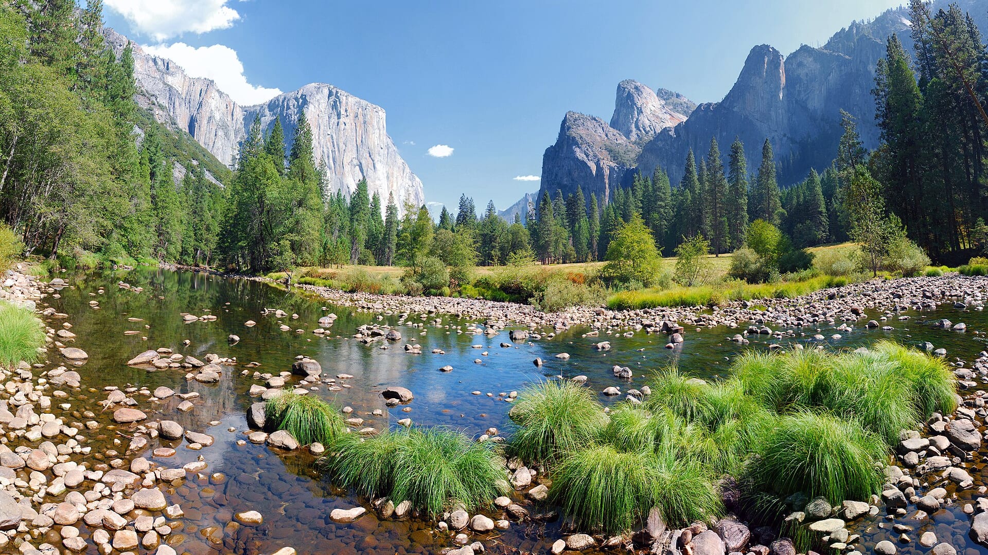
The Merced changes character from Yosemite headwater scenery to lower canyon and anadromous habitat. Regulations, access, and fish species change by reach, so this page treats the river as a planning system rather than one uniform trout stream.
USGS shows 35 cfs with a stable over about 6 hours trend. Today's flow is below the normal seasonal range, which begins near 53 cfs. This is below normal, so edge depth, temperature, and pressure matter.
A heat alert is active near this forecast point, so the score is capped at caution until water temperature and fish-handling risk are checked. NWS alert: Heat Advisory issued August 2 at 1:47PM PDT until August 3 at 11:00PM PDT by NWS Hanford CA.
Float: A float can fit better than wading only if launches, shuttle, boat skill, wind, and local rules all check out.
Early summer: Post-peak runoff can open useful trout and hatch windows, especially in cooler reaches.
USGS water temperature is about 63F, with no heat stop triggered.
Read the water
The Merced is most useful when you match the day to the reach. In Yosemite, think access, park rules, and runoff. In the canyon, think flow, heat, BLM logistics, and CDFW's reach-specific regulation boundaries.
Use stealth, long leaders, small dries, and shade-line presentations. Watch temperature.
Nymph edges, softer pockets, and side channels while staying out of dangerous main current.
Skip wading. The river can be cold, powerful, and unforgiving during snowmelt.
Fish early, carry water, and stop trout fishing if temperatures or handling conditions are poor.
Your trip plan
Use the upper-river trend as a warning system more than as a magic target. Once runoff begins to settle, pocket water and softer edges become worth the effort; when snowmelt is still pushing hard or the lower canyon is baking in heat, the best move is often to wait or switch rivers.
Skip the Merced during hard spring runoff, when Yosemite or Briceburg access is restricted, when canyon heat makes trout handling suspect, or when you have not sorted out whether park rules or lower-river regulations apply to your exact destination.
Choose Yosemite if you want cooler scenery-driven pocket water and can work within park rules, or choose the Briceburg corridor if you want BLM canyon access and accept the hotter, more exposed lower-canyon day. Fish one reach with purpose instead of driving the whole drainage in search of a generic Merced answer.
If the Merced is too high, too hot, or too crowded, pivot to Hot Creek for a technical spring-creek day or to the San Joaquin if another reach-aware Sierra freestone plan fits the travel window better.
Hatches & flies
 Fly family · report suggests “BWO emerger”Blue-Winged Olive PatternsBWO describes a hatch group, not one fly. Nymph, emerger, dry, cripple, and spinner profiles must stay separate because they occupy different parts of the water column.See family guide ↗
 Fly family · report suggests “March brown”March Brown Dry FliesThis family includes traditional hackled, parachute, and Comparadun-style March Brown dries. Each exact construction rides differently and should be named when known.See family guide ↗+ 2 more reviewed guides in the Fly Box
  Fly family · report suggests “PMD dry”Pale Morning Dun PatternsPMD names an insect group, not one fly. Pale nymphs, trailing-shuck emergers, upright or low-riding duns, cripples, and spent-wing spinners stay visibly separate.See family guide ↗
 Fly pattern · report suggests “elk hair caddis”Elk Hair CaddisLook for a tented elk- or deer-hair wing, clipped hair head, dubbed body, rib, and hackle palmered along the body. The body color should be labeled because tiers often match different natural caddis colors.See photos & how to fish it ↗+ 2 more reviewed guides in the Fly Box
  Fly family · report suggests “Ant”Ant PatternsAnt patterns can be foam, fur-bodied, winged, or sunken. The narrow waist and paired body lobes matter more than one material recipe.See family guide ↗
 Fly family · report suggests “beetle”Beetle PatternsBeetle flies range from simple foam shells to hair-bodied and sunken forms. A rounded back and compact profile distinguish the family from ants and hoppers.See family guide ↗+ 3 more reviewed guides in the Fly Box Fly family · report suggests “BWO”Blue-Winged Olive PatternsBWO describes a hatch group, not one fly. Nymph, emerger, dry, cripple, and spinner profiles must stay separate because they occupy different parts of the water column.See family guide ↗
 Fly pattern · report suggests “zebra midge”Zebra MidgeLook for a very slim tapered thread body, evenly spaced contrasting wire rib, a small bead, and no tail or wing. The reviewed classic is black with silver wire and a silver bead. Red, olive, brown, glass-bead, jig-hook, resin-coated, or tailed forms must remain labeled variations rather than replacing the classic identity.See photos & how to fish it ↗+ 2 more reviewed guides in the Fly Box
 Choose Yosemite, Briceburg/canyon, or lower-river habitat before applying any rule summary.
Use the nearest relevant gauge instead of reading one flow number for the whole river.
During runoff, fish from the bank and avoid crossings.
Look for trout in soft edges, plunge-pool lips, and shaded pocket water.
Carry extra water and sun protection in the canyon.
Rules & closures
Open the agency page to confirm the exact river section, species, season, tackle rules, limits, and emergency closures.
Official links checkedWe checked the state source but did not find a clearly supported exception for this river. Check the official rules for the exact section you plan to fish.
This summary helps with trip planning. The linked agency rule is the one you must follow.
Updates from anglers
Recent observations from general areas of Merced River. We review every update before it appears and never publish exact fishing spots, private access details, or photo locations.
You can still use the river plan above. Check back later for recent observations from other anglers.
Where this report comes from
Fishing guidance checked: May 31, 2026
Site check: Jul 14, 2026. We regularly test report links, live scores, flow and weather data, and page loading. The content date changes only when the fishing guidance or its sources change.
Common questions
It depends on season and rules. Yosemite and Briceburg/canyon reaches are the main trout-planning anchors, while lower reaches have different anadromous regulations.
Use Happy Isles, Pohono, or other Merced gauges that match your reach. This page displays the RiverReports Happy Isles gauge for upper-river context.
Yes. The Merced can be cold, fast, and unsafe to wade during runoff even on warm days.
No. Check Yosemite National Park rules and CDFW reach-specific rules separately.