Wade49/100
Wading is the most sensitive plan today. Use protected edges only, avoid crossings, and downgrade quickly if clarity or current feels wrong.
Fly fishing report · Midwest
A Driftless-style Wisconsin report for Black Earth Creek, with USGS flow, DNR trout classification, fishery-area access, hatches, and careful runoff guidance.
Check flow & weatherCurrent USGS flow is 54 cfs and has been stable for about 6 hours. Today's flow is high for this date; the upper end of the normal range is near 43 cfs. Fishable water may exist, but do not rate it highly without a safe access, clarity, and wading or boat plan.
Compare wading, bank fishing, and floating before choosing how you will fish.
Wading is the most sensitive plan today. Use protected edges only, avoid crossings, and downgrade quickly if clarity or current feels wrong.
Bank and edge fishing is the safer default when water is high, pushy, or not fully verified.
This report does not describe this as a primary mode. Verify legal access, depth, launches, and retreat options before planning around it.
Check before you drive
Look at whether the river is rising or falling, then check wind, rain, and storms. These can change both safety and fishing.
Before you rely on this report
Conditions can change quickly. Check these dates before you decide to fish, and open the official source when safety or rules matter.
High confidence in the current score inputs.
9 sources are listed below for you to open.
3 public access records are listed. Private spots are never shown.
Source checked Jul 30, 2026
Plan your access
These are public parking, launch, trail, or recreation areas—not secret fishing spots. We never show an angler's private pins, notes, or photos here.
Area description
Primary DNR public-access anchor for the report.
Fishery-area access does not mean every bank is public.
Stay on durable paths and avoid cutting soft banks.
Roadside access
Useful orientation, but check signs before entering.
Fishery-area access does not mean every bank is public.
Stay on durable paths and avoid cutting soft banks.
Parking
Good planning area for flow, parking, and runoff checks.
Fishery-area access does not mean every bank is public.
Stay on durable paths and avoid cutting soft banks.
How to fish it
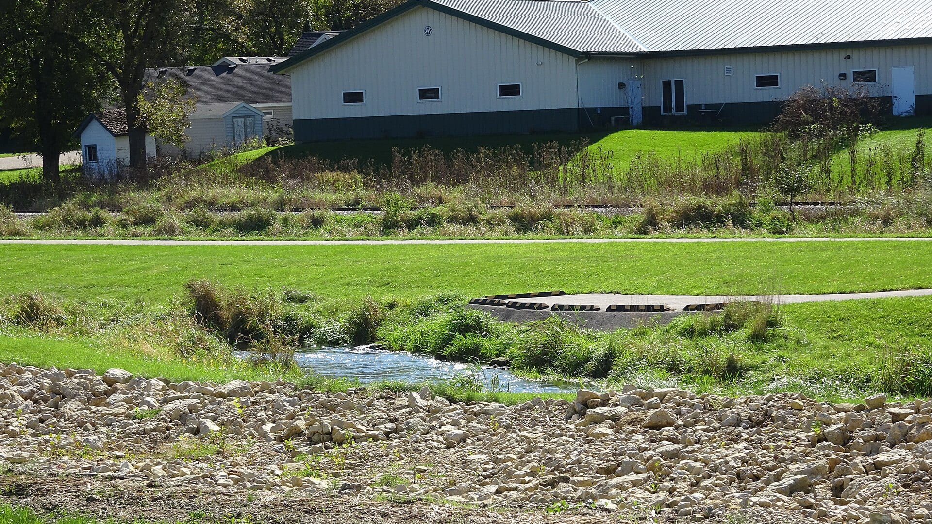
Black Earth Creek is a high-value Dane County trout stream, but it can react poorly to storm runoff. Use the Black Earth gauge, DNR trout maps, and fishery-area access before choosing a reach.
USGS shows 54 cfs with a stable over about 6 hours trend. Today's flow is high for this date; the upper end of the normal range is near 43 cfs. Fishable water may exist, but do not rate it highly without a safe access, clarity, and wading or boat plan.
Bank / edge: Bank and edge fishing is the safer default when water is high, pushy, or not fully verified.
Summer: Early mornings, tricos, terrestrials, and temperature checks.
The NWS forecast is about 77F with Mostly Clear.
No active NWS alert was returned for this forecast point.
Read the water
The best windows are stable spring flows, summer mornings with cool water, and fall terrestrial days. Heavy rain can make the creek dirty and less useful even when flow does not look extreme.
Use small dries, scuds, caddis pupa, and careful bank approaches.
Streamers and heavier nymphs can work once flow is falling.
Skip it; fish other water or wait for the creek to clear.
Check temperature and avoid trout handling when water gets stressful.
Your trip plan
Use RiverReports and USGS 05406500 at Black Earth for the live trend, then check clarity after storms. Stable clear water is best for small flies; falling stained water can support streamers.
Skip or change the plan when storm runoff makes the creek muddy, banks are too soft to protect, summer water is warm, the intended bank is not clearly public, or pressure is heavy at the only access.
Start with DNR fishery-area and trout-map context, then pair the RiverReports or USGS trend with one signed public access and a second reach before picking flies.
If Black Earth Creek is muddy, warm, crowded, or access-limited, compare West Fork Kickapoo River, Kinnickinnic River, or Rush River before forcing the same plan.
Hatches & flies
 Fly pattern · report suggests “Zebra midge”Zebra MidgeLook for a very slim tapered thread body, evenly spaced contrasting wire rib, a small bead, and no tail or wing. The reviewed classic is black with silver wire and a silver bead. Red, olive, brown, glass-bead, jig-hook, resin-coated, or tailed forms must remain labeled variations rather than replacing the classic identity.See photos & how to fish it ↗
 Fly family · report suggests “black stonefly”Black Stonefly PatternsBlack stonefly wording is a color and insect-group label, not one exact recipe. Size, nymph versus adult stage, wing profile, and weighting must remain explicit.See family guide ↗+ 3 more reviewed guides in the Fly Box
  Fly pattern · report suggests “Elk hair caddis”Elk Hair CaddisLook for a tented elk- or deer-hair wing, clipped hair head, dubbed body, rib, and hackle palmered along the body. The body color should be labeled because tiers often match different natural caddis colors.See photos & how to fish it ↗
 Fly family · report suggests “sulphur emerger”Sulphur Mayfly PatternsSulphur is hatch wording. Nymphs, emergers, Comparaduns, parachutes, traditional dries, soft hackles, and spinners have different silhouettes and depths.See family guide ↗+ 3 more reviewed guides in the Fly Box
  Fly pattern · report suggests “Trico spinner”Trico SpinnerThe reviewed dry form is extremely sparse and flat, using a black body or thread head and pale spent wing. A weighted Sunken Trico Spinner is a separate variant.See photos & how to fish it ↗
 Fly family · report suggests “foam ant”Ant PatternsAnt patterns can be foam, fur-bodied, winged, or sunken. The narrow waist and paired body lobes matter more than one material recipe.See family guide ↗+ 4 more reviewed guides in the Fly Box
  Fly family · report suggests “Midge pupa”Midge Patterns by StageMidge wording can mean a threadlike larva, wing-padded pupa, film emerger, tiny adult, or visible cluster. Those profiles fish at different depths.See family guide ↗
 Fly family · report suggests “scud”Scud Fly PatternsScud patterns typically use a curved hook, tapered dubbed body, shellback, rib segmentation, antennae, and brushed legs. Olive, tan, gray, orange, weighted, bead-body, and pregnant forms remain labeled—not aliases for one recipe.See family guide ↗+ 3 more reviewed guides in the Fly Box
 Walk slowly and fish from your knees or from back off the bank when water is low.
Use scuds and small nymphs under a yarn indicator in deeper slots.
Throw small streamers only after a safe stain or in low light.
Let trout settle after another angler moves through a popular access point.
Check water temperature before handling fish in July or August.
Rules & closures
Open the agency page to confirm the exact river section, species, season, tackle rules, limits, and emergency closures.
Official links checkedWe checked the state source but did not find a clearly supported exception for this river. Check the official rules for the exact section you plan to fish.
This summary helps with trip planning. The linked agency rule is the one you must follow.
Updates from anglers
Recent observations from general areas of Black Earth Creek. We review every update before it appears and never publish exact fishing spots, private access details, or photo locations.
You can still use the river plan above. Check back later for recent observations from other anglers.
Where this report comes from
Fishing guidance checked: Jun 1, 2026
Site check: Jul 14, 2026. We regularly test report links, live scores, flow and weather data, and page loading. The content date changes only when the fishing guidance or its sources change.
Common questions
Wisconsin trout rules, USGS flow, recent rain, fishery-area boundaries, easements, and water temperature
Use USGS 05406500 at Black Earth for live trend, then check clarity after rain before fishing small flies.
Start with the DNR Black Earth Creek Fishery Area and signed public easements near road crossings.
Yes in many reaches, but soft banks and undercuts make careful footing and bank protection important.