WadeNot advised
Wading is the most sensitive plan today. Use protected edges only, avoid crossings, and downgrade quickly if clarity or current feels wrong.
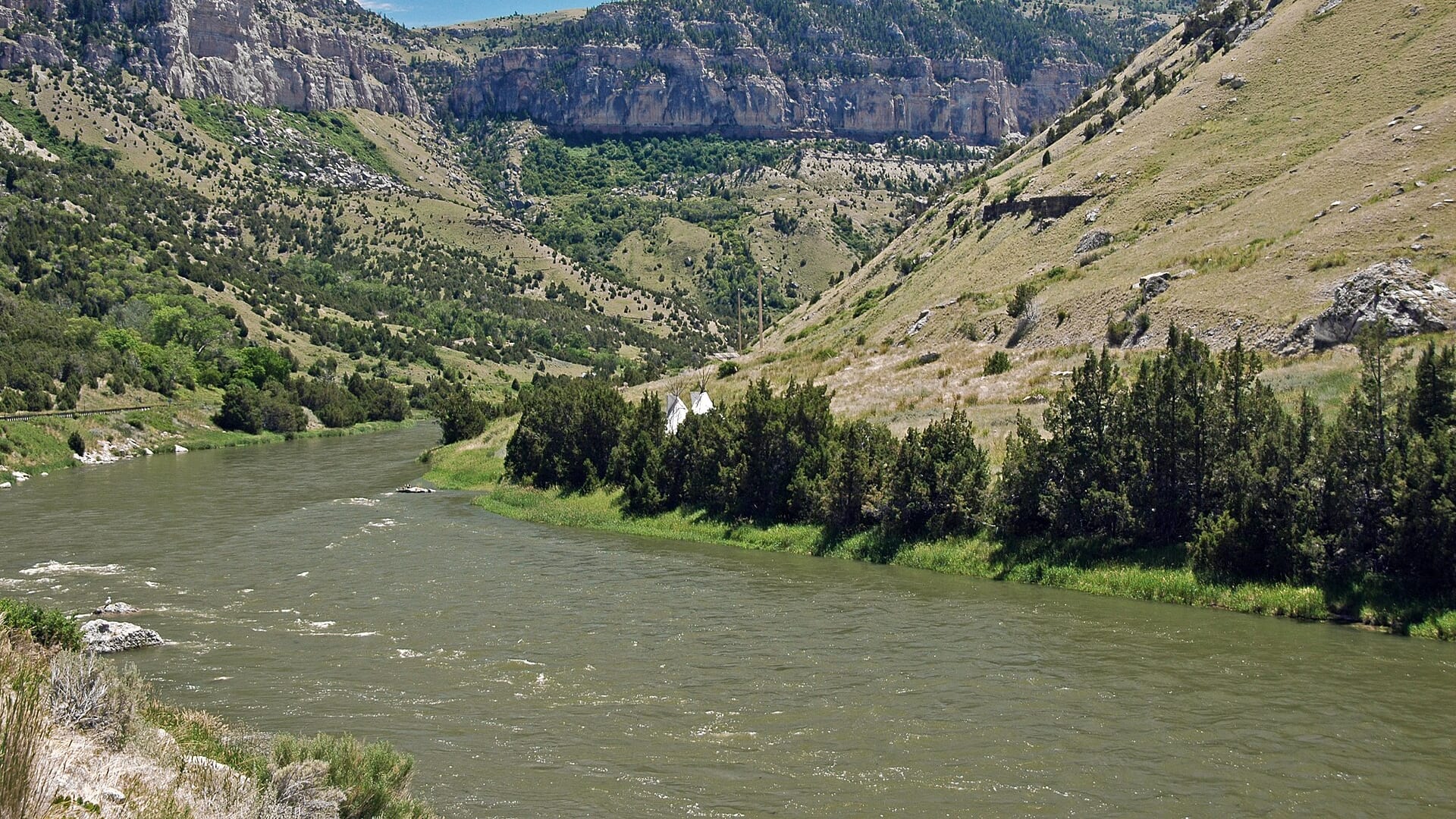
Fly fishing report · West
A Dubois-area upper Wind River report that avoids reservation/lower-river confusion and focuses on public access, USGS flow, and high-country trout tactics.
Check flow & weatherThe NWS forecast is near 85F. Fish early and verify water temperature where trout stress is possible.
Compare wading, bank fishing, and floating before choosing how you will fish.
Wading is the most sensitive plan today. Use protected edges only, avoid crossings, and downgrade quickly if clarity or current feels wrong.
Bank and edge fishing is the safer default when water is high, pushy, or not fully verified.
This report does not describe this as a primary mode. Verify legal access, depth, launches, and retreat options before planning around it.
Check before you drive
Look at whether the river is rising or falling, then check wind, rain, and storms. These can change both safety and fishing.
Before you rely on this report
Conditions can change quickly. Check these dates before you decide to fish, and open the official source when safety or rules matter.
High confidence in the current score inputs.
7 sources are listed below for you to open.
3 public access records are listed. Private spots are never shown.
Source checked Jul 30, 2026
Plan your access
These are public parking, launch, trail, or recreation areas—not secret fishing spots. We never show an angler's private pins, notes, or photos here.
Area description
WGFD public access context near Dubois; verify current signs and restrictions.
This page does not cover reservation fishing permission or lower Wind/Bighorn tailwater rules.
Public access can be reach-specific and should be verified before walking banks.
Area description
Another WGFD upper Wind access reference for reach planning.
This page does not cover reservation fishing permission or lower Wind/Bighorn tailwater rules.
Public access can be reach-specific and should be verified before walking banks.
Area description
Use USGS 06218500 before committing to pocket-water wading.
This page does not cover reservation fishing permission or lower Wind/Bighorn tailwater rules.
Public access can be reach-specific and should be verified before walking banks.
How to fish it
The useful Wind River report is the upper public-water plan near Dubois, not a vague mix of reservation water, Boysen tailwater, and Bighorn River naming changes. Use the Dubois gauge and WGFD access sources first.
The NWS forecast is near 85F. Fish early and verify water temperature where trout stress is possible.
A heat alert is active near this forecast point, so the score is capped at caution until water temperature and fish-handling risk are checked. NWS alert: Heat Advisory issued August 2 at 12:35AM MDT until August 2 at 10:00PM MDT by NWS Riverton WY.
Bank / edge: Bank and edge fishing is the safer default when water is high, pushy, or not fully verified.
USGS shows 128 cfs with a stable over about 6 hours trend. Today's flow is within the normal seasonal range of 102 cfs to 220 cfs. Weather, water temperature, and access are the next checks.
Summer: Most dependable dry-dropper and terrestrial season after runoff drops.
Read the water
Best fishing is usually after the main snowmelt push settles and before late-season cold or low water narrows the day. Have a backup plan when the Dubois gauge is rising fast.
Best all-around window for dries, dry-droppers, and nymphing.
Fish soft edges only if safe; otherwise wait for falling clarity.
Use smaller flies, longer leaders, and careful approaches.
Nymph deeper, slow down, or choose a lower-elevation backup.
Your trip plan
Use USGS 06218500 Wind River near Dubois as the primary live trend. Stable or slowly dropping flows after runoff are the best fit; high cold water, wind, or unclear public access should move the plan to short scouting or another river.
Skip the Wind when runoff makes crossings unsafe, when access boundaries are uncertain, when the plan drifts into reservation or private water without permission, or when weather makes an exposed upper-basin day impractical.
Keep the day near the upper Dubois scope. Use Dunoir or Sawmill public-access information as the planning anchors, the Dubois gauge for flow, and a separate rule check before treating downstream Wind or Bighorn water as part of the same trip.
If the upper Wind is high, cold, windy, or access-limited, compare the Shoshone near Cody, the Bighorn near Thermopolis, or the Snake River for a different Wyoming trout plan.
Hatches & flies
 Fly pattern · report suggests “Zebra midge”Zebra MidgeLook for a very slim tapered thread body, evenly spaced contrasting wire rib, a small bead, and no tail or wing. The reviewed classic is black with silver wire and a silver bead. Red, olive, brown, glass-bead, jig-hook, resin-coated, or tailed forms must remain labeled variations rather than replacing the classic identity.See photos & how to fish it ↗
 Fly family · report suggests “black stonefly”Black Stonefly PatternsBlack stonefly wording is a color and insect-group label, not one exact recipe. Size, nymph versus adult stage, wing profile, and weighting must remain explicit.See family guide ↗+ 3 more reviewed guides in the Fly Box
  Fly family · report suggests “Stonefly nymph”Stonefly Nymph PatternsStonefly nymph patterns generally emphasize two tails, a broad thorax, segmented abdomen, and bottom contact; rubber legs, biots, beads, and jig hooks define different exact forms.See family guide ↗
 Fly pattern · report suggests “Pat's rubber legs”Pat's Rubber LegsThe core Pat's Rubber Legs architecture is a long weighted stonefly nymph with a chenille body, two rubber tails, a pair of antennae, and multiple long flexible legs. Pat Bennett's documented 1995 form used true-brown chenille and true-olive Super Floss; coffee-and-black became a familiar later guide treatment. Beads, jig hooks, thoraxes, wing cases, articulated bodies, white legs, and other colors are explicit variations—not silent parts of one universal recipe.See photos & how to fish it ↗+ 3 more reviewed guides in the Fly Box
  Fly pattern · report suggests “Chubby Chernobyl”Chubby ChernobylIdentify the construction, not the color: a long foam overbody over a segmented dubbed underside, rubber legs at two tie-in stations, two distinct buoyant synthetic-yarn wing sections, and a short flash tail. The paired wing stations and layered foam-and-dubbing body separate the reviewed Chubby from the original Chernobyl Ant and from generic foam hoppers or beetles.See photos & how to fish it ↗
 Fly family · report suggests “hopper”Grasshopper PatternsHopper patterns share a substantial body and long rear-leg impression, but foam, deer hair, wing construction, and waterline differ widely among named patterns.See family guide ↗+ 4 more reviewed guides in the Fly Box
  Fly family · report suggests “BWO emerger”Blue-Winged Olive PatternsBWO describes a hatch group, not one fly. Nymph, emerger, dry, cripple, and spinner profiles must stay separate because they occupy different parts of the water column.See family guide ↗
 Fly family · report suggests “midge pupa”Midge Patterns by StageMidge wording can mean a threadlike larva, wing-padded pupa, film emerger, tiny adult, or visible cluster. Those profiles fish at different depths.See family guide ↗+ 3 more reviewed guides in the Fly Box
 Use the Dubois gauge trend to decide whether to fish edges, pockets, or skip high water.
Run a dry-dropper through broken pocket water once the river is clear and settled.
Use small streamers along undercut bends when flows are slightly up and safe.
Check access-area signs and avoid assuming downstream banks are open.
Carry bear spray and give yourself extra time on remote roads.
Rules & closures
Open the agency page to confirm the exact river section, species, season, tackle rules, limits, and emergency closures.
Official links checkedWe checked the state source but did not find a clearly supported exception for this river. Check the official rules for the exact section you plan to fish.
This summary helps with trip planning. The linked agency rule is the one you must follow.
Updates from anglers
Recent observations from general areas of Wind River. We review every update before it appears and never publish exact fishing spots, private access details, or photo locations.
You can still use the river plan above. Check back later for recent observations from other anglers.
Where this report comes from
Fishing guidance checked: Jun 1, 2026
Site check: Jul 14, 2026. We regularly test report links, live scores, flow and weather data, and page loading. The content date changes only when the fishing guidance or its sources change.
Common questions
WGFD Area 2 rules, access-area status, USGS Dubois flow, weather, snowmelt, and land boundaries
Use USGS 06218500 Wind River near Dubois for the upper page scope, with USGS 06220000 at Dubois as additional local context when needed.
Start with WGFD upper Wind public access areas such as Dunoir and Sawmill, then confirm posted boundaries and road conditions.
Yes at normal summer flows in suitable pocket water, but snowmelt and cold pushy current make conservative wading essential.