7-day U.S. Geological Survey chart
Recent flow
Discharge
5,960 cfs5,040 cfs
Oct 15Oct 22
Latest reading: 5,960 cfs. Rising over about 6 hours. Chart covers Oct 15 through Oct 22; readings are provisional and may be revised.
No single best way to fish. Wading, Bank fishing, and Floating have the same top score. Use current access, footing, weather, and local rules to choose.
Rating updatedRiver local time:
USGS shows 5,890 cfs. The flow has been stable over about 6 hours. USGS marks this reading provisional and may revise it. USGS records for this date (1914-2026, 113 readings) show a typical middle range of 4,570 cfs to 8,670 cfs. Flow is within the typical range for this date, so weather, temperature, and access become the next checks.
NWS air forecast near
This is an air forecast, not a river-temperature reading.
Discharge
Latest reading: 5,960 cfs. Rising over about 6 hours. Chart covers Oct 15 through Oct 22; readings are provisional and may be revised.
Areas Of Fog
The National Weather Service forecast is temporarily unavailable.
Current U.S. Geological Survey gauge: Wisconsin River at Muscoda
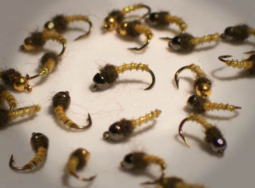
Seasonal starting points, not a live hatch report. Match what you see on the water.
Also try crayfish, hellgrammite, swimming nymph
Also try slider, cicada, crayfish
Also try crayfish, hellgrammite
Each fly name opens its matching Fly Box guide.
Stable summer and early fall flows are best for smallmouth poppers, crayfish, and baitfish streamers. High water, storms, or strong wind can make a float or sandbar plan a bad idea.
Fish poppers early, then crayfish and baitfish streamers around seams.
Use bank and boat caution. Sandbars shrink and current becomes powerful.
Longer casts, lighter streamers, and stealth around shallow bars help.
Avoid exposed sandbars and long floats when lightning or wind is likely.
Wading, Bank fishing, and Floating have the same top score. Use current access, footing, weather, and local rules to choose.
Wading is in play only where your chosen access has clear footing, legal entry, and no forced crossings.
Bank and edge fishing remains a practical low-commitment option if access is legal and footing is safe.
A float is in play where this report supports boat access and wind, releases, and shuttle logistics are manageable.
Is Wisconsin River worth the trip today? Check flow, weather, hatches, access, and rules for Wisconsin before you go.
The lower Wisconsin River is a broad warmwater fly-fishing plan for smallmouth, pike, musky, walleye, and mixed river fish. Use the Muscoda gauge, state riverway access, and weather before choosing a float or sandbar plan.
USGS shows 5,890 cfs. The flow has been stable over about 6 hours. USGS marks this reading provisional and may revise it. USGS records for this date (1914-2026, 113 readings) show a typical middle range of 4,570 cfs to 8,670 cfs. Flow is within the typical range for this date, so weather, temperature, and access become the next checks.
Fall: Streamer fishing improves as baitfish move and boat traffic drops.
The current NWS air forecast is about 44F, and the next 24-hour high reaches about 78F. Areas Of Fog.
No active NWS alert was returned for this forecast point.
Skip or shorten the plan when flows are rising, storms or wind threaten exposed sandbars, the takeout is uncertain, species rules are unclear, or fish-consumption advice has not been checked for harvest plans.
Use USGS 05407000 at Muscoda as the main lower-river trend, with USGS 05404000 near Wisconsin Dells only as upstream context. Stable summer and early fall flows are the easiest warmwater windows.
Skip or shorten the plan when flows are rising, storms or wind threaten exposed sandbars, the takeout is uncertain, species rules are unclear, or fish-consumption advice has not been checked for harvest plans.
Choose the reach and takeout first, then pair the Muscoda flow with Wisconsin rules, state-riverway access, weather, and one protected backup before selecting poppers, crayfish, or baitfish streamers.
If the Wisconsin is high, stormy, windy, crowded, or logistically difficult, compare Flambeau River, Tomorrow River, or Black Earth Creek before forcing the float.
Use these places as starting points. Open the access link below and check posted signs before you park or enter.
Check Wisconsin rules and fish-consumption advice before fishing the Wisconsin River, especially species seasons, musky rules, harvest limits, and any local closures or advisories.
Primary public planning context for lower-river access and stewardship.
Core flow and lower-river orientation for this report.
Useful upstream planning, but compare flow and dam influence before floating.
Official agencies and primary river operators come first. Secondary tools are labeled so you know what carries the most weight.
Check what is allowed, where the rule applies, and whether the river is open.
Check the latest river reading and forecast before you leave.
Check public entry points, land rules, and seasonal access changes.
Use these links for stocking, safety, and other local details.
Check what is allowed, where the rule applies, and whether the river is open.
Open the current rules and check the river section, season, and special limits.
Open the current fish eating advice and check which fish and waters it covers.
Open the current rules and check the river section, season, and special limits.
Check the latest river reading and forecast before you leave.
Open this page and check the latest safety advice before your trip.
Open this river reading to check the latest level, flow, and update time.
Open this river reading to check the latest level, flow, and update time.
Check public entry points, land rules, and seasonal access changes.
Open the land or access page, then check signs before you park or enter.
Use these links for stocking, safety, and other local details.
Open this page and check the latest safety advice before your trip.
What was checked: This report is maintained from current regulation, access, flow, weather, and public planning sources so anglers can make better trip decisions than a raw gauge or generic overview would allow.
Live measurements and forecasts keep their provider timestamps. Rules, access, and trip guidance use the source-review date shown here. BlueStreamFly planning advice is editorial interpretation, not an agency notice.
First-hand experience: BlueStreamFly does not claim a first-hand visit or local field test for this report unless a real contributor is explicitly named and linked.
Wisconsin rules, Muscoda flow, dam and weather trends, landing access, wind, and thunderstorms
Use USGS 05407000 at Muscoda for lower-river flow, and compare upstream context only if your float starts well above that reach.
Start with Lower Wisconsin State Riverway landings and match the float to flow, wind, and takeout timing.
Wade edges and sandbars carefully, but treat the main river as boat-and-bank water with real current and drop-off risk.