Wade, bank, and floatLimited data
Use the live sources and what you see at the river before choosing an approach.
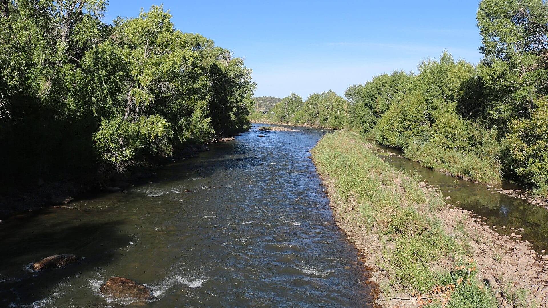
Fly fishing report · West
A Dolores River report for McPhee tailwater planning, release-dependent flows, artificial-only regulations, canyon access, hatches, and trip safety.
Check flow & weatherCurrent USGS flow is 1 cfs. It has fallen about 24% over the past 6 hours. Today's flow is unusually low for this date and below the usual low-water marker near 25 cfs. Low water can make fish spooky, warm, pressured, or concentrated; check temperature and handling risk.
There is not enough reliable current information to recommend wading, bank fishing, or floating.
Use the live sources and what you see at the river before choosing an approach.
Check before you drive
Look at whether the river is rising or falling, then check wind, rain, and storms. These can change both safety and fishing.
Before you rely on this report
Conditions can change quickly. Check these dates before you decide to fish, and open the official source when safety or rules matter.
High confidence in the current score inputs.
7 sources are listed below for you to open.
3 public access records are listed. Private spots are never shown.
Source checked Jul 30, 2026
Plan your access
These are public parking, launch, trail, or recreation areas—not secret fishing spots. We never show an angler's private pins, notes, or photos here.
Area description
Release-dependent tailwater planning near the dam and Dolores area.
McPhee releases can change the fishing more than the calendar.
Remote canyon sections need more planning than roadside tailwater water.
Area description
CPW access with current property and regulation context.
McPhee releases can change the fishing more than the calendar.
Remote canyon sections need more planning than roadside tailwater water.
Public land
BLM canyon and public-land planning for broader river access.
McPhee releases can change the fishing more than the calendar.
Remote canyon sections need more planning than roadside tailwater water.
How to fish it
The Dolores below McPhee can be a valuable trout fishery, but it is strongly shaped by reservoir releases and remote access. Check the current flow, CPW rules, and access sources before treating it like a normal freestone day.
USGS shows 1 cfs with a falling about 24% over about 6 hours trend. Today's flow is unusually low for this date and below the usual low-water marker near 25 cfs. Low water can make fish spooky, warm, pressured, or concentrated; check temperature and handling risk.
Coldwater targets are a poor choice in this heat window, but warmwater targets may still be reasonable where legal and ethical.
USGS water temperature is about 86F. Do not pressure trout or salmonids in warm water.
Summer: Early and late sessions can work if releases keep water cool enough.
No active NWS alert was returned for this forecast point.
Read the water
The Dolores is best when releases provide enough cool, clear water for ethical trout fishing. Very low flows, warm water, or remote travel risk should push you to a backup plan.
Use stealth, small flies, and avoid stressing trout in thin warm water.
Nymphs, dry-droppers, caddis, and small streamers can all be useful.
Treat wading and canyon travel conservatively; use bank water and safe access.
Check temperature and avoid trout-focused fishing when handling risk is high.
Your trip plan
Use the release trend first and the Bedrock gauge as broader downstream context. Stable cold releases are the best fit for trout fishing; abrupt changes, very low water, or warm lower-river conditions should end the idea quickly.
Skip the trip when McPhee releases leave the trout water too thin or warm, when access into the canyon becomes more of a travel problem than a fishing opportunity, or when the river you want is really the lower warm-water Dolores instead of the tailwater corridor.
Choose the mission before you drive: below-McPhee public trout water if you want the clearest release-driven plan, or a different drainage if the lower canyon is the only realistic option that day. Match flies and timing to the release trend instead of to a generic freestone idea.
If the Dolores is too low, too warm, or too release-sensitive, pivot to the Taylor River for a more controlled tailwater day or to the San Miguel when you want a freestone-style southwest Colorado backup.
Hatches & flies
 Fly pattern · report suggests “Zebra midge”Zebra MidgeLook for a very slim tapered thread body, evenly spaced contrasting wire rib, a small bead, and no tail or wing. The reviewed classic is black with silver wire and a silver bead. Red, olive, brown, glass-bead, jig-hook, resin-coated, or tailed forms must remain labeled variations rather than replacing the classic identity.See photos & how to fish it ↗
 Fly pattern · report suggests “RS2”RS2Start with the beadless architecture: two dark-dun Microfibett tails separated behind a slim, tightly twisted and visibly segmented dubbed abdomen; a fuller thorax; and saddle-hackle web clipped into a short angled wing bud. Rim Chung's original-style form uses natural beaver dubbing and hackle web. CDC- or Antron-wing ties, beads, curved hooks, flash, and tailless Avatar-style flies must remain labeled variations.See photos & how to fish it ↗+ 2 more reviewed guides in the Fly Box
  Fly family · report suggests “BWO emerger”Blue-Winged Olive PatternsBWO describes a hatch group, not one fly. Nymph, emerger, dry, cripple, and spinner profiles must stay separate because they occupy different parts of the water column.See family guide ↗
 Fly family · report suggests “caddis pupa”Caddis Pupa PatternsCaddis pupa is a life-stage family. Curved bodies, wing pads, legs, beads, and soft-hackle collars differ among exact patterns and must be labeled.See family guide ↗+ 2 more reviewed guides in the Fly Box
  Fly pattern · report suggests “Elk hair caddis”Elk Hair CaddisLook for a tented elk- or deer-hair wing, clipped hair head, dubbed body, rib, and hackle palmered along the body. The body color should be labeled because tiers often match different natural caddis colors.See photos & how to fish it ↗
 Fly family · report suggests “PMD”Pale Morning Dun PatternsPMD names an insect group, not one fly. Pale nymphs, trailing-shuck emergers, upright or low-riding duns, cripples, and spent-wing spinners stay visibly separate.See family guide ↗+ 3 more reviewed guides in the Fly Box Fly family · report suggests “BWO dry”Blue-Winged Olive PatternsBWO describes a hatch group, not one fly. Nymph, emerger, dry, cripple, and spinner profiles must stay separate because they occupy different parts of the water column.See family guide ↗Fly pattern · report suggests “zebra midge”Zebra MidgeLook for a very slim tapered thread body, evenly spaced contrasting wire rib, a small bead, and no tail or wing. The reviewed classic is black with silver wire and a silver bead. Red, olive, brown, glass-bead, jig-hook, resin-coated, or tailed forms must remain labeled variations rather than replacing the classic identity.See photos & how to fish it ↗+ 2 more reviewed guides in the Fly Box
 Check McPhee release context before choosing a reach.
Use small flies and careful approaches in low release periods.
Do not assume lower canyon flows match the tailwater plan.
Fish early and carry a thermometer in warm weather.
Plan access and exit before entering remote canyon sections.
Rules & closures
Open the agency page to confirm the exact river section, species, season, tackle rules, limits, and emergency closures.
Official links checkedWe checked the state source but did not find a clearly supported exception for this river. Check the official rules for the exact section you plan to fish.
This summary helps with trip planning. The linked agency rule is the one you must follow.
Updates from anglers
Recent observations from general areas of Dolores River. We review every update before it appears and never publish exact fishing spots, private access details, or photo locations.
You can still use the river plan above. Check back later for recent observations from other anglers.
Where this report comes from
Fishing guidance checked: May 31, 2026
Site check: Jul 14, 2026. We regularly test report links, live scores, flow and weather data, and page loading. The content date changes only when the fishing guidance or its sources change.
Common questions
It focuses on the below-McPhee trout plan and includes lower canyon context where flow and access differ.
McPhee Reservoir controls much of the below-dam fishability, so flow, temperature, and access can change sharply.
Carry midges, BWOs, caddis, PMDs, terrestrials, dry-droppers, and a few small streamers.
Avoid very low warm water, unsafe high releases, storm risk, and remote canyon trips without a clear access plan.