Menu
West · 58 river reports
Colorado fly fishing reports
Colorado is a core BlueStreamFly state because the inventory covers big freestones, technical tailwaters, Front Range creeks, high-country meadow streams, canyon water, and western slope rivers.
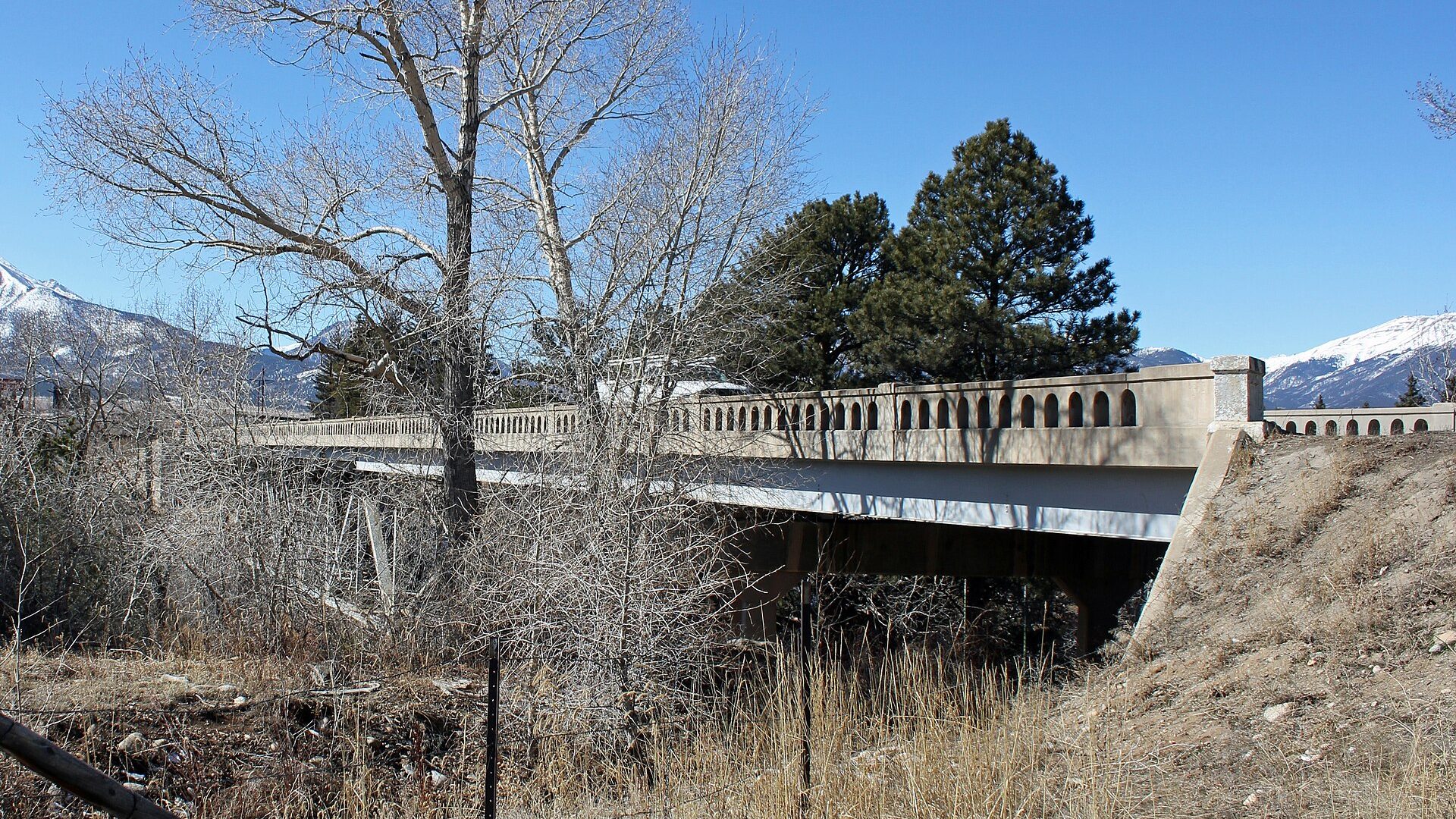
Compare riversArkansas River · Photo: Jeffrey Beall · CC BY 3.0 · Cropped for display; not current conditions.
Fishability now
Start with the strongest current read.
Scores combine current flow, weather, access, and season. Open a river to see which live data came back and how sure we are about today's call.
Fryingpan River
Fryingpan River looks very fishable right now.
Fishing-rating confidence: High · Score calculated Oct 11, 9:03 AM UTCCache La Poudre River
Cache La Poudre River looks very fishable right now.
Fishing-rating confidence: High · Score calculated Oct 11, 9:27 AM UTCTenmile Creek
Tenmile Creek looks very fishable right now.
Fishing-rating confidence: High · Score calculated Oct 11, 9:30 AM UTCChoose the right water
How to fish Colorado.
Colorado is a core BlueStreamFly state because the inventory covers big freestones, technical tailwaters, Front Range creeks, high-country meadow streams, canyon water, and western slope rivers.
The best Colorado state hub experience is comparison. An angler should be able to decide whether the Arkansas, Fryingpan, South Platte, Blue, Gunnison, Colorado, or a smaller creek fits the day before opening the detailed report.
Check Colorado Parks and Wildlife regulations and any reach-specific rules before fishing.
Runoff timing, reservoir releases, afternoon storms, ice, and warm water can all change the right river choice.
Use the state hub to separate technical tailwater plans from freestone and canyon plans.
Treat access notes seriously because public water, private frontage, canyon routes, and boat ramps vary widely by river.
All Colorado reports
Find your river.
Alphabetical for fast scanning. The current score stays visible so you can compare before opening the full report.
Animas River
A Durango-focused Animas River report for current flow checks, Gold Medal rules, town access, seasonal hatches, and practical fly choices.
Animas River is a cautious call right now.
Arkansas River
A practical upper Arkansas report for Salida and Browns Canyon planning, with flow context, hatch timing, access notes, tactics, weather, and official source links.
Arkansas River is a cautious call right now.
Arkansas River Tailwater
A Pueblo tailwater report for dam-release flows, winter trout windows, urban access, hatch timing, and special regulation checks.
Arkansas River Tailwater looks fishable right now.
Bear Creek
A Jefferson County Bear Creek report for Morrison-area access, low-flow planning, trout rules, small-stream tactics, and public-land cautions.
Bear Creek is a cautious call right now.
Big Laramie River
A Colorado-side Big Laramie report focused on Hohnholz, Laramie River Road, remote meadow water, flow checks, and careful access planning.
Big Laramie River needs a live-condition check before you commit.
Big Thompson
A practical Big Thompson plan built around Rocky Mountain National Park rules, Big Thompson Canyon access, RiverReports flow support, and trout-friendly seasonal timing.
Big Thompson is a cautious call right now.
Big Thompson at Drake
A reach-specific Big Thompson plan for the Drake canyon area, with flow checks, pullout access, pocket-water tactics, and safety notes.
Big Thompson at Drake is a cautious call right now.
Blue River
A Silverthorne-focused Blue River report for Dillon Dam releases, technical trout tactics, strict regulations, access, hatches, and flow checks.
Blue River looks fishable right now.
Boulder Creek
A Boulder Creek report for canyon and town access, catch-and-release reach planning, small-stream tactics, flow checks, and Front Range weather.
Boulder Creek looks fishable right now.
Cache La Poudre River
A practical Poudre report for canyon freestone flows, Fort Collins access, Forest Service corridor planning, and trout-safe seasonal tactics.
Cache La Poudre River looks very fishable right now.
Cimarron River
A Colorado Cimarron report focused on Silver Jack and Big Cimarron Road access, USGS/RiverReports flows, small-stream tactics, and source checks.
Cimarron River looks fishable right now.
Clear Creek near Golden fishing report
This report covers lower Clear Creek from Golden’s Vanover Park to Tunnel 1. Check CPW status, Golden flow, and exact-reach temperature before choosing access or flies.
Check the CPW advisory before fishing.
Colorado River
An upper Colorado River report for Parshall, Williams Fork, Kremmling, flow checks, trout tactics, seasonal closures, and access planning.
Colorado River looks fishable right now.
Colorado River Lower Colorado
A lower Colorado River report for Glenwood Canyon and Glenwood Springs planning, RiverReports/USGS flows, float access, hatches, and temperature checks.
Colorado River Lower Colorado does not look like a strong choice right now.
Colorado River Middle Colorado
A middle Colorado River report for Pumphouse, State Bridge, Catamount, float planning, RiverReports/USGS flows, hatches, and access rules.
Colorado River Middle Colorado looks fishable right now.
Conejos River
A practical Conejos River report for Mogote flow context, upper-river access, high-country hatches, and southern Colorado trip planning.
Conejos River needs a live-condition check before you commit.
Crystal River
A practical Crystal River plan built around the Redstone and Marble corridor, freestone runoff timing, White River National Forest access, and clear seasonal trout tactics.
Crystal River is a cautious call right now.
Dolores River
A Dolores River report for McPhee tailwater planning, release-dependent flows, artificial-only regulations, canyon access, hatches, and trip safety.
Dolores River is a cautious call right now.
Eagle River
A practical Eagle River report for the Avon, Edwards, Wolcott, and Gypsum corridor, with flow checks, access planning, hatches, and fly selection.
Eagle River is a cautious call right now.
Fraser River
A practical Fraser River plan built around RiverReports flow support, USGS Tabernash backing, valley trail access, and careful small-river trout timing.
Fraser River looks fishable right now.
Fryingpan River
A Basalt-area Fryingpan report for the Ruedi tailwater, mysis shrimp windows, technical hatches, public access, and source-checked regulations.
Fryingpan River looks very fishable right now.
Gore Creek
An East Vail Gore Creek planning page focused on trail-based access, clear-water presentations, runoff caution, and compact public-water sessions.
Gore Creek is a cautious call right now.
Gore Creek at Vail
A Vail-focused Gore Creek report built around small-water tactics, path access, upper-station flow context, public rules, and urban creek etiquette.
Gore Creek at Vail is a cautious call right now.
Gunnison Gorge of the Black Canyon
A source-checked Gunnison Gorge report for Black Canyon and Gunnison Gorge planning, with flows, access difficulty, hatches, flies, and safety notes.
Gunnison Gorge of the Black Canyon is a cautious call right now.
Homestead Creek
A Homestake Valley planning page built around Gold Park access, public-land constraints, flow checks, and high-country trout timing.
Homestead Creek is a cautious call right now.
Lake Creek
A high-elevation Lake Creek report for the Twin Lakes corridor, with flow checks, short-session tactics, access filters, and weather-aware planning.
Lake Creek needs a live-condition check before you commit.
Lake Fork of the Gunnison
A practical Lake Fork report for Gunnison-country access, BLM bank fishing, flows, hatches, and high-elevation trip timing.
Lake Fork of the Gunnison is a cautious call right now.
Los Pinos River
A practical Los Pinos report for San Juan mountain access, RiverReports flow support, official USGS context, private-water cautions, and trout tactics.
Los Pinos River does not look like a strong choice right now.
Lower Gunnison River
A lower Gunnison report for the Gunnison Forks, Delta, and Dominguez-Escalante corridor, with flow checks, float planning, access, hatches, and safety notes.
Lower Gunnison River is a cautious call right now.
Middle Fork of the South Platte
A South Park headwater report for the Middle Fork of the South Platte, with DWR/RiverReports flow context, meadow-water tactics, hatches, and access cautions.
Middle Fork of the South Platte needs a live-condition check before you commit.
Muddy Creek
A practical Muddy Creek tailwater report for the BLM access below Wolford Reservoir, with meadow wind, private-water boundaries, and flow-driven tactics.
Muddy Creek looks fishable right now.
North Fork South Platte fishing report
Bailey flow, four access reaches, current rules, and seasonal flies for the North Fork South Platte River.
North Fork of the South Platte is a cautious call right now.
North Platte River
A Colorado North Platte report focused on Northgate Canyon, North Park access, SWA rules, runoff timing, hatches, and source-checked flow planning.
North Platte River is a cautious call right now.
North St. Vrain
A Button Rock-focused North St. Vrain planning page built around walk-in access, permit-aware fishing, clear-water tactics, and Front Range backup decisions.
North St. Vrain is a cautious call right now.
Piedra River
A Piedra River report for anglers comparing lower Arboles flow context with upper San Juan National Forest access and remote canyon logistics.
Piedra River does not look like a strong choice right now.
Rio de Los Pinos
A borderland Rio de Los Pinos report for anglers checking Ortiz-area flows, high-country trail access, New Mexico campground context, and license boundaries.
Rio de Los Pinos needs a live-condition check before you commit.
Roaring Fork below Maroon Creek
A reach-specific Roaring Fork report for the fast Aspen water below Maroon Creek, with gauge context, urban access filters, and high-water caution.
Roaring Fork below Maroon Creek looks fishable right now.
Roaring Fork River
A Roaring Fork Valley report for Aspen, Basalt, Carbondale, and Glenwood Springs, with flows, public access, hatches, tactics, and regulation checks.
Roaring Fork River looks fishable right now.
San Juan at Pagosa Springs
A town-water San Juan report for Pagosa Springs, with flow checks, public access locations, careful trout handling, and visitor-friendly planning.
San Juan at Pagosa Springs does not look like a strong choice right now.
San Miguel River
A southwest Colorado San Miguel report for Telluride, Placerville, Norwood, and canyon water, with flow checks, access notes, hatches, flies, and safety guidance.
San Miguel River is a cautious call right now.
South Boulder Creek Below Gross Reservoir
A below-Gross decision page that separates one exact release station from the changing public-access pieces at Gross, Walker Ranch, and Eldorado Canyon—and never treats Boulder Creek as the same water.
South Boulder Creek Below Gross Reservoir needs a live-condition check before you commit.
South Fork Rio Grande
A practical South Fork Rio Grande page for anglers deciding whether the small valley water near town still has enough cold flow, legal access, and cover for a worthwhile session.
South Fork Rio Grande needs a live-condition check before you commit.
South Fork South Platte Below Antero
A South Park planning page for the South Fork South Platte below Antero Reservoir, centered on the Badger Basin and Knight-Imler public easements, artificial-only rules, and careful wind-and-wading judgment near Hartsel.
South Fork South Platte Below Antero is a cautious call right now.
South Platte Below Chatfield
This report covers the South Platte River below Chatfield Reservoir through the South Platte Park corridor. Check the PLACHACO flow, exact access, weather, and current rules before choosing a bank or wade plan. It is not a Chatfield Reservoir fishing report.
South Platte Below Chatfield does not look like a strong choice right now.
South Platte Dream Stream
A reach-specific Dream Stream report for the Charlie Meyers SWA water between Spinney Mountain and Eleven Mile reservoirs, with pressure, wind, access, and incomplete-flow confidence made explicit.
South Platte Dream Stream needs a live-condition check before you commit.
South Platte River
A Deckers and Cheesman-focused South Platte report with RiverReports/USGS flows, Gold Medal context, access etiquette, hatches, and technical fly tactics.
South Platte River looks fishable right now.
South Platte River 11-Mile Canyon
An Eleven Mile Canyon South Platte report for the tailwater below Eleven Mile Reservoir, with flow checks, access fees, hatches, flies, and special rules.
South Platte River 11-Mile Canyon is a cautious call right now.
South Platte Waterton Canyon
A Waterton Canyon-specific South Platte planning page built around the walkable Denver Water corridor, section-by-section fishing rules, and near-metro trout strategy.
South Platte Waterton Canyon is a cautious call right now.
St. Vrain
A Lyons-focused St. Vrain planning page built around the South St. Vrain canyon corridor, public pullout access, headwater rule context, and precise small-water trout tactics.
St. Vrain is a cautious call right now.
Tarryall Creek
A South Park Tarryall Creek report with DWR/RiverReports flow context, seasonal access rules, meadow-stream tactics, hatches, flies, and careful source notes.
Tarryall Creek is a cautious call right now.
Taylor River
A Taylor River report focused on the Taylor Park tailwater, Gold Medal water, Almont access context, hatches, flies, live flow checks, and rule-sensitive trip planning.
Taylor River looks fishable right now.
Tenmile Creek
A Frisco-focused Tenmile Creek planning page built around runoff timing, trailhead access, and short high-country trout sessions.
Tenmile Creek looks very fishable right now.
The Elk River
A North Routt Elk River report for Christina SWA, upper public-land context, runoff timing, RiverReports/USGS flow checks, hatches, and private-land-aware access.
The Elk River is a cautious call right now.
Uncompahgre River
An Uncompahgre report for the Ridgway Reservoir tailwater, Pa-Co-Chu-Puk access, RiverReports/USGS flow checks, hatches, flies, and source-checked regulations.
Uncompahgre River is a cautious call right now.
Upper Gunnison River
An Upper Gunnison report for Almont-to-Blue Mesa planning, RiverReports/USGS flows, public access, hatches, flies, kokanee rule cautions, and runoff-aware safety.
Upper Gunnison River looks fishable right now.
White River
A Meeker-focused White River planning page built around flow timing, patchy public access, and realistic wade-versus-float decisions on a bigger western-slope river.
White River does not look like a strong choice right now.
Williams Fork
A lower-river Williams Fork planning page built around the regulated tailwater below the reservoir, SWA access, and careful distinction between river, reservoir, and upper-valley trail water.
Williams Fork looks fishable right now.
Yampa River
A Yampa River report for Steamboat Springs, Stagecoach tailwater context, RiverReports/USGS flow checks, hatches, flies, access logistics, and warm-water cautions.
Yampa River looks fishable right now.
This state fits
Who should fish Colorado.
Colorado pages should pair official regulations with gauge and access sources. The ranking opportunity is helping anglers choose the correct water type for current conditions.
Anglers comparing tailwaters, freestones, and high-country trout water
Trips where runoff, releases, ice, and summer water temperature change tactics
Front Range and western slope planning from one directory
Readers choosing between wading, floating, canyon access, and roadside water
Explore beyond Colorado