RiverReports chart
Recent flow
RiverReports gauge
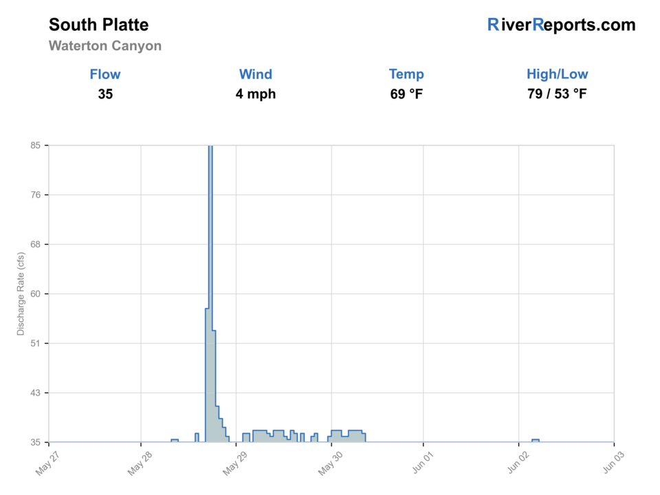
BlueStreamFly cannot read the latest value from this image. Check the chart on RiverReports Opens in a new tab.
Fish from the bank. Bank and edge fishing remains a practical low-commitment option if access is legal and footing is safe.
Check first: No structured live flow
Rating updatedRiver local time:
RiverReports is linked for the flow chart, but this page does not have a structured live flow value the score can read automatically. Treat the rating as conservative and open the chart before committing.
NWS air forecast near
This is an air forecast, not a river-temperature reading. Check the water with a stream thermometer before fishing in hot weather.
RiverReports gauge
BlueStreamFly cannot read the latest value from this image. Check the chart on RiverReports Opens in a new tab.
Sunny
The National Weather Service forecast is temporarily unavailable.
RiverReports gauge: South Platte River at Waterton
Seasonal starting points, not a live hatch report. Match what you see on the water.
Also try hopper-dropper
Each fly name opens its matching Fly Box guide.
Waterton is usually most useful in shoulder seasons, cooler summer mornings, and days when canyon access is open and the flow graph leaves clear edge water. Midday heat, heavy recreation traffic, or pushy runoff all make the river less forgiving than its proximity to Denver suggests.
Best for nymphing, dry-droppers, and careful pocket coverage from safe edge positions.
Stay bank-first and do not confuse a walkable road with easy wading.
Fish finer tippet, smaller patterns, and reach water farther from the heaviest foot traffic.
Fish early, use short handling, and expect more path traffic and warming water.
These scores compare the risks of wading, bank fishing, and floating.
Wading is in play only where your chosen access has clear footing, legal entry, and no forced crossings.
Bank and edge fishing remains a practical low-commitment option if access is legal and footing is safe.
A float is in play where this report supports boat access and wind, releases, and shuttle logistics are manageable.
Is South Platte Waterton Canyon worth the trip today? Check flow, weather, hatches, access, and rules for Colorado before you go.
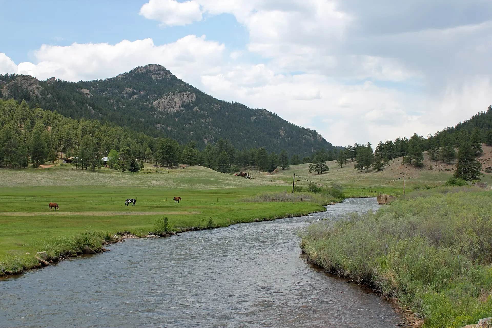
The Waterton Canyon reach of the South Platte works best when you match flow, hiking distance, and the correct section rules before you ever step into the river. The canyon is easy to reach from Denver, but it fishes better when you treat it as a structured day-use area instead of a casual afterthought.
RiverReports is linked for the flow chart, but this page does not have a structured live flow value the score can read automatically. Treat the rating as conservative and open the chart before committing.
Bank / edge: Bank and edge fishing remains a practical low-commitment option if access is legal and footing is safe.
Fall: Often the cleanest mix of stable weather, cooler water, and lighter non-fishing traffic.
The current NWS air forecast is about 71F, and the next 24-hour high reaches about 76F. Sunny.
No active NWS alert was returned for this forecast point.
Moderate clear flows that leave defined seams, soft banks, and safe edge positions without forcing aggressive wading.
Skip when annual canyon closures are active, runoff is pushing the banks, or summer path traffic makes the lower canyon feel too crowded.
Get there early, decide whether the lower mile is enough or whether you need to walk farther, and keep a higher-elevation South Platte backup ready if the canyon is packed.
Deckers, Eleven Mile Canyon, or the North Fork are better pivots when Waterton feels too crowded, hot, or closure-prone.
Use these places as starting points. Open the access link below and check posted signs before you park or enter.
Denver Water lists two fishing-rule sections that matter here: from the Waterton Canyon entrance to Marston Diversion Dam, live bait may be used and the trout bag limit is four any size. From Marston Diversion to Strontia Springs, artificial flies and lures only with a two-trout bag limit. Always confirm the current Colorado brochure before fishing.
The main Denver Water walk-in access and staging point for the whole canyon.
About 1.25 miles up the canyon with priority use for handicapped anglers.
Upper-canyon walking objective when you want fewer casual users and a longer day.
Official agencies and primary river operators come first. Secondary tools are labeled so you know what carries the most weight.
Check what is allowed, where the rule applies, and whether the river is open.
Check the latest river reading and forecast before you leave.
Check public entry points, land rules, and seasonal access changes.
Check what is allowed, where the rule applies, and whether the river is open.
Open the current rules and check the river section, season, and special limits.
Open the current rules and check the river section, season, and special limits.
Check the latest river reading and forecast before you leave.
Open this page and check the latest safety advice before your trip.
Open this river reading to check the latest level, flow, and update time.
Check public entry points, land rules, and seasonal access changes.
Open the land or access page, then check signs before you park or enter.
Open the land or access page, then check signs before you park or enter.
What was checked: This report uses official regulation, flow, weather, access, and public-land sources first, then adds practical planning guidance for fly anglers.
Live measurements and forecasts keep their provider timestamps. Rules, access, and trip guidance use the source-review date shown here. BlueStreamFly planning advice is editorial interpretation, not an agency notice.
First-hand experience: BlueStreamFly does not claim a first-hand visit or local field test for this report unless a real contributor is explicitly named and linked.
No. Waterton is the lower canyon reach near Denver with its own walk-in access pattern and section-specific fishing rules.
You can fish close to the entrance, but walking beyond the first easy mile usually gives you less casual traffic and more room.
Only in the entrance-to-Marston section listed by Denver Water. Above Marston Diversion to Strontia Springs, artificial flies and lures only apply.