Wade, bank, and floatLimited data
Use the live sources and what you see at the river before choosing an approach.
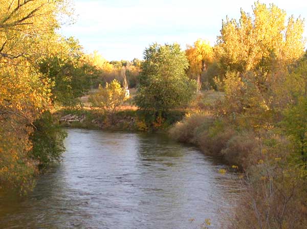
Fly fishing report · West
A practical Poudre report for canyon freestone flows, Fort Collins access, Forest Service corridor planning, and trout-safe seasonal tactics.
Check flow & weatherThe NWS forecast is near 100F and this page does not have live water temperature. Treat trout and salmonid fishing as unsafe unless a stream thermometer proves otherwise.
There is not enough reliable current information to recommend wading, bank fishing, or floating.
Use the live sources and what you see at the river before choosing an approach.
Check before you drive
Look at whether the river is rising or falling, then check wind, rain, and storms. These can change both safety and fishing.
Before you rely on this report
Conditions can change quickly. Check these dates before you decide to fish, and open the official source when safety or rules matter.
High confidence in the current score inputs.
7 sources are listed below for you to open.
3 public access records are listed. Private spots are never shown.
Source checked Jul 30, 2026
Plan your access
These are public parking, launch, trail, or recreation areas—not secret fishing spots. We never show an angler's private pins, notes, or photos here.
Roadside access
Forest Service access for classic roadside freestone water and short exploratory stops.
The Forest Service river corridor includes many recreation sites, but campsite activity, rafters, and roadside pressure change the feel of each reach.
Gateway Natural Area and Fort Collins parks improve access, but easy parking also concentrates pressure and summer non-fishing traffic.
Walk-in / wade
Walk-in style access near the North Fork confluence where Colorado lists a special-regulation stretch.
The Forest Service river corridor includes many recreation sites, but campsite activity, rafters, and roadside pressure change the feel of each reach.
Gateway Natural Area and Fort Collins parks improve access, but easy parking also concentrates pressure and summer non-fishing traffic.
Area description
Town reach access with improved river entry, but expect non-angling recreation to shape timing.
The Forest Service river corridor includes many recreation sites, but campsite activity, rafters, and roadside pressure change the feel of each reach.
Gateway Natural Area and Fort Collins parks improve access, but easy parking also concentrates pressure and summer non-fishing traffic.
How to fish it
The upper canyon, lower canyon, and Fort Collins reach all fish differently, so the best Poudre day starts with the flow trend and then narrows to one section that matches runoff, clarity, and wading comfort.
The NWS forecast is near 100F and this page does not have live water temperature. Treat trout and salmonid fishing as unsafe unless a stream thermometer proves otherwise.
USGS shows 16 cfs with a falling about 65% over about 6 hours trend. Today's flow is unusually low for this date and below the usual low-water marker near 16 cfs. Low water can make fish spooky, warm, pressured, or concentrated; check temperature and handling risk.
An Air Quality Alert is active near this forecast point, so the score is capped at caution until smoke and access conditions are checked. NWS alert: Air Quality Alert issued August 2 at 4:10PM MDT by NWS Denver CO.
Summer: Primary freestone season for dry-dropper, caddis, and terrestrial fishing.
Skip during blown-out runoff, after major summer storm pulses, or when warm low water and heavy recreation use reduce trout-safe options through town.
Read the water
The Poudre is usually most dependable when runoff has dropped, visibility is back, and you can choose either higher canyon pocket water or lower-gradient Fort Collins seams without fighting dangerous current. Summer mornings and early fall often produce the cleanest dry-dropper fishing.
Fish only soft edges and side seams, or wait for safer visibility and depth.
Best all-around condition for covering pocket water with dry-dropper rigs.
Start early, fish shade and oxygenated runs, and monitor temperature closely through town.
Expect more recreation use and softer currents than the upper canyon, with access often easier than wading.
Your trip plan
Stable or dropping freestone flow with enough clarity to fish pocket water and enough moderation for safe wading.
Skip during blown-out runoff, after major summer storm pulses, or when warm low water and heavy recreation use reduce trout-safe options through town.
Choose either upper canyon water or the lower Gateway/Fort Collins section after checking the gauge, instead of trying to split the day across the whole drainage.
Shift to Big Laramie, Boulder Creek, or Clear Creek if the Poudre is still too high or warm.
Hatches & flies
 Fly pattern · report suggests “RS2”RS2Start with the beadless architecture: two dark-dun Microfibett tails separated behind a slim, tightly twisted and visibly segmented dubbed abdomen; a fuller thorax; and saddle-hackle web clipped into a short angled wing bud. Rim Chung's original-style form uses natural beaver dubbing and hackle web. CDC- or Antron-wing ties, beads, curved hooks, flash, and tailless Avatar-style flies must remain labeled variations.See photos & how to fish it ↗
 Fly pattern · report suggests “zebra midge”Zebra MidgeLook for a very slim tapered thread body, evenly spaced contrasting wire rib, a small bead, and no tail or wing. The reviewed classic is black with silver wire and a silver bead. Red, olive, brown, glass-bead, jig-hook, resin-coated, or tailed forms must remain labeled variations rather than replacing the classic identity.See photos & how to fish it ↗+ 2 more reviewed guides in the Fly Box
  Fly pattern · report suggests “Elk hair caddis”Elk Hair CaddisLook for a tented elk- or deer-hair wing, clipped hair head, dubbed body, rib, and hackle palmered along the body. The body color should be labeled because tiers often match different natural caddis colors.See photos & how to fish it ↗
 Fly family · report suggests “PMD nymph”Pale Morning Dun PatternsPMD names an insect group, not one fly. Pale nymphs, trailing-shuck emergers, upright or low-riding duns, cripples, and spent-wing spinners stay visibly separate.See family guide ↗+ 2 more reviewed guides in the Fly Box
  Fly family · report suggests “Ant”Ant PatternsAnt patterns can be foam, fur-bodied, winged, or sunken. The narrow waist and paired body lobes matter more than one material recipe.See family guide ↗
 Fly family · report suggests “beetle”Beetle PatternsBeetle flies range from simple foam shells to hair-bodied and sunken forms. A rounded back and compact profile distinguish the family from ants and hoppers.See family guide ↗+ 1 more reviewed guide in the Fly Box Fly pattern · report suggests “RS2”RS2Start with the beadless architecture: two dark-dun Microfibett tails separated behind a slim, tightly twisted and visibly segmented dubbed abdomen; a fuller thorax; and saddle-hackle web clipped into a short angled wing bud. Rim Chung's original-style form uses natural beaver dubbing and hackle web. CDC- or Antron-wing ties, beads, curved hooks, flash, and tailless Avatar-style flies must remain labeled variations.See photos & how to fish it ↗
 Fly family · report suggests “midge larva”Midge Patterns by StageMidge wording can mean a threadlike larva, wing-padded pupa, film emerger, tiny adult, or visible cluster. Those profiles fish at different depths.See family guide ↗+ 2 more reviewed guides in the Fly Box
 Cover short pockets quickly in the canyon and save long drifts for the gentler lower river.
When runoff is falling, focus on inside seams, boulders near shore, and current breaks created by woody edges.
On summer mornings, dry-dropper rigs catch the most water fast; by midday, smaller nymphs and shade lines often matter more.
In Fort Collins, fish early to beat recreation traffic and shift to less obvious seams instead of crowding the most visible access points.
Rules & closures
Open the agency page to confirm the exact river section, species, season, tackle rules, limits, and emergency closures.
Official links checkedWe checked the state source but did not find a clearly supported exception for this river. Check the official rules for the exact section you plan to fish.
This summary helps with trip planning. The linked agency rule is the one you must follow.
Updates from anglers
Recent observations from general areas of Cache La Poudre River. We review every update before it appears and never publish exact fishing spots, private access details, or photo locations.
You can still use the river plan above. Check back later for recent observations from other anglers.
Where this report comes from
Fishing guidance checked: May 31, 2026
Site check: Jul 14, 2026. We regularly test report links, live scores, flow and weather data, and page loading. The content date changes only when the fishing guidance or its sources change.
Common questions
It depends on flow. Higher canyon water is the classic freestone plan, while Gateway and Fort Collins make more sense for shorter-access sessions once temperatures and recreation traffic line up.
Sometimes, but not automatically. Use the gauge and visibility first, because high canyon water usually means pushier lower-river current too.
Read the Colorado special-regulation page for the exact stretch you want to fish, especially around Gateway and other named Poudre sections.