Wade · Best fit74/100
Wading is in play only where your chosen access has clear footing, legal entry, and no forced crossings.
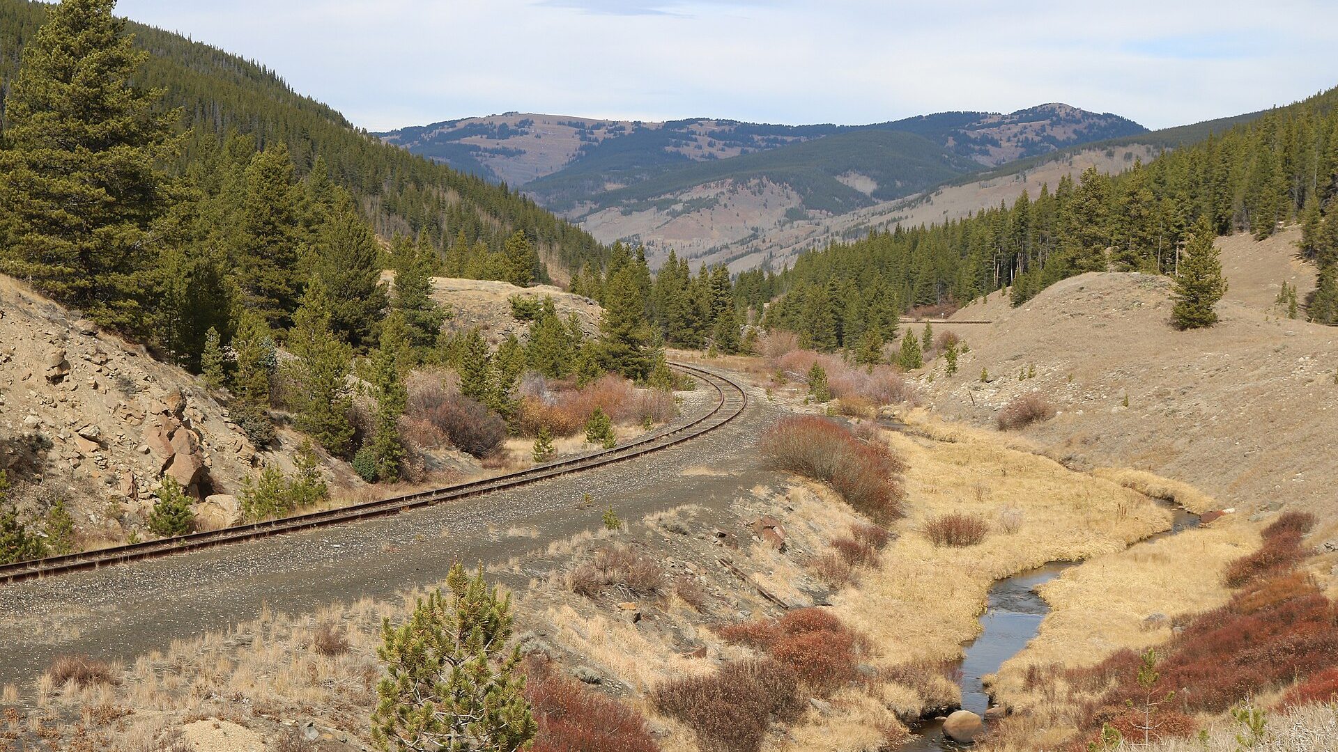
Fly fishing report · West
A practical Eagle River report for the Avon, Edwards, Wolcott, and Gypsum corridor, with flow checks, access planning, hatches, and fly selection.
Check flow & weatherCurrent USGS flow is 61 cfs and has been stable for about 6 hours. Today's flow is unusually low for this date and below the usual low-water marker near 102 cfs. Low water can make fish spooky, warm, pressured, or concentrated; check temperature and handling risk.
Compare wading, bank fishing, and floating before choosing how you will fish.
Wading is in play only where your chosen access has clear footing, legal entry, and no forced crossings.
This report does not describe this as a primary mode. Verify legal access, depth, launches, and retreat options before planning around it.
A float is in play where this report supports boat access and wind, releases, and shuttle logistics are manageable.
Check before you drive
Look at whether the river is rising or falling, then check wind, rain, and storms. These can change both safety and fishing.
Before you rely on this report
Conditions can change quickly. Check these dates before you decide to fish, and open the official source when safety or rules matter.
High confidence in the current score inputs.
7 sources are listed below for you to open.
3 public access records are listed. Private spots are never shown.
Source checked Jul 30, 2026
Plan your access
These are public parking, launch, trail, or recreation areas—not secret fishing spots. We never show an angler's private pins, notes, or photos here.
Area description
Useful public starting areas with paths, parks, and nearby services; confirm posted access boundaries.
CPW notes that Eagle County and CPW have supported public access opportunities in the lower valley.
Do not cross or stop on private land unless a public access point clearly allows it.
Public land
Mix of public and private water where open space and BLM parcels matter for planning.
CPW notes that Eagle County and CPW have supported public access opportunities in the lower valley.
Do not cross or stop on private land unless a public access point clearly allows it.
Area description
Lower-valley water can fish well, but temperature, boating, and private property are bigger factors.
CPW notes that Eagle County and CPW have supported public access opportunities in the lower valley.
Do not cross or stop on private land unless a public access point clearly allows it.
How to fish it
The Eagle is a productive valley trout river when flows are clear and stable. It fishes differently from the upper Vail water to the lower Wolcott and Gypsum reaches, so the gauge and access plan should come first.
USGS shows 61 cfs with a stable over about 6 hours trend. Today's flow is unusually low for this date and below the usual low-water marker near 102 cfs. Low water can make fish spooky, warm, pressured, or concentrated; check temperature and handling risk.
Summer: Caddis, PMDs, stones, and terrestrials matter, but lower-river temperatures should be checked.
The NWS forecast is about 74F with Mostly Clear.
No active NWS alert was returned for this forecast point.
Skip or scale back when runoff is pushy, thunderstorms muddy the valley, lower-river temperatures are stressful, public access or private boundaries are unclear, or slick cobble makes crossings unsafe.
Read the water
The Eagle rewards flexible anglers. Nymph deep during cold or off-color water, switch to caddis and mayflies when fish look up, and avoid treating every reach as equally public or equally trout-safe in summer.
Use longer leaders, lighter tippet, smaller mayfly or midge patterns, and careful bank approaches.
This is the most flexible window for nymphs, dry-droppers, caddis dries, and soft-hackle swings.
Fish inside bends, banks, and softer edges only if wading is safe. Streamers and larger stonefly nymphs become more useful.
Check temperature. If trout handling risk is high, move upstream, fish early, or choose a colder option.
Your trip plan
Use the Avon gauge trend more than one magic number. Stable or slowly falling clear flow is the best all-around trout signal; runoff, storm stain, or warm lower-river afternoons should move the plan upstream, earlier, or to another route.
Skip or scale back when runoff is pushy, thunderstorms muddy the valley, lower-river temperatures are stressful, public access or private boundaries are unclear, or slick cobble makes crossings unsafe.
Start with the Avon gauge and weather, then choose Avon/Edwards for a shorter wade check, Wolcott/Eagle for a broader valley plan, or Gypsum only when temperature and access still support trout handling.
If the Eagle is too high, warm, stained, or access-limited, compare the Fryingpan, Roaring Fork, or middle Colorado after checking each route's current flow and rules.
Hatches & flies
 Fly pattern · report suggests “Zebra midge”Zebra MidgeLook for a very slim tapered thread body, evenly spaced contrasting wire rib, a small bead, and no tail or wing. The reviewed classic is black with silver wire and a silver bead. Red, olive, brown, glass-bead, jig-hook, resin-coated, or tailed forms must remain labeled variations rather than replacing the classic identity.See photos & how to fish it ↗
 Fly pattern · report suggests “black beauty”Black Beauty MidgeA very slim black thread body, fine silver rib, and small dark thorax define the core Black Beauty. Glass-bead Mercury Black Beauty and flash-wing variants must stay labeled separately.See photos & how to fish it ↗+ 2 more reviewed guides in the Fly Box
  Fly family · report suggests “BWO emerger”Blue-Winged Olive PatternsBWO describes a hatch group, not one fly. Nymph, emerger, dry, cripple, and spinner profiles must stay separate because they occupy different parts of the water column.See family guide ↗
 Fly pattern · report suggests “elk hair caddis”Elk Hair CaddisLook for a tented elk- or deer-hair wing, clipped hair head, dubbed body, rib, and hackle palmered along the body. The body color should be labeled because tiers often match different natural caddis colors.See photos & how to fish it ↗+ 2 more reviewed guides in the Fly Box
  Fly pattern · report suggests “X-caddis”X-CaddisIdentify the X-Caddis by the combination of a sparse translucent Zelon-style trailing shuck, slim dubbed body, tented deer- or elk-hair wing, small clipped head, and no palmered body hackle. The separately photographed Elk Hair Caddis has a higher, hackled adult footprint and no defining trailing shuck. The natural-adult photograph explains the caddis tent-wing silhouette, but it does not turn the X-Caddis into an exact adult-species imitation.See photos & how to fish it ↗
 Fly family · report suggests “PMD cripple”Pale Morning Dun PatternsPMD names an insect group, not one fly. Pale nymphs, trailing-shuck emergers, upright or low-riding duns, cripples, and spent-wing spinners stay visibly separate.See family guide ↗+ 3 more reviewed guides in the Fly Box Fly family · report suggests “BWO dry”Blue-Winged Olive PatternsBWO describes a hatch group, not one fly. Nymph, emerger, dry, cripple, and spinner profiles must stay separate because they occupy different parts of the water column.See family guide ↗Fly pattern · report suggests “zebra midge”Zebra MidgeLook for a very slim tapered thread body, evenly spaced contrasting wire rib, a small bead, and no tail or wing. The reviewed classic is black with silver wire and a silver bead. Red, olive, brown, glass-bead, jig-hook, resin-coated, or tailed forms must remain labeled variations rather than replacing the classic identity.See photos & how to fish it ↗+ 2 more reviewed guides in the Fly Box
 Pick the reach after checking both flow and public access.
During runoff, fish soft edges instead of forcing mid-channel wading.
In clear summer water, lead fish with the first cast and reduce false casting.
Cover caddis water quickly, then slow down when you find rising fish.
Use a thermometer below Wolcott and Gypsum during hot afternoons.
Rules & closures
Open the agency page to confirm the exact river section, species, season, tackle rules, limits, and emergency closures.
Official links checkedWe checked the state source but did not find a clearly supported exception for this river. Check the official rules for the exact section you plan to fish.
This summary helps with trip planning. The linked agency rule is the one you must follow.
Updates from anglers
Recent observations from general areas of Eagle River. We review every update before it appears and never publish exact fishing spots, private access details, or photo locations.
You can still use the river plan above. Check back later for recent observations from other anglers.
Where this report comes from
Fishing guidance checked: May 31, 2026
Site check: Jul 14, 2026. We regularly test report links, live scores, flow and weather data, and page loading. The content date changes only when the fishing guidance or its sources change.
Common questions
It focuses on the public-facing Avon, Edwards, Wolcott, Eagle, and Gypsum corridor rather than every headwater tributary.
Use RiverReports for the quick chart and USGS 09067020 as the official Avon monitoring source.
High runoff, muddy storm bumps, and hot lower-river afternoons are the main problem windows.
Bring midges, BWOs, caddis, PMDs, yellow sallies, stonefly nymphs, terrestrials, and a few streamers.