Wade · Best fit60/100
Wading is in play only where your chosen access has clear footing, legal entry, and no forced crossings.
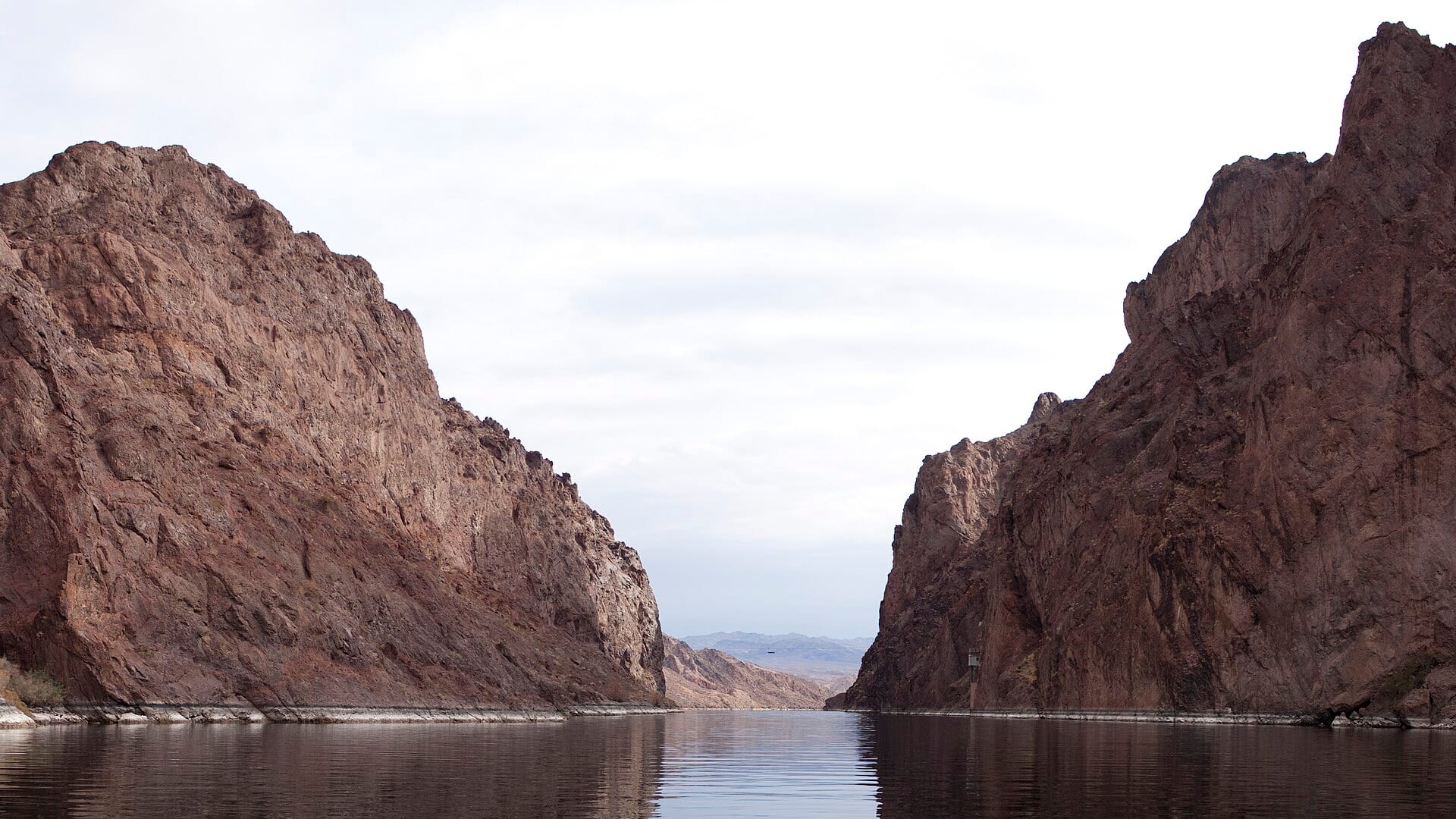
Fly fishing report · West
A lower Colorado River report for Glenwood Canyon and Glenwood Springs planning, RiverReports/USGS flows, float access, hatches, and temperature checks.
Check flow & weatherCurrent USGS flow is 1,630 cfs and has been stable for about 6 hours. Today's flow is unusually low for this date and below the usual low-water marker near 1,970 cfs. Low water can make fish spooky, warm, pressured, or concentrated; check temperature and handling risk.
Compare wading, bank fishing, and floating before choosing how you will fish.
Wading is in play only where your chosen access has clear footing, legal entry, and no forced crossings.
Bank and edge fishing remains a practical low-commitment option if access is legal and footing is safe.
A float is in play where this report supports boat access and wind, releases, and shuttle logistics are manageable.
Check before you drive
Look at whether the river is rising or falling, then check wind, rain, and storms. These can change both safety and fishing.
Before you rely on this report
Conditions can change quickly. Check these dates before you decide to fish, and open the official source when safety or rules matter.
High confidence in the current score inputs.
6 sources are listed below for you to open.
3 public access records are listed. Private spots are never shown.
Source checked Jul 30, 2026
Plan your access
These are public parking, launch, trail, or recreation areas—not secret fishing spots. We never show an angler's private pins, notes, or photos here.
Trailhead
Large-river access with canyon and weather constraints.
This page is not the Parshall/Kremmling upper Colorado page.
Canyon weather, mudslides, and I-70 conditions can affect access.
Boat launch
Town access and confluence context where crowding and boat traffic can matter.
This page is not the Parshall/Kremmling upper Colorado page.
Canyon weather, mudslides, and I-70 conditions can affect access.
Boat launch
A BLM river access and boat-launch option below Glenwood Springs.
This page is not the Parshall/Kremmling upper Colorado page.
Canyon weather, mudslides, and I-70 conditions can affect access.
How to fish it
The lower Colorado near Glenwood is bigger, warmer, and more float-oriented than the upper Parshall water. Use the Glenwood gauge, temperature judgment, and official access sources before deciding whether to wade, float, or fish a different reach.
USGS shows 1,630 cfs with a stable over about 6 hours trend. Today's flow is unusually low for this date and below the usual low-water marker near 1,970 cfs. Low water can make fish spooky, warm, pressured, or concentrated; check temperature and handling risk.
The NWS forecast is near 90F. Fish early and verify water temperature where trout stress is possible.
Wade: Wading is in play only where your chosen access has clear footing, legal entry, and no forced crossings.
Summer: Early and late windows, caddis, PMDs, stones, and terrestrials matter if temperatures stay safe.
No active NWS alert was returned for this forecast point.
Read the water
The Glenwood-area Colorado is best when flows are stable, clarity is reasonable, and water temperatures support trout handling. High runoff, canyon storm hazards, and warm low water can change the plan quickly.
Use longer leaders, lighter nymphs, and careful bank approaches.
The most flexible window for nymphs, dry-dropper banks, streamers, and float fishing.
Treat wading as limited or unsafe; focus on professional float logistics or wait.
Check temperature and avoid trout stress during hot low-flow periods.
Your trip plan
Use the RiverReports Glenwood chart and USGS 09085100 together. Stable medium flows create the widest tactic window; runoff or storm-driven color should move you to safer edges, a float-only plan, or another watershed.
Skip the lower Colorado when water is too warm for ethical trout handling, when runoff or mud makes visibility and footing poor, when canyon travel conditions are questionable, or when ramp logistics are not settled.
Start with Glenwood Springs and South Canyon access context, then decide whether the day is a short bank session, a float, or a pivot to nearby colder water. Do not use this page for Parshall, Kremmling, State Bridge, or Catamount planning.
If the lower Colorado is warm, muddy, high, or crowded, compare the Roaring Fork River for another valley option or the Fryingpan River when you want a more technical tailwater-style day after checking current rules.
Hatches & flies
 Fly pattern · report suggests “Zebra midge”Zebra MidgeLook for a very slim tapered thread body, evenly spaced contrasting wire rib, a small bead, and no tail or wing. The reviewed classic is black with silver wire and a silver bead. Red, olive, brown, glass-bead, jig-hook, resin-coated, or tailed forms must remain labeled variations rather than replacing the classic identity.See photos & how to fish it ↗
 Fly pattern · report suggests “RS2”RS2Start with the beadless architecture: two dark-dun Microfibett tails separated behind a slim, tightly twisted and visibly segmented dubbed abdomen; a fuller thorax; and saddle-hackle web clipped into a short angled wing bud. Rim Chung's original-style form uses natural beaver dubbing and hackle web. CDC- or Antron-wing ties, beads, curved hooks, flash, and tailless Avatar-style flies must remain labeled variations.See photos & how to fish it ↗+ 1 more reviewed guide in the Fly Box
  Fly family · report suggests “BWO emerger”Blue-Winged Olive PatternsBWO describes a hatch group, not one fly. Nymph, emerger, dry, cripple, and spinner profiles must stay separate because they occupy different parts of the water column.See family guide ↗
 Fly family · report suggests “caddis pupa”Caddis Pupa PatternsCaddis pupa is a life-stage family. Curved bodies, wing pads, legs, beads, and soft-hackle collars differ among exact patterns and must be labeled.See family guide ↗+ 2 more reviewed guides in the Fly Box
  Fly family · report suggests “Caddis”Caddis Patterns by StageCaddis is not one fly. Larvae live below, pupae and emergers rise through the column, tent-wing adults ride or move on top, and spent forms create other silhouettes.See family guide ↗
 Fly family · report suggests “PMD”Pale Morning Dun PatternsPMD names an insect group, not one fly. Pale nymphs, trailing-shuck emergers, upright or low-riding duns, cripples, and spent-wing spinners stay visibly separate.See family guide ↗+ 4 more reviewed guides in the Fly Box Fly family · report suggests “BWO dry”Blue-Winged Olive PatternsBWO describes a hatch group, not one fly. Nymph, emerger, dry, cripple, and spinner profiles must stay separate because they occupy different parts of the water column.See family guide ↗Fly pattern · report suggests “RS2”RS2Start with the beadless architecture: two dark-dun Microfibett tails separated behind a slim, tightly twisted and visibly segmented dubbed abdomen; a fuller thorax; and saddle-hackle web clipped into a short angled wing bud. Rim Chung's original-style form uses natural beaver dubbing and hackle web. CDC- or Antron-wing ties, beads, curved hooks, flash, and tailless Avatar-style flies must remain labeled variations.See photos & how to fish it ↗+ 2 more reviewed guides in the Fly Box
 Use the lower Colorado page only for Glenwood-area planning.
Fish banks and shelves before wading too far.
Carry a thermometer in summer and respect voluntary or emergency closures.
Watch canyon weather and road conditions before committing to Glenwood Canyon.
Use boat ramps and public access, not private banks.
Rules & closures
Open the agency page to confirm the exact river section, species, season, tackle rules, limits, and emergency closures.
Official links checkedWe checked the state source but did not find a clearly supported exception for this river. Check the official rules for the exact section you plan to fish.
This summary helps with trip planning. The linked agency rule is the one you must follow.
Updates from anglers
Recent observations from general areas of Colorado River Lower Colorado. We review every update before it appears and never publish exact fishing spots, private access details, or photo locations.
You can still use the river plan above. Check back later for recent observations from other anglers.
Where this report comes from
Fishing guidance checked: May 31, 2026
Site check: Jul 14, 2026. We regularly test report links, live scores, flow and weather data, and page loading. The content date changes only when the fishing guidance or its sources change.
Common questions
It is scoped to the Glenwood Canyon and Glenwood Springs corridor, using the Glenwood flow reference.
It can be. There are wade opportunities, but big-water safety and boat access are central to the plan.
Watch water temperature, voluntary or emergency closures, and storm-driven clarity changes.
No. Use the upper Colorado River page for Parshall and Kremmling.