Wade · Best fit74/100
Wading is in play only where your chosen access has clear footing, legal entry, and no forced crossings.
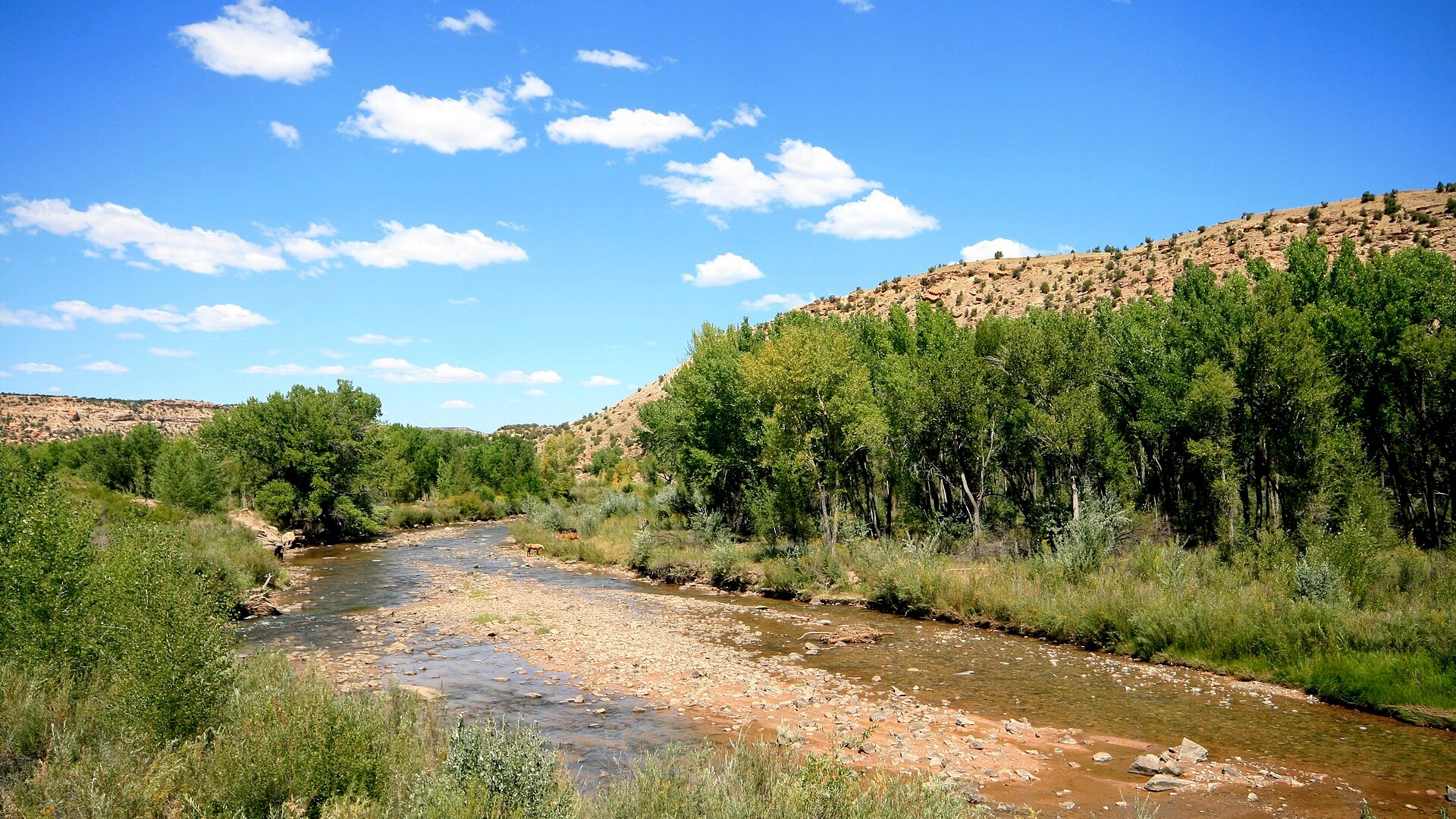
Fly fishing report · West
A southwest Colorado San Miguel report for Telluride, Placerville, Norwood, and canyon water, with flow checks, access notes, hatches, flies, and safety guidance.
Check flow & weatherCurrent USGS flow is 79 cfs and has been stable for about 6 hours. Today's flow is unusually low for this date and below the usual low-water marker near 106 cfs. Low water can make fish spooky, warm, pressured, or concentrated; check temperature and handling risk.
Compare wading, bank fishing, and floating before choosing how you will fish.
Wading is in play only where your chosen access has clear footing, legal entry, and no forced crossings.
This report does not describe this as a primary mode. Verify legal access, depth, launches, and retreat options before planning around it.
A float is in play where this report supports boat access and wind, releases, and shuttle logistics are manageable.
Check before you drive
Look at whether the river is rising or falling, then check wind, rain, and storms. These can change both safety and fishing.
Before you rely on this report
Conditions can change quickly. Check these dates before you decide to fish, and open the official source when safety or rules matter.
High confidence in the current score inputs.
7 sources are listed below for you to open.
3 public access records are listed. Private spots are never shown.
Source checked Jul 30, 2026
Plan your access
These are public parking, launch, trail, or recreation areas—not secret fishing spots. We never show an angler's private pins, notes, or photos here.
Area description
Higher trout-oriented water with town and county access context to verify.
San Miguel County trail information helps with upper-corridor public recreation planning.
BLM Caddis Flats and Lower Beaver pages document lower-river recreation access.
Area description
Useful flow reference and mid-river planning area.
San Miguel County trail information helps with upper-corridor public recreation planning.
BLM Caddis Flats and Lower Beaver pages document lower-river recreation access.
Public land
BLM lower-river recreation sites with boating, camping, and access logistics.
San Miguel County trail information helps with upper-corridor public recreation planning.
BLM Caddis Flats and Lower Beaver pages document lower-river recreation access.
How to fish it
The San Miguel changes quickly from high-gradient trout water near Telluride and Placerville to warmer lower canyon water. Use the Placerville gauge, public access checks, and season to choose the right plan.
USGS shows 79 cfs with a stable over about 6 hours trend. Today's flow is unusually low for this date and below the usual low-water marker near 106 cfs. Low water can make fish spooky, warm, pressured, or concentrated; check temperature and handling risk.
Summer: Post-runoff caddis, mayflies, yellow sallies, and terrestrials can be useful in cool water.
The NWS forecast is about 71F with Partly Cloudy.
No active NWS alert was returned for this forecast point.
Skip the trip when runoff or wood hazards turn the river reactive, when lower-river heat threatens trout handling, when access around private ground is unclear, or when you really need a simpler tailwater day instead of a reach-management problem.
Read the water
The San Miguel is best when flows are clear enough to fish and not so low or warm that trout handling becomes risky. Keep the fly plan flexible and match the reach to the season.
Snowmelt can make the river powerful, cold, and unsafe for casual wading.
Fish riffles, banks, and pocket water with caddis, mayflies, terrestrials, and light nymphs.
Carry a thermometer and stop targeting trout if water temperatures create handling risk.
Watch for debris, stain, and wood. Avoid blind crossings and lower-canyon hazards.
Your trip plan
Use the Placerville trend as the common planning anchor. Stable or slowly easing summer flow is the best fit for upper-river trout tactics; runoff surges, storm color, or hot low water should move you to cooler headwater choices or another drainage.
Skip the trip when runoff or wood hazards turn the river reactive, when lower-river heat threatens trout handling, when access around private ground is unclear, or when you really need a simpler tailwater day instead of a reach-management problem.
Pick the reach before you pick the flies: upper or mid-river public access if you want trout-focused wading, or a separate lower-canyon objective only when flow, access, and exit logistics are all settled ahead of time.
If the San Miguel is too pushy, warm, or access-sensitive, pivot to the Dolores for a release-driven southwest Colorado option or to the Taylor River for a more controlled tailwater day.
Hatches & flies
 Fly pattern · report suggests “Zebra midge”Zebra MidgeLook for a very slim tapered thread body, evenly spaced contrasting wire rib, a small bead, and no tail or wing. The reviewed classic is black with silver wire and a silver bead. Red, olive, brown, glass-bead, jig-hook, resin-coated, or tailed forms must remain labeled variations rather than replacing the classic identity.See photos & how to fish it ↗
 Fly family · report suggests “BWO emerger”Blue-Winged Olive PatternsBWO describes a hatch group, not one fly. Nymph, emerger, dry, cripple, and spinner profiles must stay separate because they occupy different parts of the water column.See family guide ↗+ 2 more reviewed guides in the Fly Box
  Fly pattern · report suggests “Elk hair caddis”Elk Hair CaddisLook for a tented elk- or deer-hair wing, clipped hair head, dubbed body, rib, and hackle palmered along the body. The body color should be labeled because tiers often match different natural caddis colors.See photos & how to fish it ↗
 Fly family · report suggests “PMD”Pale Morning Dun PatternsPMD names an insect group, not one fly. Pale nymphs, trailing-shuck emergers, upright or low-riding duns, cripples, and spent-wing spinners stay visibly separate.See family guide ↗+ 2 more reviewed guides in the Fly Box
  Fly family · report suggests “Foam ant”Ant PatternsAnt patterns can be foam, fur-bodied, winged, or sunken. The narrow waist and paired body lobes matter more than one material recipe.See family guide ↗
 Fly family · report suggests “beetle”Beetle PatternsBeetle flies range from simple foam shells to hair-bodied and sunken forms. A rounded back and compact profile distinguish the family from ants and hoppers.See family guide ↗+ 3 more reviewed guides in the Fly Box Fly family · report suggests “BWO dry”Blue-Winged Olive PatternsBWO describes a hatch group, not one fly. Nymph, emerger, dry, cripple, and spinner profiles must stay separate because they occupy different parts of the water column.See family guide ↗Fly pattern · report suggests “zebra midge”Zebra MidgeLook for a very slim tapered thread body, evenly spaced contrasting wire rib, a small bead, and no tail or wing. The reviewed classic is black with silver wire and a silver bead. Red, olive, brown, glass-bead, jig-hook, resin-coated, or tailed forms must remain labeled variations rather than replacing the classic identity.See photos & how to fish it ↗+ 3 more reviewed guides in the Fly Box
 Choose upper trout water or lower canyon water before picking tactics.
Use the Placerville gauge as the core flow read, then match it to your reach.
Avoid fishing behind private homes or ranches unless access is clearly public.
Watch for wood, strainers, and narrow channel hazards after runoff.
Use shade, early starts, and a thermometer during hot low-water periods.
Rules & closures
Open the agency page to confirm the exact river section, species, season, tackle rules, limits, and emergency closures.
Official links checkedWe checked the state source but did not find a clearly supported exception for this river. Check the official rules for the exact section you plan to fish.
This summary helps with trip planning. The linked agency rule is the one you must follow.
Updates from anglers
Recent observations from general areas of San Miguel River. We review every update before it appears and never publish exact fishing spots, private access details, or photo locations.
You can still use the river plan above. Check back later for recent observations from other anglers.
Where this report comes from
Fishing guidance checked: May 31, 2026
Site check: Jul 14, 2026. We regularly test report links, live scores, flow and weather data, and page loading. The content date changes only when the fishing guidance or its sources change.
Common questions
It covers the upper Telluride and Placerville trout plan plus lower BLM canyon access context.
Use RiverReports and USGS 09172500 near Placerville as the primary flow reference.
No. Upper and mid-river reaches are more trout-focused, while lower reaches include warmer-water and different regulation context.
Bring midges, BWOs, caddis, PMDs, yellow sallies, terrestrials, nymphs, and a few streamers.