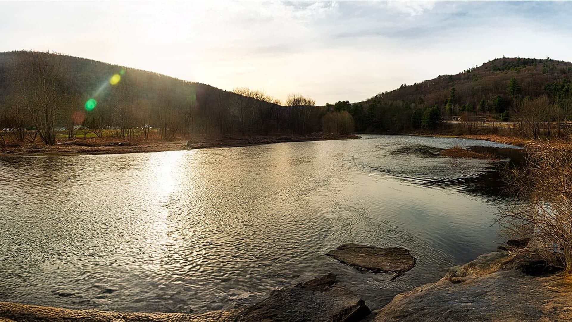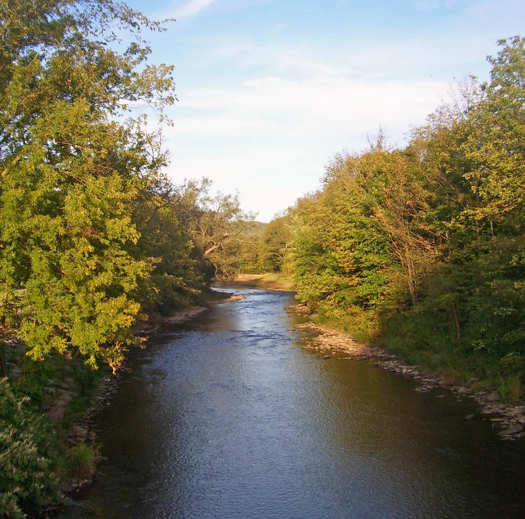
East Branch Delaware River viewed from the Bridge Street and NY 30 bridge in Margaretville, New York, in September 2008
All New York reports

Fly fishing report · Northeast

East Branch Delaware River at Margaretville Fishing Report

This report covers the upper East Branch above Pepacton Reservoir near Margaretville. Check the Margaretville flow, measure water temperature in summer, and confirm DEP access before choosing a wade or bank plan.

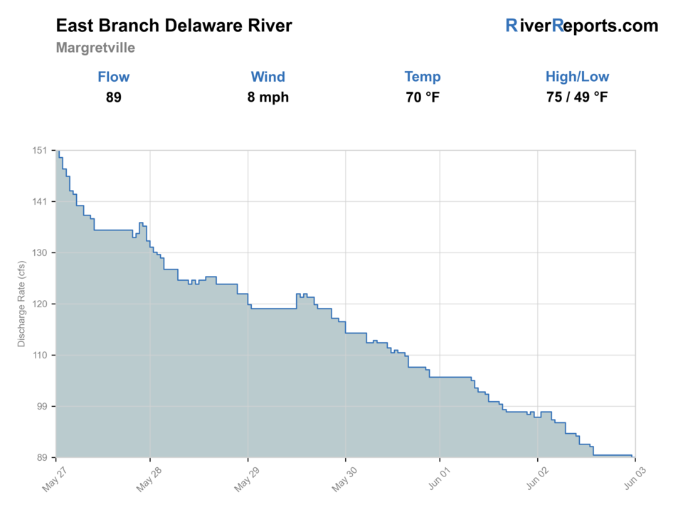
See the Margaretville flow chart ↓

Photo: Daniel Case Opens in a new tab. · 2008-09-20; not current · CC BY-SA 3.0 · JPEG to WebP

Good day to fish?Latest river check
Caution

Fishable with caution. Check the water temperature.

No clear best access mode. USGS 01413500 is upper-reach flow context at Margaretville. It does not report current continuous water temperature, prove safe wading, confirm legal access, or describe the Pepacton tailwater below the dam.

Update time and confidence
Live data checkHighHow much of the live flow, weather, and alert data came back.
Today's callMediumWater temperature not verified; do not use this score to clear warm-water risk.
Score calculated Sep 1, 2026, 4:36 AM EDTUsually checks again about every 45 minutes
Access choicesNo clear best mode

Wade and Bank / edge have the same top score. Use current access, footing, weather, and local rules to choose.

Wade64/100

Wading is in play only where your chosen access has clear footing, legal entry, and no forced crossings.

Bank / edge64/100

Bank and edge fishing remains a practical low-commitment option if access is legal and footing is safe.

FloatNot recommended

This report does not recommend floating this reach.

Your plan

A simple upper East Branch plan.

USGS 01413500 reports not yet confirmed flow and gage height for the upper East Branch at Margaretville, but its current continuous water-temperature record is unavailable. Measure the exact reach in warm weather, confirm DEP access, and treat this as a bank or protected-edge wade plan—not a float.

Check
The Margaretville flow trend, the exact reach with a thermometer, and the current DEP sign or permit requirement.
Fish
One confirmed public bank or protected edge when the river is manageable and below 70°F.
Leave
At 70°F or warmer, in rising or stained water, when footing is pushy, or when access is unclear.

Live river check

What the river is doing

Check the latest flow and weather before you go. A quick change can make the river harder or less safe to fish.

Showing server-checked river conditions while current readings refresh.
Flow
91 cfs
From the latest stored river check. Open the official source for the newest reading.
Air now
63°F

Current NWS forecast period

Next 24h high
77.0°F

NWS air forecast near

Rain chance
54%

For this forecast period

This is an air forecast, not a river-temperature reading. Check the water with a stream thermometer before fishing in hot weather.

Latest stored weather check

Patchy Fog

Patchy Fog

Wind
0 mph
Weather checked
More forecast and source details
National Weather Service

National Weather Service forecast near Margaretville

The National Weather Service forecast is temporarily unavailable.

Live data

Where these readings come from

RiverReports gauge: East Branch Delaware River at Margaretville

How to fish it

The Margaretville gauge is an upper-reach check.

A Margaretville day needs a stable or falling upper-branch trend, trout-safe water measured onsite, manageable footing, and a confirmed legal bank. A normal-looking flow graph alone cannot clear the trip, and this page does not recommend floating.

01

Stable or slowly falling flow

Use the trend as context for a short bank or protected-edge session. It is not proof that wading is safe.

02

Rising or stained after rain

Stay on the bank or leave. The upper freestone can change quickly after Catskills rain.

03

Water temperature unavailable

The gauge has no current continuous temperature. Measure the exact reach and choose another water at 70°F or warmer.

04

Access not confirmed

Do not treat a bridge, shoulder, gauge, or visible bank as permission. Read the DEP sign and verify the parcel first.

Fishing words used on this page
U.S. Geological Survey (USGS) gauge
A USGS gauge is an official river station that measures flow or water height.
Cubic feet per second (cfs)
Cubic feet per second, or cfs, shows how much water passes the gauge each second.
Nymph
A nymph is a young water insect. Anglers also use the word for a fly that copies it.
Seam
A seam is the line where fast and slow water meet.
Blue-winged olive (BWO)
Blue-winged olives, or BWOs, are small mayflies that often hatch in cool or cloudy weather.
Caddis
Caddis are small water insects. The adults look a little like tiny moths.
Confluence
A confluence is the place where two streams or rivers meet.
Midge
Midges are tiny flies and a common trout food, especially in cold water.
Pale morning dun (PMD)
Pale morning duns, or PMDs, are light-colored mayflies that often hatch in warmer months.
Stained water
Stained water is darker or cloudier after rain, runoff, or a change in flow.
Why this call

Why this score

FlowUse caution

USGS shows 91 cfs. The flow has been stable over about 6 hours. USGS marks this reading provisional and may revise it. USGS records for this date (1937-2025, 89 readings) show a median near 40 cfs and the upper quartile near 95 cfs; today's flow is on the high side for the date. USGS 01413500 is upper-reach flow context at Margaretville. It does not report current continuous water temperature, prove safe wading, confirm legal access, or describe the Pepacton tailwater below the dam. This is near the high side of normal, so be careful about wading, clarity, and pushy current before calling it good.

Water temperature checkUse caution

USGS 01413500 at Margaretville reports flow but not current continuous water temperature. Measure the exact reach with a stream thermometer. Choose another water at 70°F or warmer.

Best mode nowUse caution

Wade: Wading is in play only where your chosen access has clear footing, legal entry, and no forced crossings.

SeasonHelps

Fall · September through November: Cooling nights can help; the rule changes October 16, and low clear water still calls for careful access and approach.

WeatherHelps

The current NWS air forecast is about 63F, and the next 24-hour high reaches about 77F. Patchy Fog.

Trip notes

Trip notes

What controls this Margaretville plan.

Best flows

Use the live not yet confirmed Margaretville trend to judge change. No flow number proves safe wading, current water temperature, or legal access.

When to leave

Leave at 70°F or warmer, in rising or stained water, when footing is pushy, or when the parcel, parking, or route to the bank is unclear.

Local plan

Check the Margaretville gauge, measure the exact reach, then fish one signed DEP bank or protected edge instead of chasing roadside pull-offs.

Backup water

If the upper East Branch is warm, rising, stained, or inaccessible, check the lower East Branch tailwater, West Branch, or Esopus independently.

Fish on this river

What you can fish for

Brown trout

Primary fish

When: April through mid-October harvest season; winter catch-and-release under current statewide rules

DEC’s 2026 plan lists 1,600 browns at 9–10 inches and 140 at 12–15 inches for Middletown in April’s fourth week. Actual timing and numbers may vary. Wild brown trout also reproduce above Pepacton.

What to try

Margaretville flies through the year.

These four rows are a broad East Branch and Catskills planning menu cross-checked against a river-system hatch chart. They cover the full year without overlap, but they are not live Margaretville hatch observations.

SeasonWhat to look forFlies to try

Every linked fly has a reviewed photograph or clearly labeled illustration. Choose a pattern only after flow, temperature, and access checks pass.

Access and safety

Start with a signed DEP access decision.

The official maps are planning tools, not property surveys. A road bridge, shoulder, gauge, or visible bank does not create public fishing access. For this upper Margaretville reach, the reviewed default statewide inland-trout rules are April 1 through October 15 with no minimum size and a daily limit of five trout, only two longer than 12 inches. October 16 through March 31 is catch-and-release only with artificial lures only. The Wild-Premier East Branch reach from the Delaware confluence upstream to the Route 206/30 bridge in Downsville is below Pepacton and does not apply here. Carry a valid New York fishing license when required and recheck the exact water, current guide, emergency rules, and signs before fishing.

Reach plan

Choose the rules before the water.

01

Upper East Branch above Pepacton near Margaretville

This is the report’s freestone decision reach. Default statewide inland-trout seasons and limits apply unless the exact posted reach says otherwise. Confirm DEP access before entering.

NYSDEC Trout Stream Fishing Map in a new tab
02

East Branch below Pepacton Dam near Downsville

This is a separate release-controlled tailwater. Its Wild-Premier reach, release, species, and access details do not apply to Margaretville above the reservoir.

NYSDEC inland trout stream regulations in a new tab

East Branch Delaware Public Access Area in Roxbury

A listed 59-acre DEP Public Access Area near NY 30, County 41, and Briggs Road upstream of Margaretville. Confirm the current sign and boundary. It is not gauge-adjacent.

NYC DEP recreation-area list in a new tab

NYC DEP parcel check near the upper East Branch

DEP guidance explains permit-required land, Public Access Areas, posted land, and closures, but it does not map a fishable parcel by itself. Confirm the exact parcel in DECinfo and follow the posted boundary.

NYC DEP permit FAQ in a new tab

Margaretville gauge and Bridge Street area

Use this as a flow, clarity, and weather check only. A bridge, gauge, road shoulder, or visible bank is not blanket permission to enter or fish.

USGS 01413500 at Margaretville in a new tab

NYC DEP permits and Public Access Areas are different. Read the current sign at the exact parcel.

Do not assume Public Fishing Rights continue upstream of Margaretville. Use the current DECinfo Locator and posted signs. Bush Kill is a separately mapped smaller stream exception.

A bridge, gauge, road shoulder, or pull-off does not establish legal fishing access.

No Margaretville East Branch launch appears on the reviewed DEC list. This page does not recommend a float, shuttle, launch, or takeout.

Compare another river

If this water does not fit the day, check another report before you start the drive.

River sources

Checks used for this report.

Official flow, temperature-history, heat, trout-rule, stocking, access, launch, weather, and image sources plus a secondary East Branch hatch chart were checked August 23, 2026. No field visit, measured water temperature, or live hatch observation is claimed.

How this report was checked

How this report was checked

Trip guidance checked

What was checked: Official flow, heat, trout-rule, stocking, access, launch, weather, and image sources support this review. BlueStreamFly does not claim a field visit, measured water temperature, or live hatch observation.

Live measurements and forecasts keep their provider timestamps. Rules, access, and trip guidance use the source-review date shown here. BlueStreamFly planning advice is editorial interpretation, not an agency notice.

First-hand experience: BlueStreamFly does not claim a first-hand visit or local field test for this report unless a real contributor is explicitly named and linked.

Rules and closures

Check what is allowed, where the rule applies, and whether the river is open.

Flow and weather

Check the latest river reading and forecast before you leave.

Access and land

Check public entry points, land rules, and seasonal access changes.

More helpful links

Use these links for stocking, safety, and other local details.

See all 14 checked sources

Rules and closures

Check what is allowed, where the rule applies, and whether the river is open.

Flow and weather

Check the latest river reading and forecast before you leave.

Access and land

Check public entry points, land rules, and seasonal access changes.

More helpful links

Use these links for stocking, safety, and other local details.

Recently checked. Last checked . Conditions and rules can still change, so open decision-critical links before fishing.

See something wrong? Report a source problem. Please do not send private spots or private access notes.

Quick answers

A few useful answers.

What reach does this Margaretville report cover?

It covers the upper East Branch above Pepacton Reservoir near Margaretville. It does not use the release, rules, access, or species plan for the tailwater below Pepacton Dam.

Is the current water temperature available at the gauge?

No. USGS 01413500 reports current not yet confirmed flow and gage height, but its continuous water-temperature record ended October 1, 2024. Measure the exact reach and stop trout fishing at 70°F or warmer.

Can I float the East Branch at Margaretville?

This report does not recommend it. The reviewed DEC launch list shows no Margaretville East Branch launch, and this page has no verified launch, takeout, shuttle, or suitable-craft plan. That is a page-specific suitability decision, not a claim that every form of floating is universally illegal.

Do I need a NYC DEP Access Permit?

It depends on the signed parcel. Permit-required recreation land needs the free DEP permit. A designated Public Access Area does not. Posted, closed, and private land remain off-limits.

What trout rule applies near Margaretville?

The reviewed upper reach follows statewide inland-trout rules unless an exact posted reach says otherwise: April 1–October 15 harvest rules, then catch-and-release with artificial lures only from October 16–March 31. The Wild-Premier reach below Pepacton is separate.