RiverReports preview · current series loading
Recent flow
RiverReports gauge
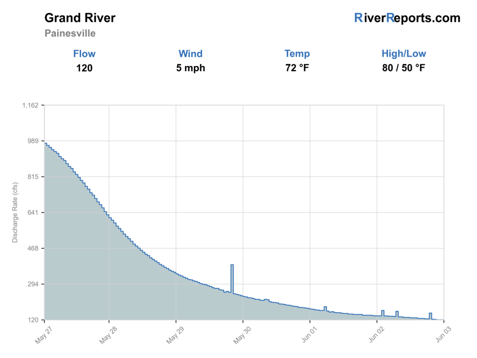
Showing the available RiverReports chart while the current structured flow series loads. Check the chart on RiverReports Opens in a new tab.
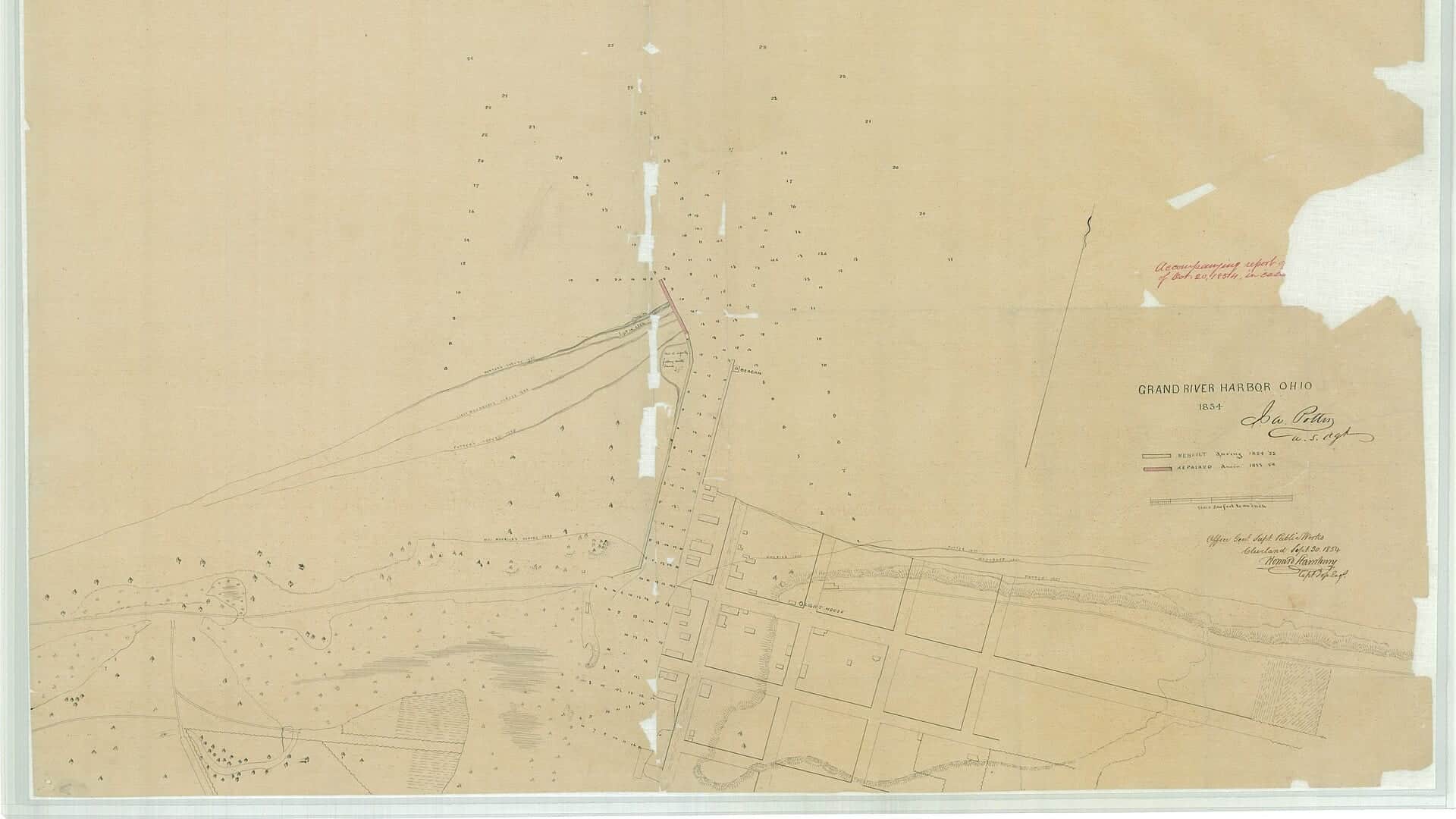
Photo: Unknown author Unknown author or not provided Opens in a new tab. · Public domain
Best option: Wading. Wading is in play only where your chosen access has clear footing, legal entry, and no forced crossings.
Rating updatedRiver local time:
USGS shows 53 cfs. The flow has been stable over about 6 hours. USGS marks this reading provisional and may revise it. USGS records for this date (1975-2026, 52 readings) show a median near 166 cfs and the lower quartile near 73 cfs; today's flow is below normal for the date. This is below normal, so edge depth, temperature, and pressure matter.
NWS air forecast near
RiverReports gauge
Showing the available RiverReports chart while the current structured flow series loads. Check the chart on RiverReports Opens in a new tab.
Clear
The National Weather Service forecast is temporarily unavailable.
RiverReports gauge: Grand River near Painesville
Seasonal starting points, not a live hatch report. Match what you see on the water.
Each fly name opens its matching Fly Box guide.
Fish the Grand when flow is dropping, color is improving, and the weather gives you safe footing. If it is still high and muddy, smaller streams or a lakefront plan may be better.
Best steelhead window. Cover travel lanes, soft inside seams, and tailouts.
Wait or choose a smaller stream. The Grand can need extra clearing time.
Use lighter tippet, smaller eggs or nymphs, and longer approaches.
Switch to smallmouth tactics and protect trout from warm-water stress.
These scores compare the risks of wading, bank fishing, and floating.
Wading is in play only where your chosen access has clear footing, legal entry, and no forced crossings.
This report does not recommend bank fishing on this reach.
This report does not recommend floating this reach.
Is Grand River worth the trip today? Check flow, weather, hatches, access, and rules for Ohio before you go.
The Grand is the largest Ohio steelhead river in this batch, and that size is both the draw and the warning. It can hold fish well, but it often needs more time than smaller streams after rain.
USGS shows 53 cfs. The flow has been stable over about 6 hours. USGS marks this reading provisional and may revise it. USGS records for this date (1975-2026, 52 readings) show a median near 166 cfs and the lower quartile near 73 cfs; today's flow is below normal for the date. This is below normal, so edge depth, temperature, and pressure matter.
Fall: Fresh steelhead move after rain and cooling lake temperatures.
USGS water temperature is about 55.8F, and the rolling 24-hour high did not trigger a heat caution. USGS marks the temperature data provisional and may revise it.
No active NWS alert was returned for this forecast point.
Skip wading when the river is high, muddy, full of debris, iced along the banks, or when the chosen access would force pushy crossings.
Use RiverReports Painesville and USGS 04212100 as the main trend. The Grand often needs more clearing time than smaller streams, so dropping and green is more useful than simply dropping.
Skip wading when the river is high, muddy, full of debris, iced along the banks, or when the chosen access would force pushy crossings.
Start with the Painesville gauge, ODNR map, city or metropark access, and the weather. If the river is still heavy, compare a smaller stream rather than forcing the Grand.
If the Grand is still high or muddy, compare Rocky River, Chagrin River, or Conneaut Creek for different clearing timing.
Use these places as starting points. Open the access link below and check posted signs before you park or enter.
Use the current Ohio fishing rules and ODNR steelhead resources before fishing. Do not rely on old bag-limit or season summaries from third-party reports.
Primary flow and access-planning area for this report.
City access with Grand River frontage and nearby stocked pond context.
Useful public access context for lower-river planning.
Official agencies and primary river operators come first. Secondary tools are labeled so you know what carries the most weight.
Check what is allowed, where the rule applies, and whether the river is open.
Check the latest river reading and forecast before you leave.
Check public entry points, land rules, and seasonal access changes.
Use these links for stocking, safety, and other local details.
Check what is allowed, where the rule applies, and whether the river is open.
Open the current rules and check the river section, season, and special limits.
Check the latest river reading and forecast before you leave.
Open this page and check the latest safety advice before your trip.
Open this river reading to check the latest level, flow, and update time.
Open this river reading to check the latest level, flow, and update time.
Check public entry points, land rules, and seasonal access changes.
Open the land or access page, then check signs before you park or enter.
Open the land or access page, then check signs before you park or enter.
Open the land or access page, then check signs before you park or enter.
Use these links for stocking, safety, and other local details.
Open this page for more river information and check when it was last updated.
What was checked: This report is maintained from current regulation, access, flow, weather, and public planning sources so anglers can make better trip decisions than a raw gauge or generic overview would allow.
Live measurements and forecasts keep their provider timestamps. Rules, access, and trip guidance use the source-review date shown here. BlueStreamFly planning advice is editorial interpretation, not an agency notice.
First-hand experience: BlueStreamFly does not claim a first-hand visit or local field test for this report unless a real contributor is explicitly named and linked.
Check Painesville flow, recent rain, water color, and the ODNR steelhead map first. The Grand is large enough that yesterday's rain may still matter today.
Start with Painesville and mapped public access, then expand only after you understand the river level and parking rules.
Yes at the right level, but it is a big river. Avoid pushy water, shelf ice, and clay or shale ledges.
Bring the seasonal fly box, a few backup nymphs or streamers, and enough tippet to change tactics when flow, clarity, temperature, or crowds change.