RiverReports chart
Recent flow
RiverReports gauge
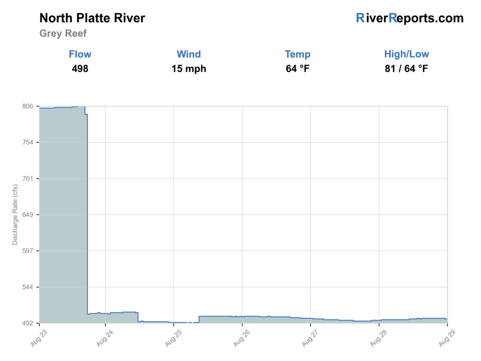
BlueStreamFly cannot read the latest value from this image. Check the chart on RiverReports Opens in a new tab.
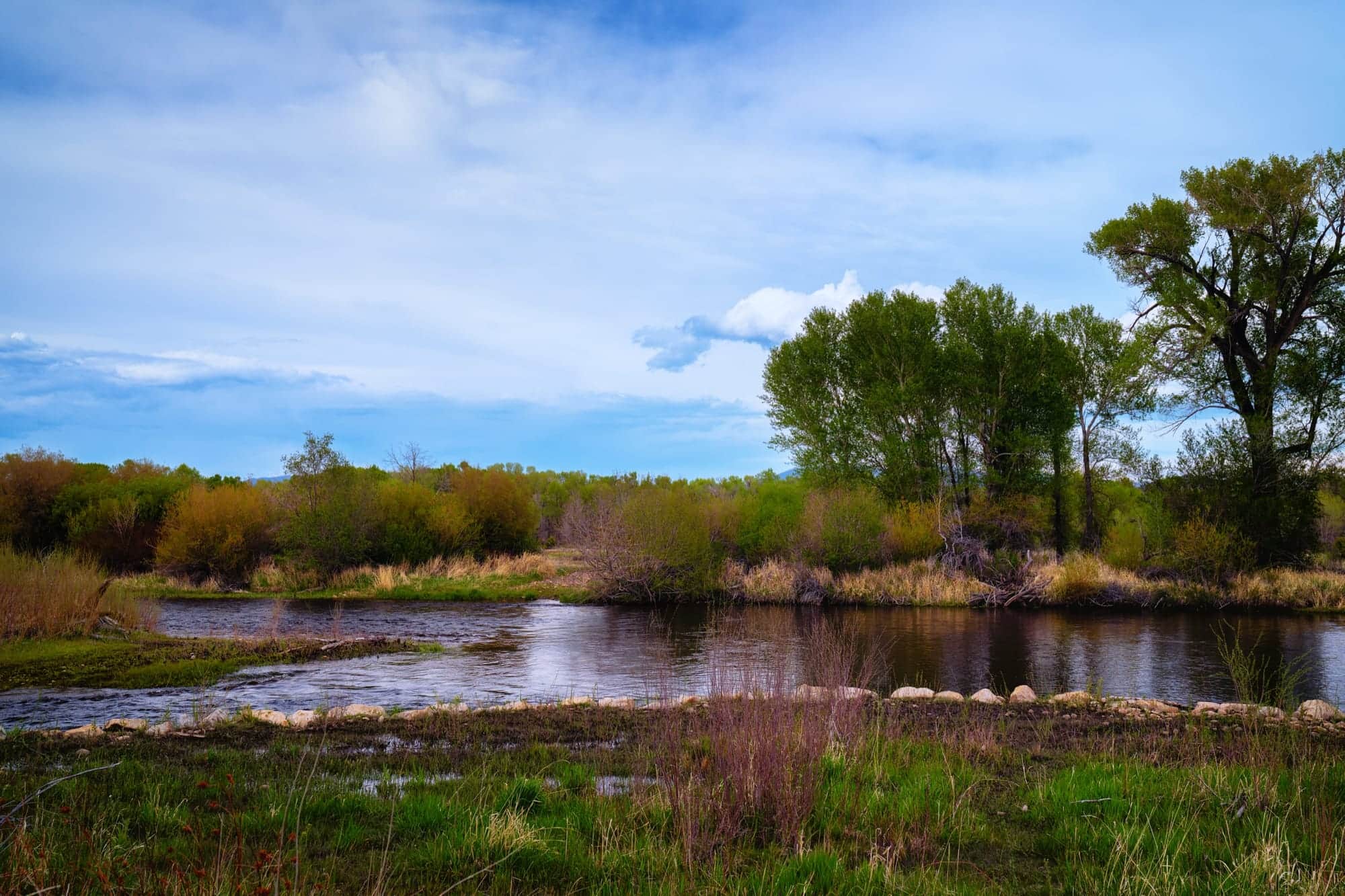
Photo: Tony Webster Opens in a new tab. · CC BY 4.0
Check the official notice before fishing.
We cannot confirm the current official status. Fishing tips stay hidden until you check the agency link.
NWS air forecast near
This is an air forecast, not a river-temperature reading. Check the water with a stream thermometer before fishing in hot weather.
RiverReports gauge
BlueStreamFly cannot read the latest value from this image. Check the chart on RiverReports Opens in a new tab.
Patchy Fog
The National Weather Service forecast is temporarily unavailable.
RiverReports gauge: North Platte River at Grey Reef (USBR-backed)
Check the current warning, restriction, or advisory before choosing flies or tactics.
Seasonal fly and tactic guidance stays hidden while this stop or unverified notice applies.
Use the official notice and current conditions instead of fishing advice.
We cannot confirm the current official status. Fishing tips stay hidden until you check the agency link.
Use these places as starting points. Open the access link below and check posted signs before you park or enter.
From Gray Reef Dam to Wyoming Highway 220/Government Bridge, the 2026 rule is one trout with all trout under 20 inches released, single-point barbless-hook artificial flies or lures only, and pegged attractors prohibited. Separate signed segments at the gauge cables and from Ledge Creek toward S Gulch close April 1-May 15. Current Wyoming rules and signs are the legal authority.
USBR documents the fishing pier, restroom, primitive camp, small-craft launch, and ramp/parking roughly one-half mile below the dam.
BLM identifies this as watercraft-only access with public/private boundary markers. It is also part of a spring closure boundary and must be checked carefully.
The downstream endpoint for the core special-rule reach. Verify current public access and private-bank markers before a float.
Applies to: Between the signed gauge-cable crossings, with the first crossing about 700 yards below Gray Reef Dam
When: April 1-May 15 annually
Source reviewed:
This is one signed subreach, not a closure of the full dam-to-Government Bridge corridor.
Open official source in a new tabApplies to: Ledge Creek confluence downstream about 1.2 miles to S Gulch
When: April 1-May 15 annually
Source reviewed:
This is a second, separate signed subreach, not a closure of the full tailwater.
Open official source in a new tabOfficial agencies and primary river operators come first. Secondary tools are labeled so you know what carries the most weight.
Check what is allowed, where the rule applies, and whether the river is open.
Check the latest river reading and forecast before you leave.
Check public entry points, land rules, and seasonal access changes.
Use these links for stocking, safety, and other local details.
Check what is allowed, where the rule applies, and whether the river is open.
Open the current rules and check the river section, season, and special limits.
Open this notice to check its current status, dates, and affected river section.
Applies to: Between the signed gauge-cable crossings, with the first crossing about 700 yards below Gray Reef Dam
When: April 1-May 15 annually
This is one signed subreach, not a closure of the full dam-to-Government Bridge corridor.
Open this notice to check its current status, dates, and affected river section.
Applies to: Ledge Creek confluence downstream about 1.2 miles to S Gulch
When: April 1-May 15 annually
This is a second, separate signed subreach, not a closure of the full tailwater.
Open the current rules and check the river section, season, and special limits.
Check the latest river reading and forecast before you leave.
Open this page and check the latest safety advice before your trip.
Open this river reading to check the latest level, flow, and update time.
Open this river reading to check the latest level, flow, and update time.
Open this river reading to check the latest level, flow, and update time.
Check public entry points, land rules, and seasonal access changes.
Open the land or access page, then check signs before you park or enter.
Open the land or access page, then check signs before you park or enter.
Open the land or access page, then check signs before you park or enter.
Use these links for stocking, safety, and other local details.
Open this page and check the latest safety advice before your trip.
Open this page and check the latest safety advice before your trip.
What was checked: This restored report is maintained from official flow, regulation, access, weather, and public-land sources. Planning guidance is separated from live observations and legal rules.
Live measurements and forecasts keep their provider timestamps. Rules, access, and trip guidance use the source-review date shown here. BlueStreamFly planning advice is editorial interpretation, not an agency notice.
First-hand experience: BlueStreamFly does not claim a first-hand visit or local field test for this report unless a real contributor is explicitly named and linked.
Fishing tips stay hidden until the official notice is clear.

