Wade · Best fit82/100
Wading is in play only where your chosen access has clear footing, legal entry, and no forced crossings.

Fly fishing report · Midwest
A Manitowoc River report built around DNR access maps, Manitou Park shoreline planning, and the mixed smallmouth-to-lake-run identity of the lower river.
Check flow & weatherCurrent USGS flow is 30 cfs and has been stable for about 6 hours. Today's flow is below the normal seasonal range, which begins near 42 cfs. This is below normal, so edge depth, temperature, and pressure matter.
Compare wading, bank fishing, and floating before choosing how you will fish.
Wading is in play only where your chosen access has clear footing, legal entry, and no forced crossings.
Bank and edge fishing remains a practical low-commitment option if access is legal and footing is safe.
A float is in play where this report supports boat access and wind, releases, and shuttle logistics are manageable.
Check before you drive
Look at whether the river is rising or falling, then check wind, rain, and storms. These can change both safety and fishing.
Before you rely on this report
Conditions can change quickly. Check these dates before you decide to fish, and open the official source when safety or rules matter.
High confidence in the current score inputs.
8 sources are listed below for you to open.
4 public access records are listed. Private spots are never shown.
Source checked Jul 30, 2026
Plan your access
These are public parking, launch, trail, or recreation areas—not secret fishing spots. We never show an angler's private pins, notes, or photos here.
Area description
The DNR close-to-home guide's clearest lower-river shoreline anchor.
The tributary map warns that users should confirm land ownership before assuming a legal bank route beyond the named accesses.
This page is strongest when you stay in the lower public park and launch corridor. It is not trying to solve every upstream parcel or branch decision.
Area description
A named access point on the DNR tributary PDF when you need another public lower-river option.
The tributary map warns that users should confirm land ownership before assuming a legal bank route beyond the named accesses.
This page is strongest when you stay in the lower public park and launch corridor. It is not trying to solve every upstream parcel or branch decision.
Area description
A mapped access checkpoint farther up the public lower-corridor system.
The tributary map warns that users should confirm land ownership before assuming a legal bank route beyond the named accesses.
This page is strongest when you stay in the lower public park and launch corridor. It is not trying to solve every upstream parcel or branch decision.
Area description
Useful for a separate branch-day decision rather than assuming it fishes the same as the main lower river.
The tributary map warns that users should confirm land ownership before assuming a legal bank route beyond the named accesses.
This page is strongest when you stay in the lower public park and launch corridor. It is not trying to solve every upstream parcel or branch decision.
How to fish it
Wisconsin DNR's official sources point to a very specific lower-river pattern here: Manitou Park shoreline access, additional mapped park and launch points, and a mixed fishery that can mean smallmouth one month and run fish the next. The river is useful because the public access is visible and repeatable, not because it gives you permission to improvise on every bank.
USGS shows 30 cfs with a stable over about 6 hours trend. Today's flow is below the normal seasonal range, which begins near 42 cfs. This is below normal, so edge depth, temperature, and pressure matter.
Summer: Most honest as a smallmouth and mixed-species lower-river page.
The NWS forecast is about 69F with Mostly Clear.
No active NWS alert was returned for this forecast point.
Skip blowouts, access-map guesswork, and warm low periods when you are forcing a trout identity the season does not support.
Read the water
Manitowoc is strongest when you use the mapped lower-river public access points and match your fly plan to the season. Stable shoulder-season flow gives you the best shot at lake-run trout, while summer works better as a lower-river smallmouth and mixed-species page.
Best for trout-run coverage from the lower public accesses.
A better smallmouth and mixed-species plan than a forced lake-run trout trip.
Can bring fish in, but too much mud and push quickly turn shoreline access into guesswork.
Requires lighter presentations and a more cautious lower-river approach around obvious holding lanes.
Your trip plan
Best when the lower river is cool and stable enough to fish current breaks cleanly without turning park banks into mud traps.
Skip blowouts, access-map guesswork, and warm low periods when you are forcing a trout identity the season does not support.
Choose one public site, fish it hard, then rotate only among the other named DNR points if the river is still shaping up well.
Move to Kewaunee or Sheboygan when the Manitowoc's lower public corridor is too crowded or too dirty to fish well.
Hatches & flies
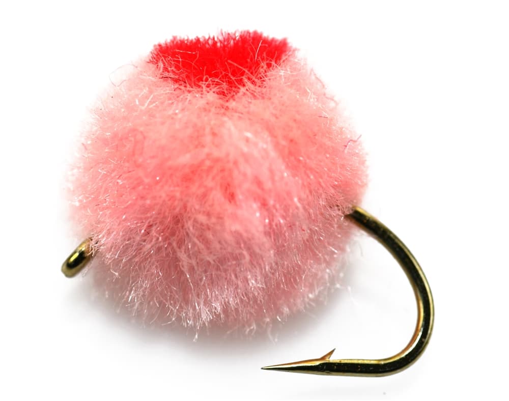 Fly family · report suggests “Egg pattern”Egg Fly PatternsEgg flies are tied to the hook. Round clipped-yarn eggs, sparkly chenille eggs, veiled eggs, single eggs, and clusters differ in material and silhouette; pegged or free-sliding beads are rigs, not fly patterns.See family guide ↗Fly family · report suggests “yarn fly”Egg Fly PatternsEgg flies are tied to the hook. Round clipped-yarn eggs, sparkly chenille eggs, veiled eggs, single eggs, and clusters differ in material and silhouette; pegged or free-sliding beads are rigs, not fly patterns.See family guide ↗+ 3 more reviewed guides in the Fly Box Fly family · report suggests “Egg pattern”Egg Fly PatternsEgg flies are tied to the hook. Round clipped-yarn eggs, sparkly chenille eggs, veiled eggs, single eggs, and clusters differ in material and silhouette; pegged or free-sliding beads are rigs, not fly patterns.See family guide ↗
 Fly pattern · report suggests “woolly bugger”Woolly BuggerThe shared pattern language is a marabou tail, chenille or dubbed body, and palmered hackle. Bead heads, dumbbell eyes, flash, rubber tails, colors, and body materials materially change the tied variation and must be labeled.See photos & how to fish it ↗+ 2 more reviewed guides in the Fly Box
  Fly family · report suggests “Poppers”Bass and Panfish Popper PatternsPoppers may use cupped foam, cork, balsa, deer hair, or pencil-shaped heads. Head face, size, buoyancy, tail, legs, and weed guard determine sound and action; a generic popper label does not identify one fly.See family guide ↗
 Fly pattern · report suggests “Clouser”Clouser Deep MinnowThe reviewed chartreuse-and-white form uses sparse layered bucktail with flash around lead barbell eyes. The eyes make the fly sink between strips and ride hook point up; color, eye weight, hook, and saltwater materials must remain labeled.See photos & how to fish it ↗+ 2 more reviewed guides in the Fly Box Fly family · report suggests “Egg pattern”Egg Fly PatternsEgg flies are tied to the hook. Round clipped-yarn eggs, sparkly chenille eggs, veiled eggs, single eggs, and clusters differ in material and silhouette; pegged or free-sliding beads are rigs, not fly patterns.See family guide ↗
 Fly family · report suggests “midge”Midge Patterns by StageMidge wording can mean a threadlike larva, wing-padded pupa, film emerger, tiny adult, or visible cluster. Those profiles fish at different depths.See family guide ↗+ 2 more reviewed guides in the Fly Box
 Start at Manitou Park or one of the other named map points and fish the water you can see well rather than chasing every rumor of a run.
Run-season days call for eggs, leeches, and short swing presentations around lower-river current breaks.
Summer days should switch to smallmouth tactics around shoreline structure, softer inside bends, and park-access pockets.
If flow or crowding kills confidence at one named access, move to the next mapped park rather than inventing a new bank entry.
Rules & closures
Open the agency page to confirm the exact river section, species, season, tackle rules, limits, and emergency closures.
Official links checkedWe checked the state source but did not find a clearly supported exception for this river. Check the official rules for the exact section you plan to fish.
This summary helps with trip planning. The linked agency rule is the one you must follow.
Updates from anglers
Recent observations from general areas of Manitowoc River. We review every update before it appears and never publish exact fishing spots, private access details, or photo locations.
You can still use the river plan above. Check back later for recent observations from other anglers.
Where this report comes from
Fishing guidance checked: Jun 3, 2026
Site check: Jul 14, 2026. We regularly test report links, live scores, flow and weather data, and page loading. The content date changes only when the fishing guidance or its sources change.
Common questions
Start at Manitou Park if you want the cleanest lower-river shoreline plan, then move among the named DNR map accesses only if the first water is crowded or poorly shaped.
No. The official DNR source stack supports both seasonal run-fish value and lower-river smallmouth fishing, so the right page changes with the season.
Check the Wisconsin regulations, the current gauge trend, which named public access you will actually use, and whether the season matches a run-fish or warmwater plan.
Skip it when the lower river is a dirty blowout, when public accesses are too crowded to fish safely, or when your plan depends on unconfirmed bank access off the map.