Wade, bank, and floatLimited data
Use the live sources and what you see at the river before choosing an approach.
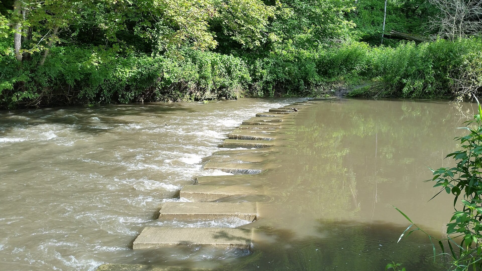
Fly fishing report · Midwest
A Whitewater River report for southeastern Minnesota trout anglers checking stream conditions, fork access, hatches, weather, and special rules.
Check flow & weatherThis river does not have a reliable live gauge attached. Check the weather, recent rain, local reports, and the water when you arrive.
There is not enough reliable current information to recommend wading, bank fishing, or floating.
Use the live sources and what you see at the river before choosing an approach.
Check before you drive
Look at whether the river is rising or falling, then check wind, rain, and storms. These can change both safety and fishing.
Before you rely on this report
Conditions can change quickly. Check these dates before you decide to fish, and open the official source when safety or rules matter.
Medium confidence in the current score inputs.
7 sources are listed below for you to open.
3 public access records are listed. Private spots are never shown.
Source checked Jul 30, 2026
Plan your access
These are public parking, launch, trail, or recreation areas—not secret fishing spots. We never show an angler's private pins, notes, or photos here.
Public land
Useful public base with trout-water and park-rule planning.
Use DNR maps, state park information, and trout easements. Private land is common outside mapped access.
Recent rain can change the river faster than a stale gauge page can help you.
Area description
Fork-specific access and stream-condition checks matter before driving.
Use DNR maps, state park information, and trout easements. Private land is common outside mapped access.
Recent rain can change the river faster than a stale gauge page can help you.
Trailhead
A different lower-river context than the core trout reaches.
Use DNR maps, state park information, and trout easements. Private land is common outside mapped access.
Recent rain can change the river faster than a stale gauge page can help you.
How to fish it
The Whitewater is a strong southeastern Minnesota trout option, but the reviewed USGS discharge feed was not reliable as a current live gauge. Use DNR stream conditions, rainfall, and fork-specific access.
No verified live public gauge is attached, so the page cannot make a strong real-time call.
Early summer: Caddis, sulphurs, terrestrials, and dry-dropper fishing can be productive.
The NWS forecast is about 75F with Clear.
No active NWS alert was returned for this forecast point.
Skip the creek when bluff-country storms have stained the water, banks are muddy, the stream is rising, water is warm, or the exact fork and access boundary are unclear.
Read the water
Fish the Whitewater when stream-condition reports and recent weather show clear, safe water. If rain has moved through, wait for clarity or pick a different Driftless option.
Fish small dries, scuds, pheasant tails, and caddis with quiet approaches.
Use small streamers or larger nymphs around banks and deeper bends.
Skip the creek. Bluff-country water and banks can become unsafe quickly.
Fish early, stay near cold influence, and stop trout handling when temperatures climb.
Your trip plan
Use DNR stream-condition updates and rainfall first. The USGS Whitewater station is useful context, but this report does not treat it as a dependable current cfs reading for every trout reach.
Skip the creek when bluff-country storms have stained the water, banks are muddy, the stream is rising, water is warm, or the exact fork and access boundary are unclear.
Start with DNR stream conditions, the trout map, and Whitewater State Park or fork-specific access, then choose small nymphs and dries for clear water or light streamers only after mild stain.
If the Whitewater is muddy, warm, or crowded, compare the South Fork Root, South Branch Root, or St. Croix before forcing a poor trout-stream day.
Hatches & flies
 Fly pattern · report suggests “Zebra midge”Zebra MidgeLook for a very slim tapered thread body, evenly spaced contrasting wire rib, a small bead, and no tail or wing. The reviewed classic is black with silver wire and a silver bead. Red, olive, brown, glass-bead, jig-hook, resin-coated, or tailed forms must remain labeled variations rather than replacing the classic identity.See photos & how to fish it ↗
 Fly family · report suggests “scud”Scud Fly PatternsScud patterns typically use a curved hook, tapered dubbed body, shellback, rib segmentation, antennae, and brushed legs. Olive, tan, gray, orange, weighted, bead-body, and pregnant forms remain labeled—not aliases for one recipe.See family guide ↗+ 3 more reviewed guides in the Fly Box
  Fly pattern · report suggests “Elk hair caddis”Elk Hair CaddisLook for a tented elk- or deer-hair wing, clipped hair head, dubbed body, rib, and hackle palmered along the body. The body color should be labeled because tiers often match different natural caddis colors.See photos & how to fish it ↗
 Fly family · report suggests “caddis pupa”Caddis Pupa PatternsCaddis pupa is a life-stage family. Curved bodies, wing pads, legs, beads, and soft-hackle collars differ among exact patterns and must be labeled.See family guide ↗+ 3 more reviewed guides in the Fly Box
  Fly family · report suggests “Foam ant”Ant PatternsAnt patterns can be foam, fur-bodied, winged, or sunken. The narrow waist and paired body lobes matter more than one material recipe.See family guide ↗
 Fly family · report suggests “beetle”Beetle PatternsBeetle flies range from simple foam shells to hair-bodied and sunken forms. A rounded back and compact profile distinguish the family from ants and hoppers.See family guide ↗+ 2 more reviewed guides in the Fly Box
  Fly family · report suggests “BWO”Blue-Winged Olive PatternsBWO describes a hatch group, not one fly. Nymph, emerger, dry, cripple, and spinner profiles must stay separate because they occupy different parts of the water column.See family guide ↗Fly pattern · report suggests “zebra midge”Zebra MidgeLook for a very slim tapered thread body, evenly spaced contrasting wire rib, a small bead, and no tail or wing. The reviewed classic is black with silver wire and a silver bead. Red, olive, brown, glass-bead, jig-hook, resin-coated, or tailed forms must remain labeled variations rather than replacing the classic identity.See photos & how to fish it ↗+ 3 more reviewed guides in the Fly Box
 Check the fork and access before picking flies; the same river name can mean very different water.
Use small nymphs and scuds first when fish are not visibly rising.
Fish terrestrials tight to grass and brush in summer, especially with a light breeze.
Use small streamers after light stain, but do not fish through unsafe muddy water.
Move slowly in clear pools and give pressured state-park fish extra distance.
Rules & closures
Open the agency page to confirm the exact river section, species, season, tackle rules, limits, and emergency closures.
Official links checkedWe checked the state source but did not find a clearly supported exception for this river. Check the official rules for the exact section you plan to fish.
This summary helps with trip planning. The linked agency rule is the one you must follow.
Updates from anglers
Recent observations from general areas of Whitewater River. We review every update before it appears and never publish exact fishing spots, private access details, or photo locations.
You can still use the river plan above. Check back later for recent observations from other anglers.
Where this report comes from
Fishing guidance checked: Jul 6, 2026
Site check: Jul 14, 2026. We regularly test report links, live scores, flow and weather data, and page loading. The content date changes only when the fishing guidance or its sources change.
Common questions
Check DNR stream conditions, recent rain, trout maps, park access, and the exact fork before fishing.
Yes. Minnesota trout regulations and special reaches can apply, so check the current rule PDF and maps.
Yes, if you match the reach, season, target species, water temperature, and current access rules. This report is built to help you choose that plan.
Bring the hatch-chart flies, confidence nymphs, and a backup streamer or warmwater box so you can adjust to flow, clarity, and temperature.
Use Whitewater State Park information, DNR trout easements, water-trail pages, and legal road access.