Recent flow chart is loading
The latest stored reading is shown above. Check the official source below if you need the newest value now.
No single best way to fish. Wading and Bank fishing have the same top score. Use current access, footing, weather, and local rules to choose.
Rating updatedRiver local time:
USGS shows 4,230 cfs. The flow has been stable over about 6 hours. USGS marks this reading provisional and may revise it. USGS records for this date (1931-2026, 96 readings) show a median near 2,570 cfs and the upper quartile near 4,320 cfs; today's flow is on the high side for the date. This is near the high side of normal, so be careful about wading, clarity, and pushy current before calling it good.
NWS air forecast near
The latest stored reading is shown above. Check the official source below if you need the newest value now.
Sunny
The National Weather Service forecast is temporarily unavailable.
RiverReports gauge: Potomac River at Little Falls Pump Station
From the latest stored river check. Open the official source for the newest reading.
Seasonal starting points, not a live hatch report. Match what you see on the water.
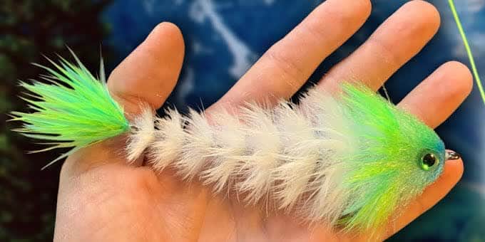
Also try Slider, damselfly nymph, crayfish
Try Scout access; fish slow streamers only during safe mild windows.
Each fly name opens its matching Fly Box guide.
The Potomac fishes best when flows are stable, water is clear enough for how you fish the fly, and heat or storms are not creating unsafe conditions. If the river is high, switch to shore scouting or smaller streams.
Fish ledge edges, eddies, current breaks, and bank shade with baitfish or crayfish patterns.
Fish early or late, use smaller streamers or poppers, and avoid stressing fish in heat.
Do not wade ledges. Fish safe banks or choose another water.
Lower sections need tide, wind, and boat-traffic planning more than trout-style flow reading.
Wading and Bank fishing have the same top score. Use current access, footing, weather, and local rules to choose.
Wading is in play only where your chosen access has clear footing, legal entry, and no forced crossings.
Bank and edge fishing remains a practical low-commitment option if access is legal and footing is safe.
This report does not recommend floating this reach.
Is Potomac River worth the trip today? Check flow, weather, hatches, access, and rules for Maryland before you go.
The Maryland Potomac changes from rocky nontidal water to tidal and metro water. Around Great Falls and Little Falls, flow, safety, and target species should drive the plan.
USGS shows 4,230 cfs. The flow has been stable over about 6 hours. USGS marks this reading provisional and may revise it. USGS records for this date (1931-2026, 96 readings) show a median near 2,570 cfs and the upper quartile near 4,320 cfs; today's flow is on the high side for the date. This is near the high side of normal, so be careful about wading, clarity, and pushy current before calling it good.
An active public alert is in effect near this forecast point, so the score is capped at caution until conditions are checked. NWS alert: Test Message.
Wade: Wading is in play only where your chosen access has clear footing, legal entry, and no forced crossings.
Fall: Cooling water can restart baitfish and streamer windows.
USGS water temperature is about 57.9F, and the rolling 24-hour high did not trigger a heat caution. USGS marks the temperature data provisional and may revise it.
Use RiverReports and USGS 01646500 at Little Falls for lower Maryland and DC area context. Stable moderate flows are best for warmwater structure. High water should move the plan to safe banks or another river.
Skip wading or boating when the river is high, Great Falls safety restrictions apply, storms or debris are moving through, tidal or striped bass rules are unclear, or the access point depends on unsafe ledges.
Choose the river style first: C&O area bank access, Great Falls observation and safety context, Little Falls flow planning, or a lower tidal plan that has a separate rule and launch check.
If the Potomac is high, hot, crowded, or safety-limited, compare the North Branch Potomac, Big Gunpowder Falls, or Savage River system for a more focused Maryland plan.
Use these places as starting points. Open the access link below and check posted signs before you park or enter.
Maryland rules vary by freshwater/tidal context and target species. Check current DNR rules for black bass, striped bass, walleye, musky, and any harvest plan.
Useful Maryland-side access, but check NPS closures, parking, and trail conditions.
Scenic and fishy, but dangerous in high water. Respect posted safety restrictions.
The flow-reference reach for this page, with big-river safety and urban access considerations.
Official agencies and primary river operators come first. Secondary tools are labeled so you know what carries the most weight.
Check what is allowed, where the rule applies, and whether the river is open.
Check the latest river reading and forecast before you leave.
Check public entry points, land rules, and seasonal access changes.
Use these links for stocking, safety, and other local details.
Check what is allowed, where the rule applies, and whether the river is open.
Open the current rules and check the river section, season, and special limits.
Check the latest river reading and forecast before you leave.
Open this page and check the latest safety advice before your trip.
Open this river reading to check the latest level, flow, and update time.
Open this river reading to check the latest level, flow, and update time.
Check public entry points, land rules, and seasonal access changes.
Open the land or access page, then check signs before you park or enter.
Open the land or access page, then check signs before you park or enter.
Use these links for stocking, safety, and other local details.
Open this page and check the latest safety advice before your trip.
Open this page for more river information and check when it was last updated.
What was checked: This report is maintained from current regulation, access, flow, weather, and public planning sources so anglers can make better trip decisions than a raw gauge or generic overview would allow.
Live measurements and forecasts keep their provider timestamps. Rules, access, and trip guidance use the source-review date shown here. BlueStreamFly planning advice is editorial interpretation, not an agency notice.
First-hand experience: BlueStreamFly does not claim a first-hand visit or local field test for this report unless a real contributor is explicitly named and linked.
Check Little Falls flow, weather, and C&O/NPS access before choosing a wade, bank, or boat plan.
Yes. Rules depend on target species and whether you are in freshwater or tidal context.
Access is broad but not simple. Safety, parking, NPS rules, high water, and private or restricted areas all matter.
Bring the hatch chart flies, a few confidence nymphs or baitfish patterns, and a backup selection for high, low, clear, stained, cold, or warm conditions.