Wade, bank, and floatLimited data
Use the live sources and what you see at the river before choosing an approach.
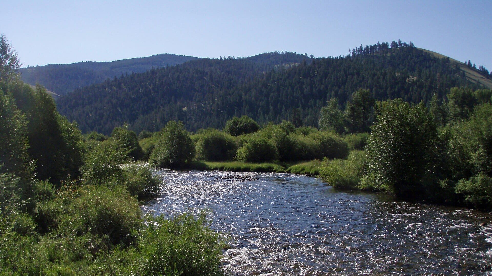
Fly fishing report · West
An East Fork Bitterroot report for anglers planning small freestone trout water with no exact live gauge, public-land access checks, and current FWP rules.
Check flow & weatherThis river does not have a reliable live gauge attached. Check the weather, recent rain, local reports, and the water when you arrive.
There is not enough reliable current information to recommend wading, bank fishing, or floating.
Use the live sources and what you see at the river before choosing an approach.
Check before you drive
Look at whether the river is rising or falling, then check wind, rain, and storms. These can change both safety and fishing.
Before you rely on this report
Conditions can change quickly. Check these dates before you decide to fish, and open the official source when safety or rules matter.
Medium confidence in the current score inputs.
6 sources are listed below for you to open.
3 public access records are listed. Private spots are never shown.
Source checked Jul 30, 2026
Plan your access
These are public parking, launch, trail, or recreation areas—not secret fishing spots. We never show an angler's private pins, notes, or photos here.
Roadside access
Use public-land information and posted access to choose a legal reach.
Public access is not continuous. Confirm public land or permission before leaving the road.
Spring water can be fast and snag-filled even when the creek looks small from the bank.
Public land
Forest recreation pages confirm fishing and travel planning, but do not replace FWP regulations.
Public access is not continuous. Confirm public land or permission before leaving the road.
Spring water can be fast and snag-filled even when the creek looks small from the bank.
Roadside access
Useful towns for weather, road, and nearby Bitterroot backup plans.
Public access is not continuous. Confirm public land or permission before leaving the road.
Spring water can be fast and snag-filled even when the creek looks small from the bank.
How to fish it
No verified public live gauge was confirmed for the East Fork Bitterroot fishing reach during this review. Use the weather module, nearby Bitterroot context, and on-site clarity before committing.
No verified live public gauge is attached, so the page cannot make a strong real-time call.
An Air Quality Alert is active near this forecast point, so the score is capped at caution until smoke and access conditions are checked. NWS alert: Air Quality Alert issued August 2 at 9:12AM MDT by NWS Great Falls MT.
Summer: The best small-water dry-dropper window, with morning temperature checks.
The NWS forecast is about 77F with Patchy Smoke.
Skip or move to a larger, better-gauged river when runoff is pushy, roads or public access are unclear, thunderstorms have changed clarity, or water temperature and handling conditions are poor.
Read the water
The best East Fork plan is a clear, stable, cool-water day with light gear and conservative wading. If runoff, thunderstorms, or private-access uncertainty are present, pick a safer Bitterroot reach.
Fish dry-droppers, small attractors, caddis, and soft hackles through pocket water.
Expect cold, fast, pushy water and wood hazards; wait for safer flows.
Use longer leaders, smaller flies, shade, and short fights.
Check clarity and road conditions before dropping into a narrow reach.
Your trip plan
No verified public live gauge is used for this reach. Use the National Weather Service point, recent rain and snowmelt trend, visual clarity, and downstream Bitterroot context before stepping into a narrow or woody reach.
Skip or move to a larger, better-gauged river when runoff is pushy, roads or public access are unclear, thunderstorms have changed clarity, or water temperature and handling conditions are poor.
Start with current FWP rules and a public-land access plan near Sula or Conner. Fish a short defined reach carefully instead of trying to solve the entire fork in one day.
If the East Fork is high, woody, muddy, or access-limited, compare the West Fork Bitterroot for better flow support, the main Bitterroot for more room, or Rock Creek for a stronger public-access framework.
Hatches & flies
 Fly family · report suggests “BWO emerger”Blue-Winged Olive PatternsBWO describes a hatch group, not one fly. Nymph, emerger, dry, cripple, and spinner profiles must stay separate because they occupy different parts of the water column.See family guide ↗
 Fly family · report suggests “March Brown”March Brown Dry FliesThis family includes traditional hackled, parachute, and Comparadun-style March Brown dries. Each exact construction rides differently and should be named when known.See family guide ↗+ 3 more reviewed guides in the Fly Box
  Fly pattern · report suggests “Elk hair caddis”Elk Hair CaddisLook for a tented elk- or deer-hair wing, clipped hair head, dubbed body, rib, and hackle palmered along the body. The body color should be labeled because tiers often match different natural caddis colors.See photos & how to fish it ↗
 Fly family · report suggests “PMD”Pale Morning Dun PatternsPMD names an insect group, not one fly. Pale nymphs, trailing-shuck emergers, upright or low-riding duns, cripples, and spent-wing spinners stay visibly separate.See family guide ↗+ 2 more reviewed guides in the Fly Box
  Fly family · report suggests “Foam hopper”Grasshopper PatternsHopper patterns share a substantial body and long rear-leg impression, but foam, deer hair, wing construction, and waterline differ widely among named patterns.See family guide ↗
 Fly family · report suggests “ant”Ant PatternsAnt patterns can be foam, fur-bodied, winged, or sunken. The narrow waist and paired body lobes matter more than one material recipe.See family guide ↗+ 3 more reviewed guides in the Fly Box Fly family · report suggests “BWO”Blue-Winged Olive PatternsBWO describes a hatch group, not one fly. Nymph, emerger, dry, cripple, and spinner profiles must stay separate because they occupy different parts of the water column.See family guide ↗
 Fly pattern · report suggests “zebra midge”Zebra MidgeLook for a very slim tapered thread body, evenly spaced contrasting wire rib, a small bead, and no tail or wing. The reviewed classic is black with silver wire and a silver bead. Red, olive, brown, glass-bead, jig-hook, resin-coated, or tailed forms must remain labeled variations rather than replacing the classic identity.See photos & how to fish it ↗+ 3 more reviewed guides in the Fly Box
 Approach from downstream and keep casts short, accurate, and quiet.
Use a small dry-dropper through pocket water before changing flies too often.
Fish shade, undercut banks, soft edges behind boulders, and tailouts.
Carry a few small streamers for stained water, but avoid pushing unsafe runoff.
If a reach is too tight, private, or woody, move instead of forcing it.
Rules & closures
Open the agency page to confirm the exact river section, species, season, tackle rules, limits, and emergency closures.
Official links checkedWe checked the state source but did not find a clearly supported exception for this river. Check the official rules for the exact section you plan to fish.
This summary helps with trip planning. The linked agency rule is the one you must follow.
Updates from anglers
Recent observations from general areas of East Fork Bitterroot River. We review every update before it appears and never publish exact fishing spots, private access details, or photo locations.
You can still use the river plan above. Check back later for recent observations from other anglers.
Where this report comes from
Fishing guidance checked: Jul 6, 2026
Site check: Jul 14, 2026. We regularly test report links, live scores, flow and weather data, and page loading. The content date changes only when the fishing guidance or its sources change.
Common questions
Check FWP rules, recent rain, snowmelt, road access, weather, and visual water clarity because no exact live gauge was verified.
Yes. Check the current Montana FWP regulations for the East Fork and nearby Bitterroot reaches.
Bring the hatch-chart flies, a few confidence nymphs, and a streamer box. Then adjust for water temperature, clarity, and the insects you actually see.
Yes in public or permitted reaches, but access is mixed and the creek can be woody. Confirm legal access before parking.
Skip it when flows are unsafe, temperatures stress trout, wildfire or emergency closures are active, or legal access for the reach is not clear.