RiverReports preview · current series loading
Recent flow
RiverReports gauge
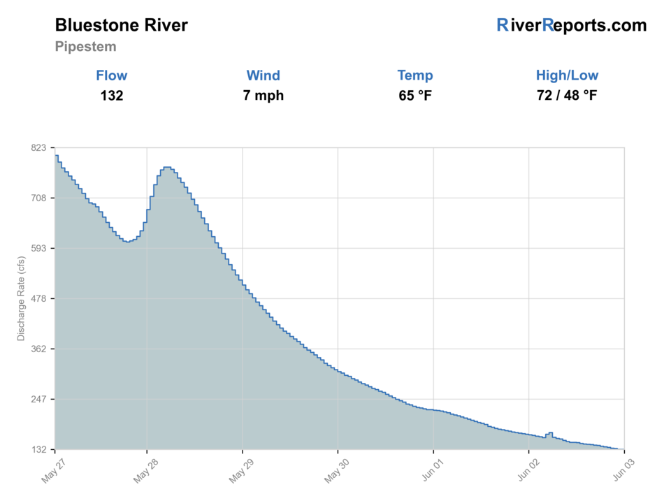
Showing the available RiverReports chart while the current structured flow series loads. Check the chart on RiverReports Opens in a new tab.
Flow is high for this time of year.
Best option: Floating. A float can fit better than wading only if launches, shuttle, boat skill, wind, and local rules all check out.
Rating updatedRiver local time:
USGS shows 176 cfs. The flow has been stable over about 6 hours. USGS marks this reading provisional and may revise it. USGS records for this date (1951-2026, 76 readings) show a median near 62 cfs and the upper quartile near 120 cfs; today's flow is high for the date. Fishable water may exist, but do not rate it highly without a safe access, clarity, and wading or boat plan.
NWS air forecast near
RiverReports gauge
Showing the available RiverReports chart while the current structured flow series loads. Check the chart on RiverReports Opens in a new tab.
Sunny
The National Weather Service forecast is temporarily unavailable.
RiverReports gauge: BLUESTONE RIVER NEAR PIPESTEM, WV
Seasonal starting points, not a live hatch report. Match what you see on the water.
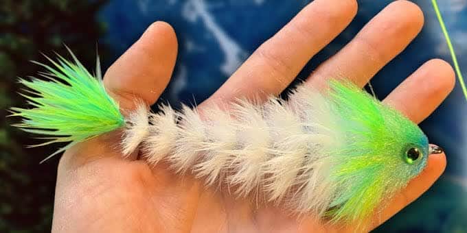
Also try crayfish, popper-dropper
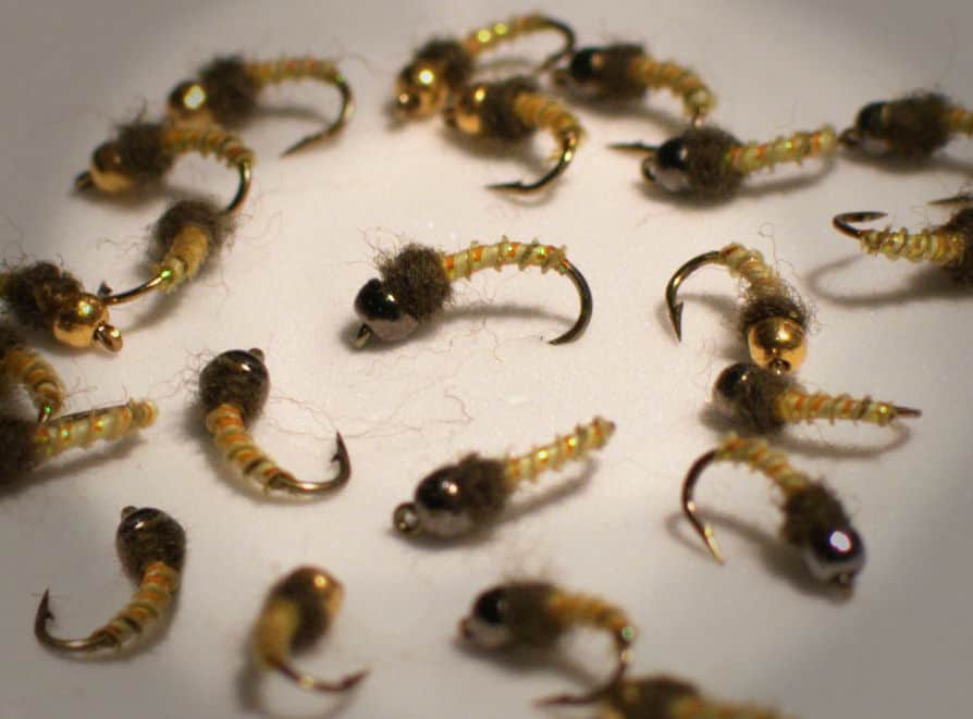
Also try Crayfish, hellgrammite
Each fly name opens its matching Fly Box guide.
Bluestone shines on stable moderate flow when you can fish ledges, current tongues, and soft summer shade lanes without fighting unsafe banks or dirty water. If storms are feeding the watershed, shorten the plan or move to another river.
The best all-around level for wading selected edges and working smallmouth structure cleanly.
Fish early and late, stay near shade and depth changes, and expect fish to bunch into fewer obvious lanes.
A borderline window at best. Current and launch quality matter more than whether you can still see a foot down.
A clear skip signal on trail-access and small-float plans.
These scores compare the risks of wading, bank fishing, and floating.
Wading is the most sensitive plan today. Use protected edges only, avoid crossings, and downgrade quickly if clarity or current feels wrong.
This report does not recommend bank fishing on this reach.
A float can fit better than wading only if launches, shuttle, boat skill, wind, and local rules all check out.
Is Bluestone River worth the trip today? Check flow, weather, hatches, access, and rules for West Virginia before you go.
The National Park Service treats this as a quality warmwater fishery with smallmouth, bluegill, and rock bass, but it is not a casual bank-hopping river. Match the RiverReports and USGS trend to one specific access plan, and keep your day shorter whenever the gorge or launch conditions start making the river feel bigger than it looks on paper.
USGS shows 176 cfs. The flow has been stable over about 6 hours. USGS marks this reading provisional and may revise it. USGS records for this date (1951-2026, 76 readings) show a median near 62 cfs and the upper quartile near 120 cfs; today's flow is high for the date. Fishable water may exist, but do not rate it highly without a safe access, clarity, and wading or boat plan.
Fall: Strong streamer and craw windows with cooler water and less pressure.
USGS water temperature is about 49.8F, and the rolling 24-hour high did not trigger a heat caution. USGS marks the temperature data provisional and may revise it.
No active NWS alert was returned for this forecast point.
Skip muddy spikes, blazing hot middays with flat low flow, and any day when the trail access feels harder than the fishing payoff.
Best when the graph is steady enough to expose ledges and soft bank lanes without turning entries into a scramble.
Skip muddy spikes, blazing hot middays with flat low flow, and any day when the trail access feels harder than the fishing payoff.
Fish one section near your chosen access and give it time before relocating. The Bluestone rewards patience more than mileage.
Move to a more straightforward valley river if weather or bank angle turns the day into an access problem instead of a fishing problem.
Use these places as starting points. Open the access link below and check posted signs before you park or enter.
Check West Virginia fishing rules before fishing the Bluestone River, and treat NPS river access and safety guidance as part of the legal planning process, not optional reading.
Use NPS fishing guidance and park contact points to match your entry to the day's level.
A practical base for short wade sessions or simple launch planning near the gauge reach.
Good for anglers willing to walk, but only when the return climb and bank angle stay reasonable.
Official agencies and primary river operators come first. Secondary tools are labeled so you know what carries the most weight.
Check what is allowed, where the rule applies, and whether the river is open.
Check the latest river reading and forecast before you leave.
Check public entry points, land rules, and seasonal access changes.
Use these links for stocking, safety, and other local details.
Check what is allowed, where the rule applies, and whether the river is open.
Open the current rules and check the river section, season, and special limits.
Check the latest river reading and forecast before you leave.
Open this page and check the latest safety advice before your trip.
Open this river reading to check the latest level, flow, and update time.
Open this river reading to check the latest level, flow, and update time.
Check public entry points, land rules, and seasonal access changes.
Open the land or access page, then check signs before you park or enter.
Use these links for stocking, safety, and other local details.
Open this page for more river information and check when it was last updated.
Open this page and check the latest safety advice before your trip.
What was checked: This report starts with official regulation, access, flow, weather, and public-water sources, then adds practical planning guidance for fly anglers.
Live measurements and forecasts keep their provider timestamps. Rules, access, and trip guidance use the source-review date shown here. BlueStreamFly planning advice is editorial interpretation, not an agency notice.
First-hand experience: BlueStreamFly does not claim a first-hand visit or local field test for this report unless a real contributor is explicitly named and linked.
Check the West Virginia rules, then compare RiverReports with USGS 03179000 and the NPS fishing and paddling guidance to make sure your chosen access still fits the day's level.
It depends on level, but this page assumes selective wading or short simple float plans. If the banks or current make the access feel bigger than expected, downshift to a shorter wade day.
Start with baitfish and craw patterns for smallmouth, then switch to poppers or sliders during low-light windows when fish slide shallow.
Skip it after fast rain spikes, when muddy flow hides structure, or when launch and trail conditions make a safe return uncertain.