Wade, bank, and floatPaused
Approach recommendations stay hidden until the hard stop clears.
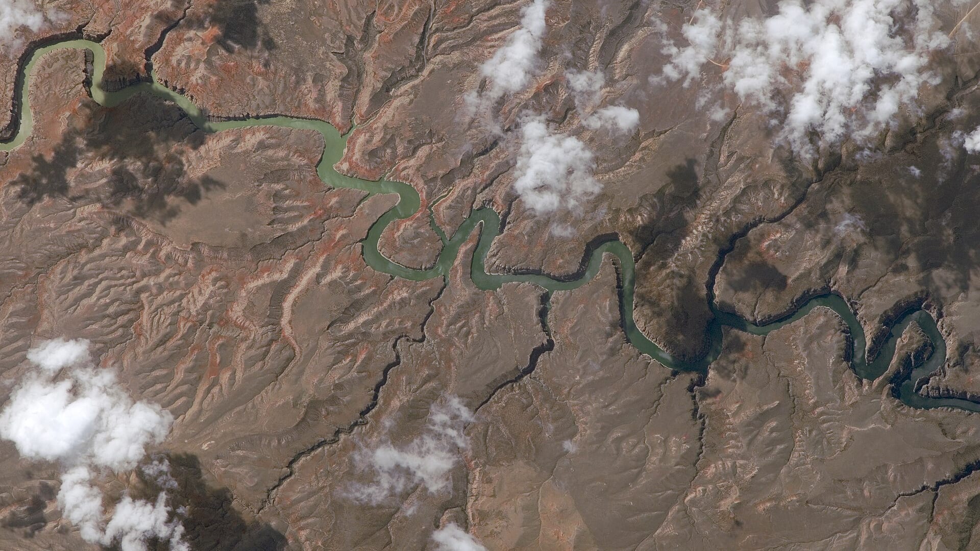
Fly fishing report · West
A Bighorn River report for Montana tailwater anglers checking Afterbay flow, hatches, access points, public-use rules, weather, and sources.
Check flow & weatherRed Flag Warning issued August 2 at 2:59PM MDT until August 3 at 3:00AM MDT by NWS Billings MT
Red Flag Warning issued August 2 at 2:59PM MDT until August 3 at 3:00AM MDT by NWS Billings MT
The active safety or closure reason takes priority over wading, bank fishing, and floating guidance.
Approach recommendations stay hidden until the hard stop clears.
Check before you drive
Look at whether the river is rising or falling, then check wind, rain, and storms. These can change both safety and fishing.
Before you rely on this report
Conditions can change quickly. Check these dates before you decide to fish, and open the official source when safety or rules matter.
High confidence in the current score inputs.
6 sources are listed below for you to open.
3 public access records are listed. Private spots are never shown.
Source checked Jul 30, 2026
Plan your access
These are public parking, launch, trail, or recreation areas—not secret fishing spots. We never show an angler's private pins, notes, or photos here.
Boat launch
Core upper tailwater launch and flow-reference area below Yellowtail Afterbay.
Limited access concentrates anglers and boats. Plan shuttle, launch timing, and etiquette before arrival.
Land status around the river is complex. Stay within legal access and confirm reservation-related rules before leaving the river corridor.
Area description
Important public-access style corridor; confirm current site rules before launching.
Limited access concentrates anglers and boats. Plan shuttle, launch timing, and etiquette before arrival.
Land status around the river is complex. Stay within legal access and confirm reservation-related rules before leaving the river corridor.
Area description
FWP access context for lower Fort Smith-area planning.
Limited access concentrates anglers and boats. Plan shuttle, launch timing, and etiquette before arrival.
Land status around the river is complex. Stay within legal access and confirm reservation-related rules before leaving the river corridor.
How to fish it
The Montana Bighorn below Yellowtail Afterbay is a famous trout tailwater, but access, releases, reservation context, and exact rules matter. Use the Afterbay gauge and official sources before fishing.
The NWS forecast is near 95F. Without live water temperature, heat risk needs a conservative check.
An active alert is in effect: Red Flag Warning issued August 2 at 2:59PM MDT until August 3 at 3:00AM MDT by NWS Billings MT. Check public safety sources before going.
USGS shows 1,600 cfs with a stable over about 6 hours trend. Today's flow is unusually low for this date and below the usual low-water marker near 1,670 cfs. Low water can make fish spooky, warm, pressured, or concentrated; check temperature and handling risk.
Coldwater targets are a poor choice in this heat window without a current water-temperature check; consider warmwater targets only where that matches the river and rules.
Summer: PMDs, caddis, tricos, hoppers on banks, and strong boat traffic.
Read the water
Stable releases and moderate weather make the Bighorn one of the more reliable trout plans in Montana. The tradeoff is pressure, technical fish, boat traffic, and access that rewards preparation.
Nymph riffles, seams, and flats with scuds, sowbugs, midges, or PMDs.
Fish edges, softer seams, and boat-based drifts; avoid unsafe wading.
Use smaller flies, longer leaders, and careful presentations to pressured fish.
Streamers, soft hackles, and leeward banks can become more useful.
Your trip plan
Use USGS 06287000 below Yellowtail Afterbay for the current release trend. Moderate stable releases support technical nymph and dry-fly work; higher releases move the plan toward boat-based drifts and safer edges.
Skip or narrow the plan when launches, take-outs, shuttle timing, land status, or weather make the corridor uncertain, or when flow changes make wading unsafe.
Start with the Afterbay flow and the legal access plan. Then decide whether the day is a nymphing float, a technical dry-fly hunt, or a streamer window around wind, clouds, and bank structure.
If the Bighorn is too crowded, windy, or logistically tight, compare the Big Hole for freestone fishing, the Bitterroot for western Montana hatches, or the Madison for another major Montana trout plan.
Hatches & flies
 Fly pattern · report suggests “Zebra midge”Zebra MidgeLook for a very slim tapered thread body, evenly spaced contrasting wire rib, a small bead, and no tail or wing. The reviewed classic is black with silver wire and a silver bead. Red, olive, brown, glass-bead, jig-hook, resin-coated, or tailed forms must remain labeled variations rather than replacing the classic identity.See photos & how to fish it ↗
 Fly family · report suggests “scud”Scud Fly PatternsScud patterns typically use a curved hook, tapered dubbed body, shellback, rib segmentation, antennae, and brushed legs. Olive, tan, gray, orange, weighted, bead-body, and pregnant forms remain labeled—not aliases for one recipe.See family guide ↗+ 3 more reviewed guides in the Fly Box
  Fly family · report suggests “PMD emerger”Pale Morning Dun PatternsPMD names an insect group, not one fly. Pale nymphs, trailing-shuck emergers, upright or low-riding duns, cripples, and spent-wing spinners stay visibly separate.See family guide ↗
 Fly family · report suggests “sparkle caddis”Caddis Patterns by StageCaddis is not one fly. Larvae live below, pupae and emergers rise through the column, tent-wing adults ride or move on top, and spent forms create other silhouettes.See family guide ↗+ 3 more reviewed guides in the Fly Box
  Fly pattern · report suggests “Trico spinner”Trico SpinnerThe reviewed dry form is extremely sparse and flat, using a black body or thread head and pale spent wing. A weighted Sunken Trico Spinner is a separate variant.See photos & how to fish it ↗
 Fly family · report suggests “small BWO”Blue-Winged Olive PatternsBWO describes a hatch group, not one fly. Nymph, emerger, dry, cripple, and spinner profiles must stay separate because they occupy different parts of the water column.See family guide ↗+ 2 more reviewed guides in the Fly Box
  Fly family · report suggests “Midge”Midge Patterns by StageMidge wording can mean a threadlike larva, wing-padded pupa, film emerger, tiny adult, or visible cluster. Those profiles fish at different depths.See family guide ↗Fly family · report suggests “BWO emerger”Blue-Winged Olive PatternsBWO describes a hatch group, not one fly. Nymph, emerger, dry, cripple, and spinner profiles must stay separate because they occupy different parts of the water column.See family guide ↗+ 3 more reviewed guides in the Fly Box
 Use the Afterbay flow to decide whether to wade or plan a boat day.
Start with scuds, sowbugs, and midges before forcing larger attractor flies.
Watch flats and foam lines for pods before changing every fly in the box.
Use streamers during clouds, wind, or flow changes, especially along banks and buckets.
Respect access limits and do not assume every bank or island is available for public use.
Rules & closures
Open the agency page to confirm the exact river section, species, season, tackle rules, limits, and emergency closures.
Official links checkedWe checked the state source but did not find a clearly supported exception for this river. Check the official rules for the exact section you plan to fish.
This summary helps with trip planning. The linked agency rule is the one you must follow.
Updates from anglers
Recent observations from general areas of Bighorn River. We review every update before it appears and never publish exact fishing spots, private access details, or photo locations.
You can still use the river plan above. Check back later for recent observations from other anglers.
Where this report comes from
Fishing guidance checked: May 31, 2026
Site check: Jul 14, 2026. We regularly test report links, live scores, flow and weather data, and page loading. The content date changes only when the fishing guidance or its sources change.
Common questions
Check Afterbay flow, Montana rules, NPS/FWP access, land status, weather, and shuttle logistics.
Yes. Montana rules apply, and land/access context near Crow Reservation lands must be handled carefully.
Yes, if you match the reach, season, target species, water temperature, and current access rules. This report is built to help you choose that plan.
Bring the hatch-chart flies, confidence nymphs, and a backup streamer or warmwater box so you can adjust to flow, clarity, and temperature.
Use official launches and access areas such as Afterbay, Three Mile, and Bighorn FAS style planning points.