RiverReports preview · current series loading
Recent flow
RiverReports gauge
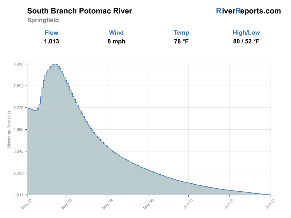
Showing the available RiverReports chart while the current structured flow series loads. Check the chart on RiverReports Opens in a new tab.
Flow is high for this time of year.
Best option: Floating. A float can fit better than wading only if launches, shuttle, boat skill, wind, and local rules all check out.
Rating updatedRiver local time:
USGS shows 811 cfs. The flow has been stable over about 6 hours. USGS marks this reading provisional and may revise it. USGS records for this date (1900-2026, 104 readings) show a median near 211 cfs and the upper quartile near 564 cfs; today's flow is high for the date. Fishable water may exist, but do not rate it highly without a safe access, clarity, and wading or boat plan.
NWS air forecast near
RiverReports gauge
Showing the available RiverReports chart while the current structured flow series loads. Check the chart on RiverReports Opens in a new tab.
Sunny
The National Weather Service forecast is temporarily unavailable.
RiverReports gauge: SOUTH BRANCH POTOMAC RIVER NEAR SPRINGFIELD, WV
Seasonal starting points, not a live hatch report. Match what you see on the water.
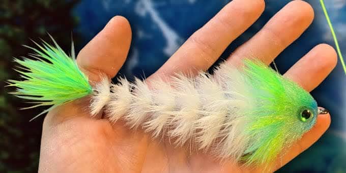
Also try crayfish, popper-dropper
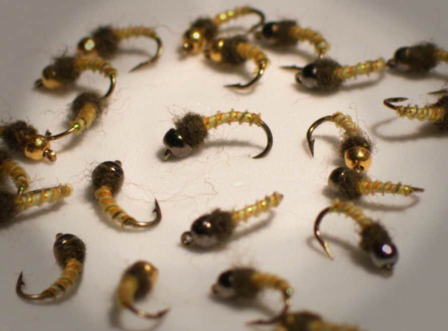
Also try Crayfish, hellgrammite
Each fly name opens its matching Fly Box guide.
The South Branch is most useful when stable flow lets you pick one reach personality and fish it well. If storms are raising the river, if you do not have a clear take-out, or if summer heat is flattening the trout water, tighten the plan or shift species.
The best all-around condition for wading selected banks or running a simple float between public sites.
Fish early and late for bass, and avoid pretending the lower river still wants a trout-style schedule.
Can improve bass positioning or trout movement if the rise is modest and the graph settles quickly.
A skip signal for casual wading and a caution flag for any float without a very clear shuttle.
These scores compare the risks of wading, bank fishing, and floating.
Wading is the most sensitive plan today. Use protected edges only, avoid crossings, and downgrade quickly if clarity or current feels wrong.
This report does not recommend bank fishing on this reach.
A float can fit better than wading only if launches, shuttle, boat skill, wind, and local rules all check out.
Is South Branch Potomac River worth the trip today? Check flow, weather, hatches, access, and rules for West Virginia before you go.
WVDNR's own materials describe the South Branch as a long public-access system with a cool-water stocked-trout character upstream to Petersburg and a warmwater smallmouth character below that transition. This page centers the Springfield area and nearby launches, so start by matching the RiverReports and USGS trend to one style of day instead of trying to force both in one trip.
USGS shows 811 cfs. The flow has been stable over about 6 hours. USGS marks this reading provisional and may revise it. USGS records for this date (1900-2026, 104 readings) show a median near 211 cfs and the upper quartile near 564 cfs; today's flow is high for the date. Fishable water may exist, but do not rate it highly without a safe access, clarity, and wading or boat plan.
Fall: Excellent for streamers, comfortable floats, and cleaner broad-river conditions.
USGS water temperature is about 53.1F, and the rolling 24-hour high did not trigger a heat caution. USGS marks the temperature data provisional and may revise it.
No active NWS alert was returned for this forecast point.
Skip hard rises, blown-out floats, or hot upper-river trout plans that depend on cold-water luck instead of real conditions.
Best when the graph is steady enough to expose current breaks and keep launches honest without turning the whole river pushy.
Skip hard rises, blown-out floats, or hot upper-river trout plans that depend on cold-water luck instead of real conditions.
Pick one public launch pair or one wade area and commit to it instead of sampling too much of a very long river.
Move to a smaller river if current, wind, or launch uncertainty makes the South Branch feel bigger than the day deserves.
Use these places as starting points. Open the access link below and check posted signs before you park or enter.
Check West Virginia fishing rules before fishing the South Branch Potomac River. Reach, season, and species target change the right legal and ethical plan on this river.
The practical home base for the lower river gauge reach and mixed warmwater planning.
Useful when you want the cooler stocked-trout side of the river instead of the lower smallmouth focus.
The official access backbone for float planning on the South Branch.
Official agencies and primary river operators come first. Secondary tools are labeled so you know what carries the most weight.
Check what is allowed, where the rule applies, and whether the river is open.
Check the latest river reading and forecast before you leave.
Check public entry points, land rules, and seasonal access changes.
Use these links for stocking, safety, and other local details.
Check what is allowed, where the rule applies, and whether the river is open.
Open the current rules and check the river section, season, and special limits.
Check the latest river reading and forecast before you leave.
Open this page and check the latest safety advice before your trip.
Open this river reading to check the latest level, flow, and update time.
Open this river reading to check the latest level, flow, and update time.
Check public entry points, land rules, and seasonal access changes.
Open the land or access page, then check signs before you park or enter.
Use these links for stocking, safety, and other local details.
Open this page for more river information and check when it was last updated.
Open this page for more river information and check when it was last updated.
Open this page for more river information and check when it was last updated.
What was checked: This report starts with official regulation, access, flow, weather, and public-water sources, then adds practical planning guidance for fly anglers.
Live measurements and forecasts keep their provider timestamps. Rules, access, and trip guidance use the source-review date shown here. BlueStreamFly planning advice is editorial interpretation, not an agency notice.
First-hand experience: BlueStreamFly does not claim a first-hand visit or local field test for this report unless a real contributor is explicitly named and linked.
Check West Virginia rules first, then use RiverReports and USGS 01608500 to decide whether the day fits a trout-style upper reach or a bass-focused lower-area plan.
It can do both, but only when access and level line up. Use the public launch network for floats and keep broad-river wading conservative when current is up.
Plan around stocked trout in the cooler Petersburg side or around smallmouth, catfish, and sunfish in the lower Springfield and downstream area.
Skip it when the river is rising hard, when you do not have a clean shuttle, or when summer heat makes the trout-style plan a poor fit for the upper water.