Not recommended today. Recheck the river, weather, and access before planning another trip.

Fly fishing report · Reno-Tahoe
Truckee River Fishing Report — Reno, Nevada
This report covers the regulated Truckee River mainstem from west-Reno parks through downtown to the Reno gauge. Check flow, temperature, access, and Nevada rules before fishing.
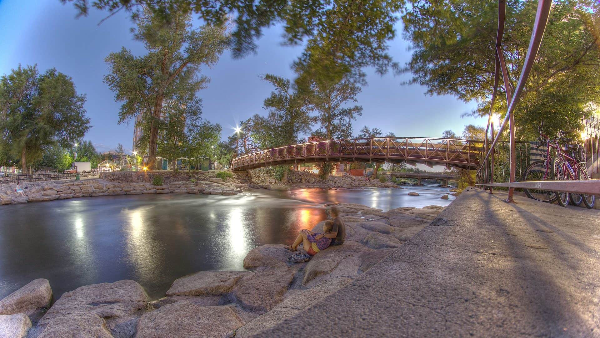
See the Reno flow chart ↓Photo: Darron Birgenheier from Reno, NV, USA Opens in a new tab. · CC BY-SA 2.0
Not today. Choose another time or reach.
No access method is recommended today. Skip this reach for now. Recheck the Reno flow, weather, alerts, and water temperature before choosing another window.
Update time and confidence
No access method is recommended in today's conditions. Review the live river and weather checks before making another plan.
Not recommended today. Recheck the river, weather, and access before planning another trip.
This report does not recommend floating this reach.
Red Flag Warning issued September 1 at 12:43AM PDT until September 1 at 11:00PM PDT by NWS Reno NV
Your plan
A simple Reno plan.
USGS 10348000 supplies flow, stage, and a USGS parameter 63680 sensor reading for the Reno reach, but it does not report water temperature. Use the live rating as a starting call, then check temperature and your exact bank before fishing.
- Check
- Read the Reno flow, trend, weather, and current park notices. Measure water temperature at the reach you fish.
- Fish
- Go early. Start from a legal bank or protected edge and avoid any crossing that feels forced.
- Leave
- Stop for warm water, rising or pushy flow, unsafe heat or storms, poor footing, or a posted restriction.
Live river check
What the river is doing
Check the latest flow and weather before you go. A quick change can make the river harder or less safe to fish.
- Flow
- 357 cfs
- From the latest stored river check. Open the official source for the newest reading.
- Air now
- 75°F
Current NWS forecast period
- Next 24h high
- 75.0°F
NWS air forecast near
- Rain chance
- 0%
For this forecast period
This is an air forecast, not a river-temperature reading. Check the water with a stream thermometer before fishing in hot weather.
Mostly Cloudy
Mostly Cloudy
- Wind
- 20 mph
- Weather checked
USGS 10348000 · Truckee River at Reno · discharge in cfs · provisional
RiverReports gauge
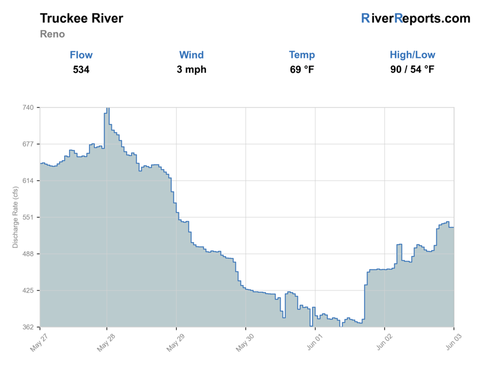
Showing the available RiverReports chart while the current structured flow series loads. Check the chart on RiverReports Opens in a new tab.

More forecast and source details
Reno, NV
The National Weather Service forecast is temporarily unavailable.
Where these readings come from
RiverReports gauge: Truckee River at Reno — USGS 10348000
How to fish it
The Reno gauge covers this city reach.
Treat the Reno Truckee as a regulated, technical city river. Stable flow can support short nymph, dry-fly, or small-streamer sessions, but summer temperature, storm color, and recreation pressure can change the plan without changing the chart. Fish one good edge or seam carefully, and leave when the reach no longer supports a safe trout session.
Low and clear
Use longer leaders, smaller nymphs or dries, lighter indicators, and careful approach angles from downstream or the side.
Stable medium flow
This is the most flexible window for indicator nymphs, Euro-style nymphing, caddis soft hackles, and dry-dropper rigs.
High or stained
Stay off heavy mid-river current. Fish banks, bridge-safe edges, slower inside seams, and streamers where visibility allows.
Hot weather
Take a thermometer. In summer, fish early, check water temperature, and stop trout fishing when conditions are stressful.
Fishing words used on this page
- U.S. Geological Survey (USGS) gauge
- A USGS gauge is an official river station that measures flow or water height.
- Cubic feet per second (cfs)
- Cubic feet per second, or cfs, shows how much water passes the gauge each second.
- Technical fishing
- Technical fishing means the fish are hard to fool, so careful casts and natural drifts matter.
- Nymph
- A nymph is a young water insect. Anglers also use the word for a fly that copies it.
- Presentation
- Presentation means how you cast and move the fly so it looks natural to a fish.
- Seam
- A seam is the line where fast and slow water meet.
- Blue-winged olive (BWO)
- Blue-winged olives, or BWOs, are small mayflies that often hatch in cool or cloudy weather.
- Caddis
- Caddis are small water insects. The adults look a little like tiny moths.
- Dry-dropper
- A dry-dropper rig has a floating fly with an underwater fly tied below it.
- Emerger
- An emerger copies an insect as it rises from below the water toward the surface.
Why this call
Why this score
An active alert is in effect: Red Flag Warning issued September 1 at 12:43AM PDT until September 1 at 11:00PM PDT by NWS Reno NV. Check public safety sources before going.
USGS shows 357 cfs. The flow has been stable over about 6 hours. USGS marks this reading provisional and may revise it. USGS records for this date (1907-2025, 103 readings) show a median near 223 cfs and the upper quartile near 317 cfs; today's flow is high for the date. USGS 10348000 measures the regulated Truckee River mainstem at Reno. Its flow, stage, and turbidity describe the urban Reno reach, but the gauge does not report current continuous water temperature, prove safe wading, or confirm each park access. A downstream Sparks temperature reading is context only and cannot clear the Reno reach. Fishable water may exist, but do not rate it highly without a safe access, clarity, and wading or boat plan.
USGS 10348000 at Reno reports flow, stage, and turbidity but not current continuous water temperature. Measure the exact Reno reach with a stream thermometer; the downstream Sparks temperature gauge is context only and is not interchangeable. Choose another water at 70°F or warmer.
Summer · July through September: Go early with caddis, PMDs, golden-stone nymphs, and a small dark streamer.
The current NWS air forecast is about 75F. Mostly Cloudy.
Trip notes
Trip notes
Four checks before you fish.
Use a fresh USGS 10348000 reading and trend instead of a universal cfs promise. Stable flow can support bank and protected-edge fishing, but temperature, the USGS parameter 63680 sensor reading, debris, weather, and access still decide the trip.
Skip or leave for warm water, rising or pushy flow, unsafe heat or storms, poor footing, heavy debris, unclear access, or an official restriction affecting the plan.
Check the Reno gauge, weather, and City notices. Go early. Choose one named park. Measure water temperature. And fish one protected edge before considering any wade.
Use the California Truckee or Upper Truckee reports only after starting a new gauge, access, rule, and temperature check. Pyramid Lake requires its separate tribal plan.
What to try
Truckee flies by season.
Use the current date row first. NDOW's June 29 Truckee water report supports caddis, PMD, golden-stone, small dead-drift streamer, and tight-line choices. Hopper and ant are seasonal planning options, not NDOW-reported Truckee activity.
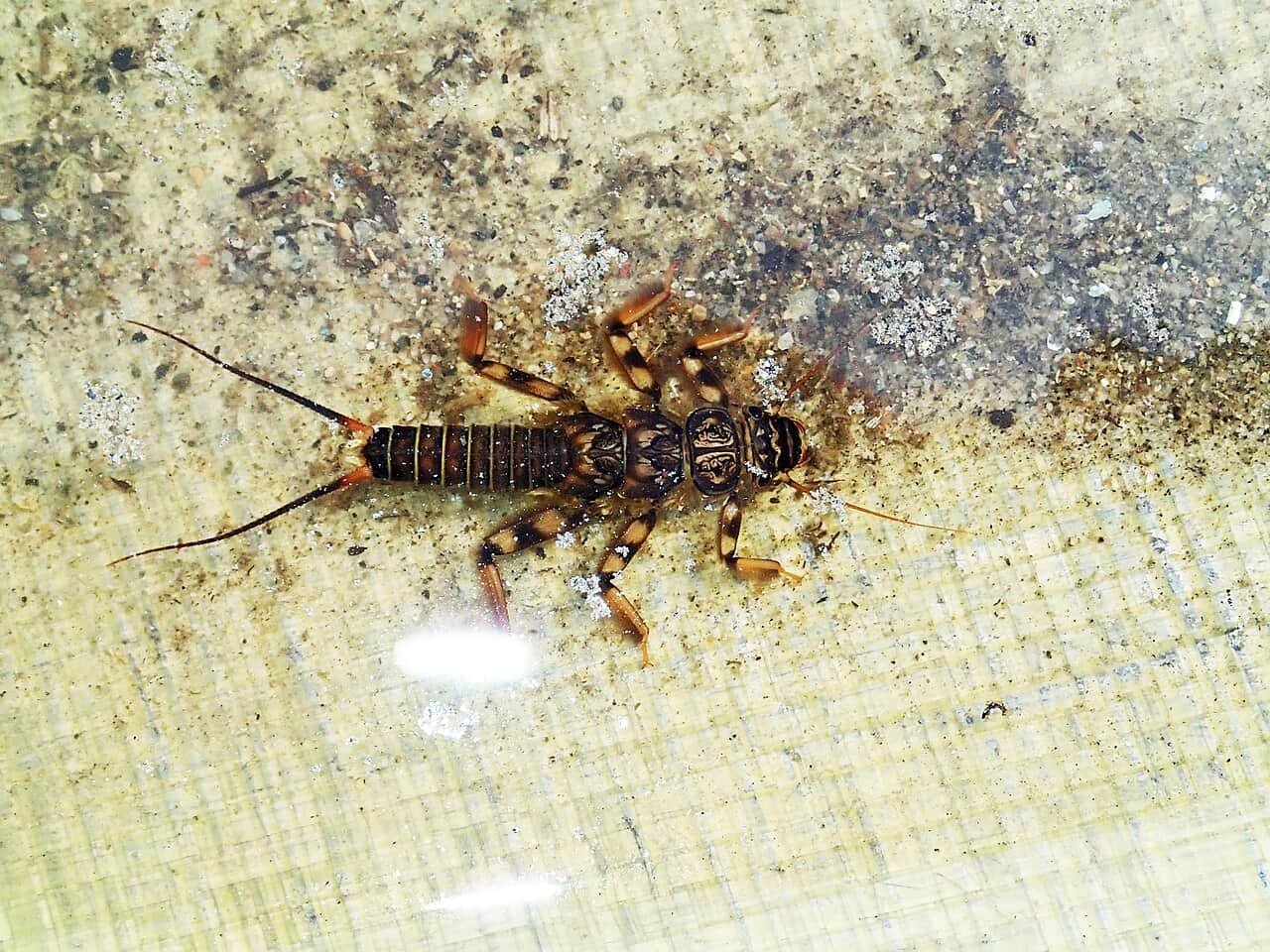
Each pictured fly opens its matching Fly Box guide. Change one pattern or depth choice at a time.
Access and safety
Reno reach, access, and rules.
Use named city parks and confirm current construction, parking, signs, and water conditions before entering the river. NDOW's 2026–2027 rules list the Truckee River as open year-round except closed areas. For the Reno reach, the daily limit is 3 game fish, the possession limit is 6 game fish, and fishing is allowed at any hour. The separate E. Mustang Road bridge-to-Pyramid Lake Reservation boundary reach allows 3 game fish daily with only 1 trout, and 6 game fish in possession with only 2 trout. Derby Dam and the 1,000-foot downstream closure are farther downstream and outside this Reno report. Recheck the current rule and posted restrictions for the exact place and date before keeping fish.
Choose the rules before the water.
Idlewild through Wingfield Park · report reach
Start with a named public park, then inspect flow speed, water temperature, footing, recreation pressure, and an easy exit before fishing.
Open the City parks directory in a new tabDowntown to USGS 10348000 · report reach
The Reno gauge is the live flow, stage, and USGS parameter 63680 sensor reference for this page. It does not measure water temperature or clear a crossing.
Open the Reno gauge in a new tabUSGS 10348200 near Sparks · downstream context only
This station can report downstream temperature and flow. Its temperature is not a Reno measurement, and the two gauges are not interchangeable.
Open the downstream Sparks gauge in a new tabIdlewild Park and west-Reno parks
Use the City parks directory to confirm the named park, current facilities, parking, and posted restrictions. Inspect the bank and water before choosing a wade.
Check the City of Reno parks directory in a new tabWingfield Park / Truckee River Whitewater Park
The Arlington Avenue Bridges project reported Wingfield Park reopened June 9, 2026. Recheck project and City notices because construction staging, river recreation, and access can change.
Check the City whitewater-park page in a new tabDowntown Truckee Riverwalk
Use the public area to scout flow, color, and crowding. A path or bridge view does not make every bank legal or safe to enter.
Check current City park information in a new tabUse signed public park access and visible parking. A bridge, trail, or landscaped bank does not prove legal entry or safe footing.
Wingfield Park reopened June 9, 2026 according to the Arlington Avenue Bridges project. Check the project and City pages again for current staging or closures.
Reno Fire's water-safety guidance treats the river as cold, swift water. A fishing rating or familiar park does not make a crossing safe.
CNRFC officially lists 10.0 feet as Reno's action/monitor stage. Use that threshold as high-water context: leave and check current warnings if the river approaches it. It is not an agency fishing closure or a separate scoring cutoff. The dynamic rating separately uses 5,000 cfs as a BlueStreamFly editorial hard stop. Lower readings do not clear a bank, crossing, or wade.
Share the area with walkers, cyclists, dogs, swimmers, paddlers, and other anglers. Stop casting when you cannot maintain clear space.
This report does not recommend a Reno float route. Build a separate legal launch, takeout, shuttle, suitable craft, PFD, and obstruction plan before floating.
River sources
Where this Reno report comes from.
Official gauges, NDOW reports and rules, City of Reno access and safety pages, and the Reno forecast were checked August 27, 2026. No field visit is claimed.
How this report was checked
What was checked: Official sources support the exact Reno gauge, downstream Sparks context, June 29 Truckee water report, August 20 regional update, current rule path, city access and safety pages, and weather. Hopper and ant are seasonal editorial choices rather than NDOW-reported Truckee activity. No field visit, current Reno water-temperature reading, bacteria result, safe-wading clearance, or verified float route is claimed.
Live measurements and forecasts keep their provider timestamps. Rules, access, and trip guidance use the source-review date shown here. BlueStreamFly planning advice is editorial interpretation, not an agency notice.
First-hand experience: BlueStreamFly does not claim a first-hand visit or local field test for this report unless a real contributor is explicitly named and linked.
Rules and closures
Check what is allowed, where the rule applies, and whether the river is open.
Flow and weather
Check the latest river reading and forecast before you leave.
Access and land
Check public entry points, land rules, and seasonal access changes.
More helpful links
Use these links for stocking, safety, and other local details.
See all 13 checked sources
Rules and closures
Check what is allowed, where the rule applies, and whether the river is open.
What this source covers
Open the current rules and check the river section, season, and special limits.
Flow and weather
Check the latest river reading and forecast before you leave.
What this source covers
Open this page and check the latest safety advice before your trip.
What this source covers
Open this page and check the latest safety advice before your trip.
What this source covers
Open this river reading to check the latest level, flow, and update time.
What this source covers
Open this river reading to check the latest level, flow, and update time.
What this source covers
Open this river reading to check the latest level, flow, and update time.
Access and land
Check public entry points, land rules, and seasonal access changes.
What this source covers
Open the land or access page, then check signs before you park or enter.
What this source covers
Open the land or access page, then check signs before you park or enter.
What this source covers
Open the land or access page, then check signs before you park or enter.
More helpful links
Use these links for stocking, safety, and other local details.
What this source covers
Open this page and check the latest safety advice before your trip.
What this source covers
Open this page for more river information and check when it was last updated.
What this source covers
Open this page for more river information and check when it was last updated.
What this source covers
Open this page for more river information and check when it was last updated.
Quick answers
Reno trip questions.
What part of the Truckee River does this Reno report cover?
It covers the Nevada main river from west-Reno parks around Idlewild through Wingfield Park and downtown to USGS 10348000. It does not cover California's main river, the Upper Truckee, the E. Mustang special-limit reach, Derby Dam, or Pyramid Lake Reservation.
Which gauge powers the Reno fishing rating and chart?
USGS 10348000 at Reno supplies the live report-reach flow, stage, and USGS parameter 63680 sensor reading. The chart uses its discharge history. The station does not report Reno water temperature.
Can I use the Sparks water temperature for Reno?
No. USGS 10348200 is downstream near Sparks. Use it only as labeled downstream context. It cannot substitute for a thermometer in the Reno reach or positively clear Reno for trout fishing.
What flies should I use on the Truckee River in Reno?
Start with the current date row. NDOW's June 29 Truckee water report supports caddis, PMDs, golden stones, small dead-drift streamers, and tight-line methods. Hopper and ant are additional seasonal planning choices, not NDOW-reported Truckee activity. Match observed feeding, depth, and safe water temperature rather than treating the list as a live hatch report.
Can I wade or float through downtown Reno?
Start from a legal bank and wade only after checking current, depth, footing, temperature, and an easy exit. This report does not recommend a float route. Any float needs a separate launch, takeout, shuttle, suitable craft, PFD, and obstruction check.
What Truckee River fishing rules apply in Reno?
NDOW's 2026–2027 rules list the Reno reach as open year-round except closed areas, with 3 game fish daily, 6 in possession, and fishing allowed at any hour. Do not apply the separate E. Mustang, Derby Dam, or Pyramid Lake Reservation rules to this city reach.