Wade, bank, and floatLimited data
Use the live sources and what you see at the river before choosing an approach.
Fly fishing report · Southwest
A Lees Ferry tailwater report for the Colorado River below Glen Canyon Dam, with RiverReports flow context, USGS water data, trout tactics, access notes, regulations, weather, and source links.
Check flow & weatherCurrent USGS flow is 8,070 cfs and has been stable for about 6 hours. Today's flow is below the normal seasonal range, which begins near 10,500 cfs. This is below normal, so edge depth, temperature, and pressure matter.
There is not enough reliable current information to recommend wading, bank fishing, or floating.
Use the live sources and what you see at the river before choosing an approach.
Check before you drive
Look at whether the river is rising or falling, then check wind, rain, and storms. These can change both safety and fishing.
Before you rely on this report
Conditions can change quickly. Check these dates before you decide to fish, and open the official source when safety or rules matter.
High confidence in the current score inputs.
8 sources are listed below for you to open.
5 public access records are listed. Private spots are never shown.
Source checked Jul 30, 2026
Plan your access
These are public parking, launch, trail, or recreation areas—not secret fishing spots. We never show an angler's private pins, notes, or photos here.
Boat launch
NPS lists a public launch ramp at Lees Ferry. The ramp is the main staging point for upriver boat and backhaul plans.
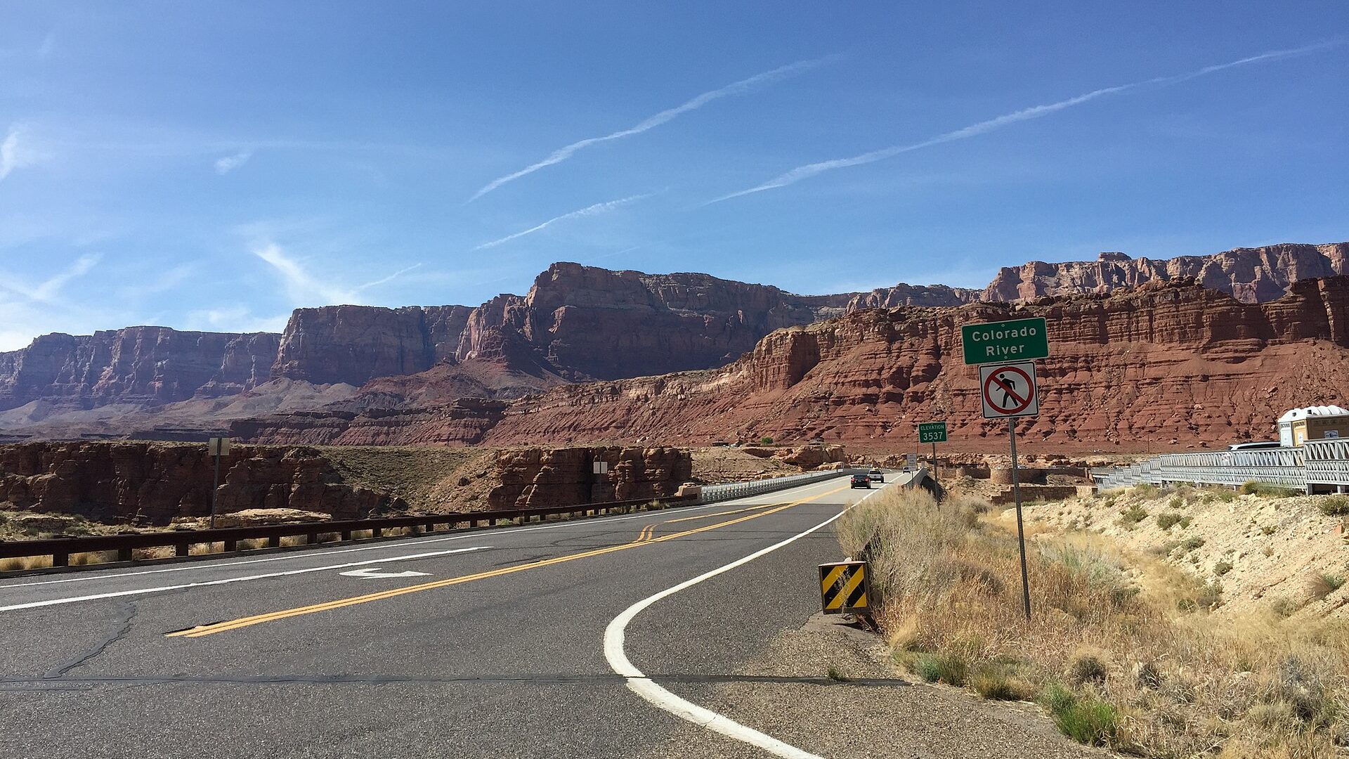
Lees Ferry is reached from Page by US 89 and US 89A, then a paved road into the ferry area.
Do not block the launch ramp. NPS notes a 30-minute length-of-time restriction at public access courtesy docks and ramps.
Walk-in / wade
NPS states permits are not required for visitors only hiking or fishing along the riverbank.
Lees Ferry is reached from Page by US 89 and US 89A, then a paved road into the ferry area.
Do not block the launch ramp. NPS notes a 30-minute length-of-time restriction at public access courtesy docks and ramps.
Boat launch
Watercraft users in this corridor need a Lees Ferry Backcountry Permit from the self-service kiosks near the launch area.
Lees Ferry is reached from Page by US 89 and US 89A, then a paved road into the ferry area.
Do not block the launch ramp. NPS notes a 30-minute length-of-time restriction at public access courtesy docks and ramps.
Roadside access
Important regulation boundary. NPS separates rules from Glen Canyon Dam to the beginning of Paria Riffle and from Paria Riffle to Navajo Bridge.
Lees Ferry is reached from Page by US 89 and US 89A, then a paved road into the ferry area.
Do not block the launch ramp. NPS notes a 30-minute length-of-time restriction at public access courtesy docks and ramps.
Roadside access
Useful travel and orientation points. NPS notes services at Marble Canyon and recommends stopping at Navajo Bridge.
Lees Ferry is reached from Page by US 89 and US 89A, then a paved road into the ferry area.
Do not block the launch ramp. NPS notes a 30-minute length-of-time restriction at public access courtesy docks and ramps.
How to fish it
The Colorado River at Lees Ferry is one of Arizona's most important trout trips because cold dam releases, clear water, canyon access, and special regulations all meet in one place. The best plan starts with flows, water temperature, and whether you are walking in or using a boat.
USGS shows 8,070 cfs with a stable over about 6 hours trend. Today's flow is below the normal seasonal range, which begins near 10,500 cfs. This is below normal, so edge depth, temperature, and pressure matter.
USGS water temperature is about 69F. Fish early and stop if handling stress is likely.
A heat alert is active near this forecast point, so the score is capped at caution until water temperature and fish-handling risk are checked. NWS alert: Extreme Heat Warning issued August 1 at 11:27AM MST until August 3 at 8:00PM MST by NWS Flagstaff AZ.
Summer: The river stays cold, but desert heat, sun exposure, and afternoon wind make early starts, water, and shade important.
Read the water
Expect clear-water trout fishing where small changes in dam release, light, wind, and boat traffic can change the best tactic. Low, clear, bright water favors long leaders, small flies, and careful presentations. Higher or changing releases make edge fishing, heavier nymph rigs, and boat planning more important.
Wade and walk-in options can be easier, but clear water demands longer leaders, smaller flies, and careful angles.
Move with the water, stay off low bars that may flood, and fish fresh edge water rather than standing in changing current.
Boat or backhaul logistics become more important. Fish protected banks, softer seams, and shelves instead of forcing unsafe wades.
Use small midges, scuds, and slim nymphs with clean drifts. Sight-fishing and long drifts often matter more than changing flies every cast.
Your trip plan
Use the Lees Ferry release trend and water temperature together. Stable releases are the easiest planning window; rising or changing releases should move anglers off low bars and toward safer edges, boat control, or a later check.
Skip or scale back when releases are changing faster than your access plan can handle, canyon wind is unsafe for your craft, heat and sun exposure are extreme, the backcountry permit or boating setup is not squared away, or rule boundaries are unclear.
Decide walk-in versus boat first. Walk-in anglers should start with legal bank access near Lees Ferry; boat anglers should verify permit, ramp, PFD, wind, and release timing before choosing fly weight or drift length.
If Lees Ferry is poor because of wind, releases, permits, or heat, compare smaller Arizona trout waters such as Canyon Creek, Black River, or the Little Colorado only after checking their current rules and access.
Hatches & flies
 Fly pattern · report suggests “Zebra midges”Zebra MidgeLook for a very slim tapered thread body, evenly spaced contrasting wire rib, a small bead, and no tail or wing. The reviewed classic is black with silver wire and a silver bead. Red, olive, brown, glass-bead, jig-hook, resin-coated, or tailed forms must remain labeled variations rather than replacing the classic identity.See photos & how to fish it ↗
 Fly family · report suggests “thread midges”Midge Patterns by StageMidge wording can mean a threadlike larva, wing-padded pupa, film emerger, tiny adult, or visible cluster. Those profiles fish at different depths.See family guide ↗+ 2 more reviewed guides in the Fly Box Fly family · report suggests “Midge pupa”Midge Patterns by StageMidge wording can mean a threadlike larva, wing-padded pupa, film emerger, tiny adult, or visible cluster. Those profiles fish at different depths.See family guide ↗
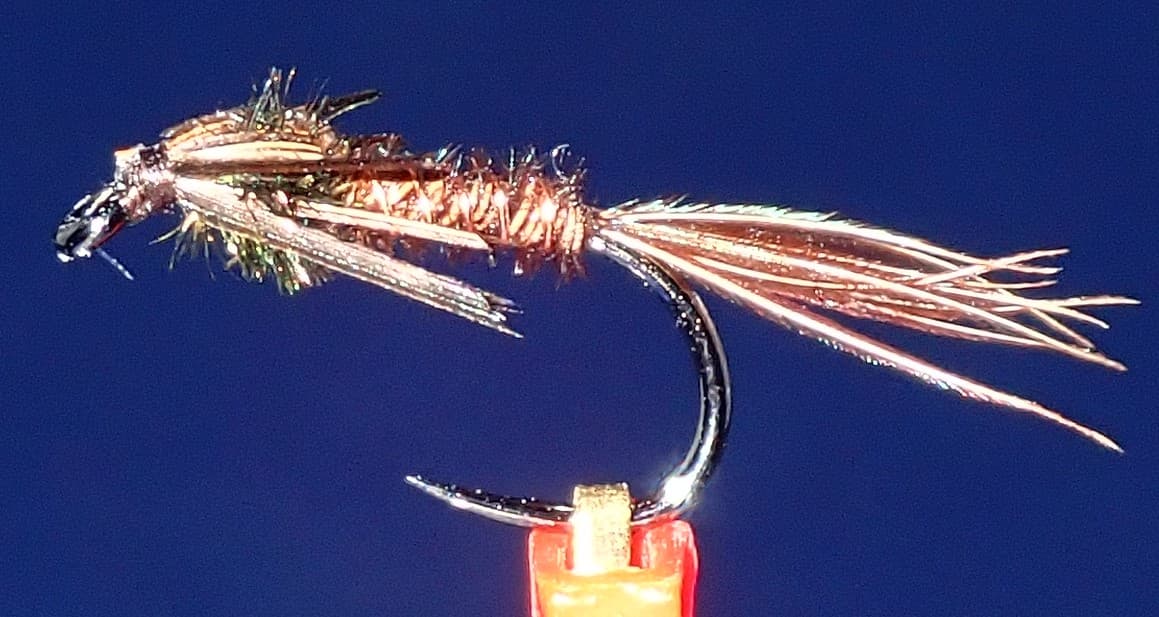 Fly pattern · report suggests “small pheasant tails”Pheasant Tail NymphThe pilot page distinguishes the sparse original idea from the bulkier American form. Both use pheasant-tail fibers and copper wire, but bead heads, peacock-herl thoraxes, legs, flashbacks, jig hooks, and soft-hackle collars are variations that must be labeled.See photos & how to fish it ↗+ 2 more reviewed guides in the Fly Box Fly family · report suggests “Small midges”Midge Patterns by StageMidge wording can mean a threadlike larva, wing-padded pupa, film emerger, tiny adult, or visible cluster. Those profiles fish at different depths.See family guide ↗
 Fly family · report suggests “scuds”Scud Fly PatternsScud patterns typically use a curved hook, tapered dubbed body, shellback, rib segmentation, antennae, and brushed legs. Olive, tan, gray, orange, weighted, bead-body, and pregnant forms remain labeled—not aliases for one recipe.See family guide ↗+ 1 more reviewed guide in the Fly Box Fly family · report suggests “Midges”Midge Patterns by StageMidge wording can mean a threadlike larva, wing-padded pupa, film emerger, tiny adult, or visible cluster. Those profiles fish at different depths.See family guide ↗Fly family · report suggests “scuds”Scud Fly PatternsScud patterns typically use a curved hook, tapered dubbed body, shellback, rib segmentation, antennae, and brushed legs. Olive, tan, gray, orange, weighted, bead-body, and pregnant forms remain labeled—not aliases for one recipe.See family guide ↗+ 3 more reviewed guides in the Fly Box
  Fly pattern · report suggests “San Juan worms”San Juan WormThe name covers several established constructions rather than one invisible recipe. Look for a long worm-like profile following a curved hook, then identify the actual body: Ultra Chenille or yarn with free extensions, a fully wrapped wire or yarn body, or a separately labeled rubber form. A bead adds built-in weight; Squirmy Wormy and Son of San Juan Worm remain separate named variations.See photos & how to fish it ↗Fly family · report suggests “scuds”Scud Fly PatternsScud patterns typically use a curved hook, tapered dubbed body, shellback, rib segmentation, antennae, and brushed legs. Olive, tan, gray, orange, weighted, bead-body, and pregnant forms remain labeled—not aliases for one recipe.See family guide ↗+ 1 more reviewed guide in the Fly Box
 Decide first whether the day is a walk-in day, a boat day, or a backhaul day. The reachable water changes the whole report.
For walk-in fishing, start near legal bank access and fish slowly. Clear water rewards long drifts and low profiles.
From a boat, use controlled drifts through shelves, seams, and bank structure instead of racing to every visible trout.
Watch water level changes around bars and shoreline shelves. A safe spot at one release can become unsafe later.
Carry both tiny technical flies and simple food patterns. Lees Ferry fish can be selective, but current changes often make worms and scuds practical.
Rules & closures
Open the agency page to confirm the exact river section, species, season, tackle rules, limits, and emergency closures.
Official links checkedTackle restriction
This summary helps with trip planning. The linked agency rule is the one you must follow.
Updates from anglers
Recent observations from general areas of Colorado River. We review every update before it appears and never publish exact fishing spots, private access details, or photo locations.
You can still use the river plan above. Check back later for recent observations from other anglers.
Where this report comes from
Fishing guidance checked: May 31, 2026
Site check: Jul 14, 2026. We regularly test report links, live scores, flow and weather data, and page loading. The content date changes only when the fishing guidance or its sources change.
Common questions
Yes. NPS describes the cold clear water between Glen Canyon Dam and Lees Ferry as a world-class trout fishery. It is a technical tailwater, so flows, clarity, regulations, and access style matter.
Use RiverReports for a quick chart and USGS 09380000, Colorado River at Lees Ferry, for official streamflow, gage height, and water temperature.
Bank-only hiking and fishing do not require the Lees Ferry Backcountry Permit according to NPS. Visitors using any watercraft between Glen Canyon Dam and Lees Ferry do need the permit.
Bring tiny midges, scuds, pheasant tails, slim nymphs, San Juan worms, small eggs, soft hackles, and a few small streamers.