Wade, bank, and floatLimited data
Use the live sources and what you see at the river before choosing an approach.
Fly fishing report · West
A Lower Rogue report for Agness flows, wild-section safety, steelhead and salmon timing, permits, float planning, weather, and official sources.
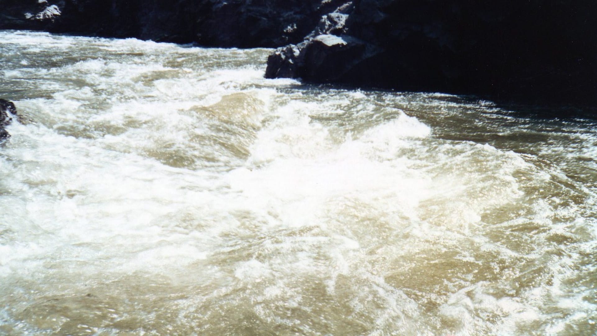
Check flow & weatherCurrent USGS flow is 1,490 cfs and has been stable for about 6 hours. Today's flow is below the normal seasonal range, which begins near 1,610 cfs. This is below normal, so edge depth, temperature, and pressure matter.
There is not enough reliable current information to recommend wading, bank fishing, or floating.
Use the live sources and what you see at the river before choosing an approach.
Check before you drive
Look at whether the river is rising or falling, then check wind, rain, and storms. These can change both safety and fishing.
Before you rely on this report
Conditions can change quickly. Check these dates before you decide to fish, and open the official source when safety or rules matter.
High confidence in the current score inputs.
9 sources are listed below for you to open.
3 public access records are listed. Private spots are never shown.
Source checked Jul 30, 2026
Plan your access
These are public parking, launch, trail, or recreation areas—not secret fishing spots. We never show an angler's private pins, notes, or photos here.
Walk-in / wade
Permit and float planning area; not a casual wade-only decision.
BLM permits, fire pans, waste rules, and boating safety are central to wild-section trips.
The Rogue River Trail is remote and difficult; there is no simple bailout for poor planning.
Area description
Primary flow reference and lower-river planning anchor.
BLM permits, fire pans, waste rules, and boating safety are central to wild-section trips.
The Rogue River Trail is remote and difficult; there is no simple bailout for poor planning.
Area description
Coastal weather and lower-river travel planning area.
BLM permits, fire pans, waste rules, and boating safety are central to wild-section trips.
The Rogue River Trail is remote and difficult; there is no simple bailout for poor planning.
How to fish it
The Lower Rogue is not just the downstream end of the upper-river page. The wild section, Agness corridor, coastal influence, boating hazards, and permit requirements make it a separate trip plan.
USGS shows 1,490 cfs with a stable over about 6 hours trend. Today's flow is below the normal seasonal range, which begins near 1,610 cfs. This is below normal, so edge depth, temperature, and pressure matter.
Coldwater targets are a poor choice in this heat window, but warmwater targets may still be reasonable where legal and ethical.
USGS water temperature is about 75F. Do not pressure trout or salmonids in warm water.
A heat alert is active near this forecast point, so the score is capped at caution until water temperature and fish-handling risk are checked. NWS alert: Heat Advisory issued August 2 at 10:32AM PDT until August 6 at 11:00PM PDT by NWS Medford OR.
Summer: Summer steelhead and half-pounder interest grows with early/late low-light windows.
Read the water
Fish the Lower Rogue when Agness flow, weather, and access line up with a safe float or bank plan. If permits, fire restrictions, or river hazards are unclear, do not improvise.
Best for safe float planning and covering steelhead water.
Use smaller wet flies, stealth, and early/late sessions.
Remote canyon hazards increase; do not force a float or wade plan.
Wind, rain, and tidewater influence can change the lower plan quickly.
Your trip plan
Use USGS 14372300 near Agness as the main live gauge. Stable flows with clear travel and safe banks are best; sharp rises, high water, or difficult boat and trail conditions should delay or shorten the plan.
Skip or pivot when permits or access are not sorted out, flows make boating or wading unsafe, heat or smoke affects safety, steelhead validation or rule details are not confirmed, or trail and shuttle logistics are uncertain.
Start with Agness flow, BLM permit and Wild Section sources, ODFW updates, and one realistic access or travel plan. Decide whether the day is bank-focused, boat-supported, or trail-based before choosing flies.
If the Lower Rogue is high, permit-limited, smoky, hot, or logistically difficult, compare the upper Rogue for a different flow and access profile, the McKenzie River for trout water, or the Upper Klamath River for a separate southern Oregon plan.
Hatches & flies
 Fly family · report suggests “Caddis pupa”Caddis Pupa PatternsCaddis pupa is a life-stage family. Curved bodies, wing pads, legs, beads, and soft-hackle collars differ among exact patterns and must be labeled.See family guide ↗
 Fly family · report suggests “March Brown”March Brown Dry FliesThis family includes traditional hackled, parachute, and Comparadun-style March Brown dries. Each exact construction rides differently and should be named when known.See family guide ↗+ 3 more reviewed guides in the Fly Box
  Fly family · report suggests “Skater”Steelhead Skater and Bomber PatternsSkaters use angled wings, foam, or clipped hair to wake across current; Bomber-style flies use a buoyant cigar-shaped hair body and hackle. Neither label identifies a single universal dressing.See family guide ↗
 Fly family · report suggests “wet fly”Steelhead Wet, Spey, and Hairwing PatternsHairwings generally combine a compact body with a swept hair wing. Spey styles emphasize long, flowing body hackle and a low wing. Low-water dressings intentionally reduce material and profile, while marabou patterns use soft, mobile collars or wings. A broad steelhead-wet label does not establish one recipe or construction.See family guide ↗+ 4 more reviewed guides in the Fly Box Fly family · report suggests “Traditional wet fly”Steelhead Wet, Spey, and Hairwing PatternsHairwings generally combine a compact body with a swept hair wing. Spey styles emphasize long, flowing body hackle and a low wing. Low-water dressings intentionally reduce material and profile, while marabou patterns use soft, mobile collars or wings. A broad steelhead-wet label does not establish one recipe or construction.See family guide ↗
 Fly family · report suggests “October caddis”October Caddis PatternsOctober Caddis names a hatch group. Amber or orange pupae, soft-hackle or wet forms, and large tent-wing adults fish at different levels.See family guide ↗+ 3 more reviewed guides in the Fly Box Fly family · report suggests “Sink-tip wet fly”Steelhead Wet, Spey, and Hairwing PatternsHairwings generally combine a compact body with a swept hair wing. Spey styles emphasize long, flowing body hackle and a low wing. Low-water dressings intentionally reduce material and profile, while marabou patterns use soft, mobile collars or wings. A broad steelhead-wet label does not establish one recipe or construction.See family guide ↗
 Fly family · report suggests “rabbit leech”Leech PatternsLeech patterns share an elongated moving silhouette, but material, weighting, hook orientation, and retrieve vary. Pine-squirrel, rabbit-strip, balanced, and Woolly Bugger forms remain separately labeled rather than being presented as one recipe.See family guide ↗+ 3 more reviewed guides in the Fly Box
 Choose float, trail, or bank access before choosing flies.
Swing small wet flies and traditional steelhead patterns in walking-speed tailouts.
Use sink tips and larger profiles only when colder or higher water calls for depth.
Keep salmon tactics regulation-caveated and avoid targeting closed or stressed fish.
Respect permit, fire, waste, and river-safety rules in the wild section.
Rules & closures
Open the agency page to confirm the exact river section, species, season, tackle rules, limits, and emergency closures.
Official links checkedWe checked the state source but did not find a clearly supported exception for this river. Check the official rules for the exact section you plan to fish.
This summary helps with trip planning. The linked agency rule is the one you must follow.
Updates from anglers
Recent observations from general areas of Rogue River Lower. We review every update before it appears and never publish exact fishing spots, private access details, or photo locations.
You can still use the river plan above. Check back later for recent observations from other anglers.
Where this report comes from
Fishing guidance checked: Jun 1, 2026
Site check: Jul 14, 2026. We regularly test report links, live scores, flow and weather data, and page loading. The content date changes only when the fishing guidance or its sources change.
Common questions
Check the Agness gauge, BLM permit and wild-section rules, ODFW Southwest updates, weather, and fire restrictions first.
Agness is the best lower-river flow anchor. Use Grave Creek or Gold Beach context only after matching the trip to access and permit rules.
Some bank and wade access exists, but much of the lower plan is float, trail, or remote canyon travel. Do not wade or float high water casually.
Bring the seasonal fly box, a few backup nymphs or streamers, and enough tippet to change tactics when flow, clarity, temperature, or crowds change.