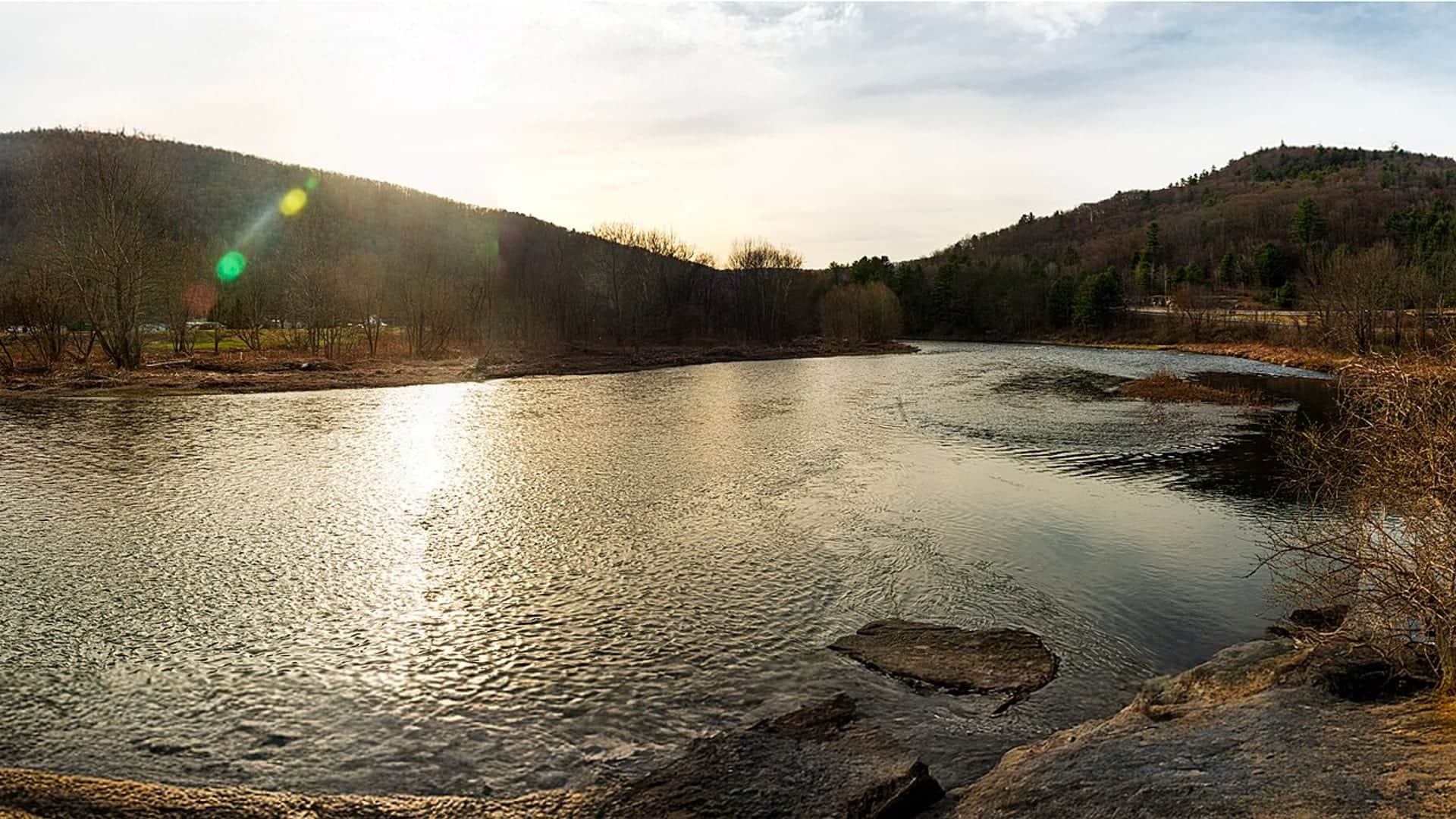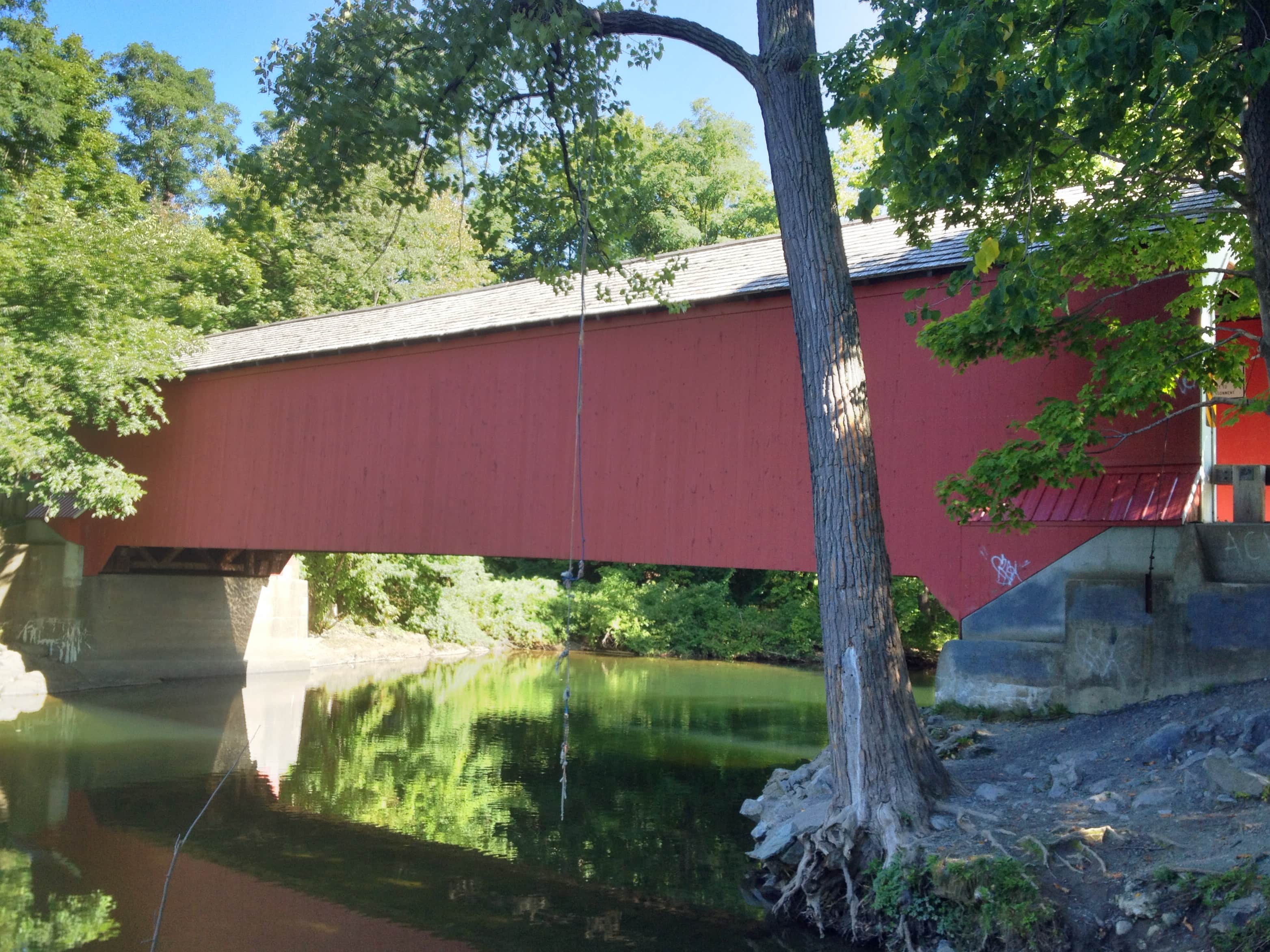
Historical photograph of the Batten Kill beneath Eagleville covered bridge in New York, August 2014
All New York reports

Battenkill Fishing Report — New York

Photo: David Broad Opens in a new tab. · CC BY 3.0 Opens in a new tab. · Historical New York river photograph, not today's conditions. Cropped for display.

Should I go fishing?

Go with caution.

Fishable with caution. Keep to reachable water.

Fish from the bank. Avoid crossings. Keep an easy exit, measure the water and leave for rising flow or lightning.

Check first: Water temperature not verified; do not use this score to clear warm-water risk. Battenville flow and weather support New York trout planning. Water temperature, clarity, fish activity and safe footing at the fishing spot are not measured.

Rating updatedRiver local time:

Why this recommendation?

USGS 01329490 at Battenville measures flow and stage, not current water temperature. Measure the fishing spot; the 70°F trout-care stop is not a legal closure. Choose another water at 70°F or warmer.

Available live dataHighHow much of the live flow, weather, and alert data came back.
Confidence in this recommendationMediumWater temperature not verified; do not use this score to clear warm-water risk. Battenville flow and weather support New York trout planning. Water temperature, clarity, fish activity and safe footing at the fishing spot are not measured.
Usually checks again about every 45 minutes

If you go

Start
Choose a legal New York access. Read the Battenville flow trend and measure the water before targeting trout.
Try
Watch one reachable lane. Start with a small nymph below the surface, or match a dry fly to the rises you see.
Adjust
Change the drift and depth before switching flies. Avoid crossings, leave for lightning or rising water, and stop trout fishing at 70°F or warmer.

Flow and weather

Showing server-checked river conditions while current readings refresh.
Flow
178 cfs
Falling over about 6 hoursU.S. Geological Survey may revise this reading
Air forecast
50°F
Next 24h high
77.0°F

NWS air forecast near

Rain chance
0%

This is an air forecast, not a river-temperature reading. Check the water with a stream thermometer before fishing in hot weather.

7-day U.S. Geological Survey chart

USGS 01329490 at Battenville · downstream New York flow · discharge in cfs

Discharge

245 cfs123 cfs
Sep 5Sep 12

Latest reading: 178 cfs. Falling over about 6 hours. Chart covers Sep 5 through Sep 12; readings are provisional and may be revised.

Water-temperature chart is unavailable

Measure the water at your fishing spot; air temperature is not a substitute. USGS has too few recent readings for the 7-day chart.

Latest stored weather check

Clear

Wind
0 mph
Weather checked
More forecast and source details

Clear

National Weather Service

Battenkill River forecast point near Battenville

The National Weather Service forecast is temporarily unavailable.

Live data

Where these readings come from

Current U.S. Geological Survey gauge: Batten Kill below the mill at Battenville

Falling over about 6 hoursU.S. Geological Survey may revise this readingObserved

Flies for this time of year

Seasonal starting points, not a live hatch report. Match what you see on the water.

See flies for every season

Seasonal flies for the Battenkill

Choose your month's row, then match the size and stage of the feeding you see. These are seasonal options, not a live hatch report.

SeasonWhat to look forFlies to try
June
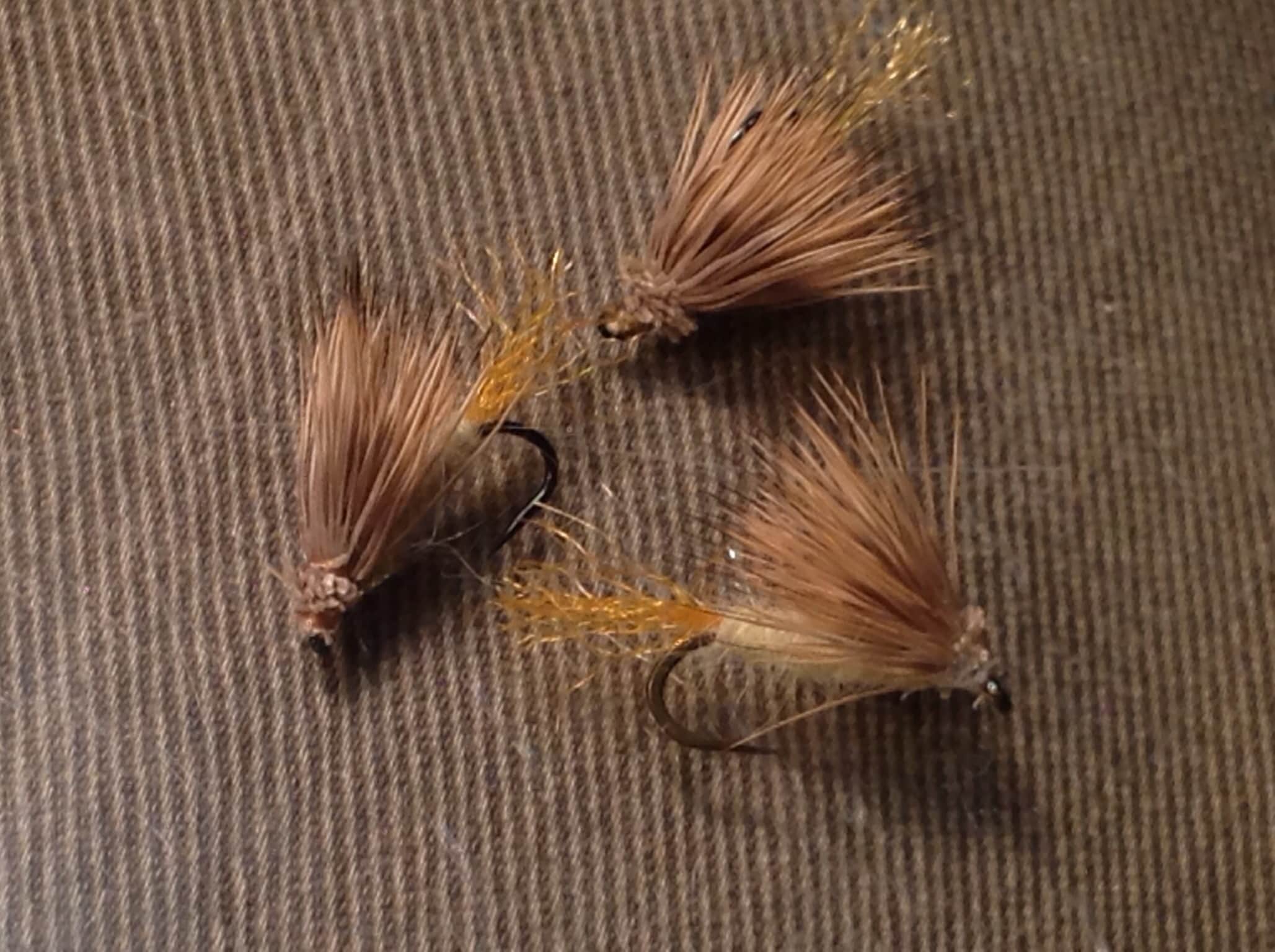
What to look forMatch actual caddis and mayfly feeding. Try a #14–18 Elk Hair Caddis or Parachute Adams on the surface, a #14–18 X-Caddis for emerging caddis, or a #14–18 Partridge and Orange below. A locally matched Comparadun is a different dry-fly option, not the Adams pictured here.

Photos show the named artificial fly or disclosed family example. The BWO is an adult dry, not an emerger; Partridge and Orange is the soft-hackle example; the Woolly Bugger is black. A Comparadun needs a size-and-color match of its own—the pictured Parachute Adams is not a Comparadun.

More fishing tips

Methods, fish species and trip notes

Battenville flow and local checks

Watch the flow trend and forecast before leaving. A steady gauge helps planning but does not confirm clear, cool water or feeding fish. Recheck your access after rain.

Steady

Try a controlled drift in reachable water. Steady discharge does not establish safe wading or water temperature.

Rising

Avoid crossings and stay on land when current or the exit is uncertain. Leave quickly rising water.

Low

Reduce disturbance and check actual depth and temperature. Low flow does not prove clear or cool water.

Warm

Measure your fishing spot. As a conservative trout-care rule, stop at 70°F or warmer, or sooner if fish show stress.

Wading, bank fishing or floating?
Best access methodBank fishing

These scores compare the risks of wading, bank fishing, and floating.

WadingCheck

Only enter a visible protected edge after checking depth, footing, current and an easy exit. Avoid forced crossings.

Bank fishing · Best fit69/100

Use a legal bank with stable footing and casting room. Check water temperature, current, weather and exact-reach rules.

FloatingNot recommended

This report does not recommend floating this reach.

Full river report

Plan a New York trout session around Battenville flow, a legal access and the feeding you see. Bring a thermometer: this gauge does not measure water temperature.

USGS 01329490 supplies live flow and stage below the mill at Battenville. The /100 rating uses current flow, its trend and weather. Water temperature, clarity, fish activity and safe footing are not measured.

Fishing words used on this page
U.S. Geological Survey (USGS) gauge
A USGS gauge is an official river station that measures flow or water height.
Cubic feet per second (cfs)
Cubic feet per second, or cfs, shows how much water passes the gauge each second.
Blue-winged olive (BWO)
Blue-winged olives, or BWOs, are small mayflies that often hatch in cool or cloudy weather.
Caddis
Caddis are small water insects. The adults look a little like tiny moths.
Midge
Midges are tiny flies and a common trout food, especially in cold water.
River reach
A reach is one named section of a river or stream.
Soft hackle
A soft-hackle fly has moving fibers that can look like an insect rising through the water.
Terrestrial
Terrestrials are land insects, such as ants, beetles, and grasshoppers.
Why this call

Why this score

Water temperature checkUse caution

USGS 01329490 at Battenville measures flow and stage, not current water temperature. Measure the fishing spot; the 70°F trout-care stop is not a legal closure. Choose another water at 70°F or warmer.

Best mode nowUse caution

Bank / edge: Use a legal bank with stable footing and casting room. Check water temperature, current, weather and exact-reach rules.

FlowHelps

USGS shows 178 cfs. The flow has been stable over about 6 hours. USGS marks this reading provisional and may revise it. This is the clearest starting signal.

SeasonHelps

September–December: Small mayflies, nymphs and streamers are options as water cools.

WeatherHelps

The current NWS air forecast is about 50F, and the next 24-hour high reaches about 77F. Clear.

Trip notes

What the Battenville gauge tells you

Best flows

Use fresh Battenville flow and trend. Same-date history is context, not a safe-wading or productive-flow band.

When to leave

Leave for lightning, rapid rises, uncertain footing or restrictions. Stop trout fishing at 70°F or warmer, or sooner if fish show stress.

Local plan

Choose an exact reach, check the rules, measure the water and watch one reachable lane before selecting a fly.

Backup water

Return during a more workable window. Another river requires its own temperature, flow, access and rule check.

What you can fish for

Brown and brook trout

Primary fish

When: Year-round fishing within exact-reach rules

Match observed food and feeding. Water temperature and the current reach rules control the plan.

Other fish or Vermont reaches

Check current rules

When: Separate local check

This rating does not establish rainbow stocking, other-species abundance or conditions across the state line.

Find New York access

Start with a marked parking area and legal path. A bridge or gauge is a landmark, not permission to cross private land.

Before you go

The three listed reaches below Eagleville use Stocked-Extended or Wild Quality rules: April 1–October 15: three trout daily, no more than one longer than 12 inches. October 16–March 31: catch-and-release only, artificial lures only. Eagleville covered bridge upstream to the Vermont line: catch-and-release only, artificial lures only, all year. Do not apply these categories to unlisted gaps. Check statewide and current special rules for your exact location. Artificial lures only does not mean fly-only.

Rules by reach

Rules by reach: fishing rules by reach and season
River section and seasonFishing rules
Whittaker Brook–Rexleigh Bridge

From the confluence upstream to the bridge: Stocked-Extended. April 1–October 15: three trout daily, no more than one longer than 12 inches. October 16–March 31: catch-and-release only, artificial lures only.

Official rule
Shushan Route 61–Route 64

From County Route 61 Bridge upstream to County Route 64 Bridge: Stocked-Extended. April 1–October 15: three trout daily, no more than one longer than 12 inches. October 16–March 31: catch-and-release only, artificial lures only.

Official rule
Route 64–Eagleville covered bridge

From County Route 64 Bridge upstream to the covered bridge: Wild Quality. April 1–October 15: three trout daily, no more than one longer than 12 inches. October 16–March 31: catch-and-release only, artificial lures only.

Official rule
Eagleville–Vermont line

Eagleville covered bridge upstream to the Vermont line: catch-and-release only, artificial lures only, all year.

Official rule

Where to access the river

Eagleville Road

DEC identifies river parking and a hand launch on the north side of the road. Check signs and current conditions. Nearby private parcels still require permission.

Site details

Mapped public fishing easements

Use DEC's current fishing-map tools and marked paths. Fishing rights do not extend across every field, bridge approach or bank.

Site details

Batten Kill State Forest map

The linked map distinguishes Eagleville river access from the Route 313 Folded Rock trailhead. Its 2016 date means it is not today's access inspection.

Site details
  • Public Fishing Rights allow fishing and walking on marked easements, not blanket boating, camping or access across private land.
  • Use posted parking and paths. A gauge location is not a fishing-access designation.
  • Confirm current notices before travel. The source review is not an inspection of today's banks, roads or launch.

If this water does not fit the day, check another report before you start the drive.

Sources and report details

Desk review dated September 4, 2026. Live readings update separately. No field visit, current hatch, catch report or access inspection is claimed.

Rules and closures

Check what is allowed, where the rule applies, and whether the river is open.

Flow and weather

Check the latest river reading and forecast before you leave.

Access and land

Check public entry points, land rules, and seasonal access changes.

More helpful links

Use these links for stocking, safety, and other local details.

See all 8 checked sources

Rules and closures

Check what is allowed, where the rule applies, and whether the river is open.

Flow and weather

Check the latest river reading and forecast before you leave.

Access and land

Check public entry points, land rules, and seasonal access changes.

More helpful links

Use these links for stocking, safety, and other local details.

Recently checked. Last checked . Conditions and rules can still change, so open decision-critical links before fishing.

See something wrong? Report a source problem. Please do not send private spots or private access notes.

How this report was checked

How this report was checked

Trip guidance checked

What was checked: Desk review of USGS, NWS and NYSDEC sources. No field visit, current hatch, catch report, access inspection or safe-wading assessment is claimed. Live readings have separate timestamps.

Live measurements and forecasts keep their provider timestamps. Rules, access, and trip guidance use the source-review date shown here. BlueStreamFly planning advice is editorial interpretation, not an agency notice.

First-hand experience: BlueStreamFly does not claim a first-hand visit or local field test for this report unless a real contributor is explicitly named and linked.

Quick questions

Which Battenkill does this report cover?

The New York river, using downstream Battenville flow for planning. Vermont reaches have separate rules and access. A Vermont guide's report is not a measurement of this New York reach.

Does the Battenkill have a live gauge?

Yes. USGS 01329490 below the mill at Battenville supplies flow and stage. The seven-day discharge chart uses that station. It does not measure water temperature, depth at your access, clarity or safe wading.

Why is there no water-temperature line?

The station has no current measured water-temperature series. The page keeps an unavailable chart message rather than inventing readings. Measure your fishing spot. Air temperature is not river temperature.

Does the /100 fishing rating change?

Yes. It responds to current flow, its trend and weather. Stale or missing key readings can withhold the score. It is a planning estimate, not a catch prediction or safe-wading certificate.

What rules apply above Eagleville?

From the Eagleville covered bridge upstream to the Vermont line, trout fishing is catch-and-release with artificial lures all year. Other listed New York reaches have seasonal possession rules. Check current DEC rules before fishing.

Where can I start a public-access plan?

DEC identifies Eagleville Road parking and river access on the north side of the road. For other reaches, use current Public Fishing Rights maps and signs. Do not assume every bridge approach is public.

Does this report recommend floating?

No. This is a bank/protected-edge trout plan, not an assessed float itinerary or a paddling ban. A float needs confirmed launch, takeout, shuttle, suitable craft, PFD, weather and current conditions.