Wade · Best fit63/100
Wading is in play only where your chosen access has clear footing, legal entry, and no forced crossings.
Fly fishing report · Southwest
A practical White Mountains report for the East Fork, West Fork, and mainstem Black River, with flow context, trout tactics, remote access notes, permits, weather, and source links.
Check flow & weatherCurrent USGS flow is 33 cfs and has been stable for about 6 hours. Today's flow is unusually low for this date and below the usual low-water marker near 36 cfs. Low water can make fish spooky, warm, pressured, or concentrated; check temperature and handling risk.
Compare wading, bank fishing, and floating before choosing how you will fish.
Wading is in play only where your chosen access has clear footing, legal entry, and no forced crossings.
Bank and edge fishing remains a practical low-commitment option if access is legal and footing is safe.
A float is in play where this report supports boat access and wind, releases, and shuttle logistics are manageable.
Check before you drive
Look at whether the river is rising or falling, then check wind, rain, and storms. These can change both safety and fishing.
Before you rely on this report
Conditions can change quickly. Check these dates before you decide to fish, and open the official source when safety or rules matter.
High confidence in the current score inputs.
10 sources are listed below for you to open.
5 public access records are listed. Private spots are never shown.
Source checked Jul 30, 2026
Plan your access
These are public parking, launch, trail, or recreation areas—not secret fishing spots. We never show an angler's private pins, notes, or photos here.
Area description
Forest Service describes this streamside campground as a direct East Fork planning point near Alpine.
Use official Forest Service roads, signed trailheads, and current Apache-Sitgreaves alerts. Fire restrictions and closures can change the plan.
The Forest Service warns that Wallow Fire-affected areas can have falling trees, flooding, burned-out stump holes, and storm-related hazards.
Trailhead
The Forest Service identifies Buffalo Crossing as the start of the Black River Mainstream Trail downstream.
Use official Forest Service roads, signed trailheads, and current Apache-Sitgreaves alerts. Fire restrictions and closures can change the plan.
The Forest Service warns that Wallow Fire-affected areas can have falling trees, flooding, burned-out stump holes, and storm-related hazards.
Trailhead
A named trail-log reference on the Mainstream Trail; useful for anglers hiking below Buffalo Crossing.
Use official Forest Service roads, signed trailheads, and current Apache-Sitgreaves alerts. Fire restrictions and closures can change the plan.
The Forest Service warns that Wallow Fire-affected areas can have falling trees, flooding, burned-out stump holes, and storm-related hazards.
Trailhead
A downstream access reference on the Forest Service trail log. Road and weather conditions matter.
Use official Forest Service roads, signed trailheads, and current Apache-Sitgreaves alerts. Fire restrictions and closures can change the plan.
The Forest Service warns that Wallow Fire-affected areas can have falling trees, flooding, burned-out stump holes, and storm-related hazards.
Trailhead
The Forest Service trail log identifies a San Carlos Apache Indian Reservation boundary downstream. Confirm permits and rules before entering tribal land.
Use official Forest Service roads, signed trailheads, and current Apache-Sitgreaves alerts. Fire restrictions and closures can change the plan.
The Forest Service warns that Wallow Fire-affected areas can have falling trees, flooding, burned-out stump holes, and storm-related hazards.
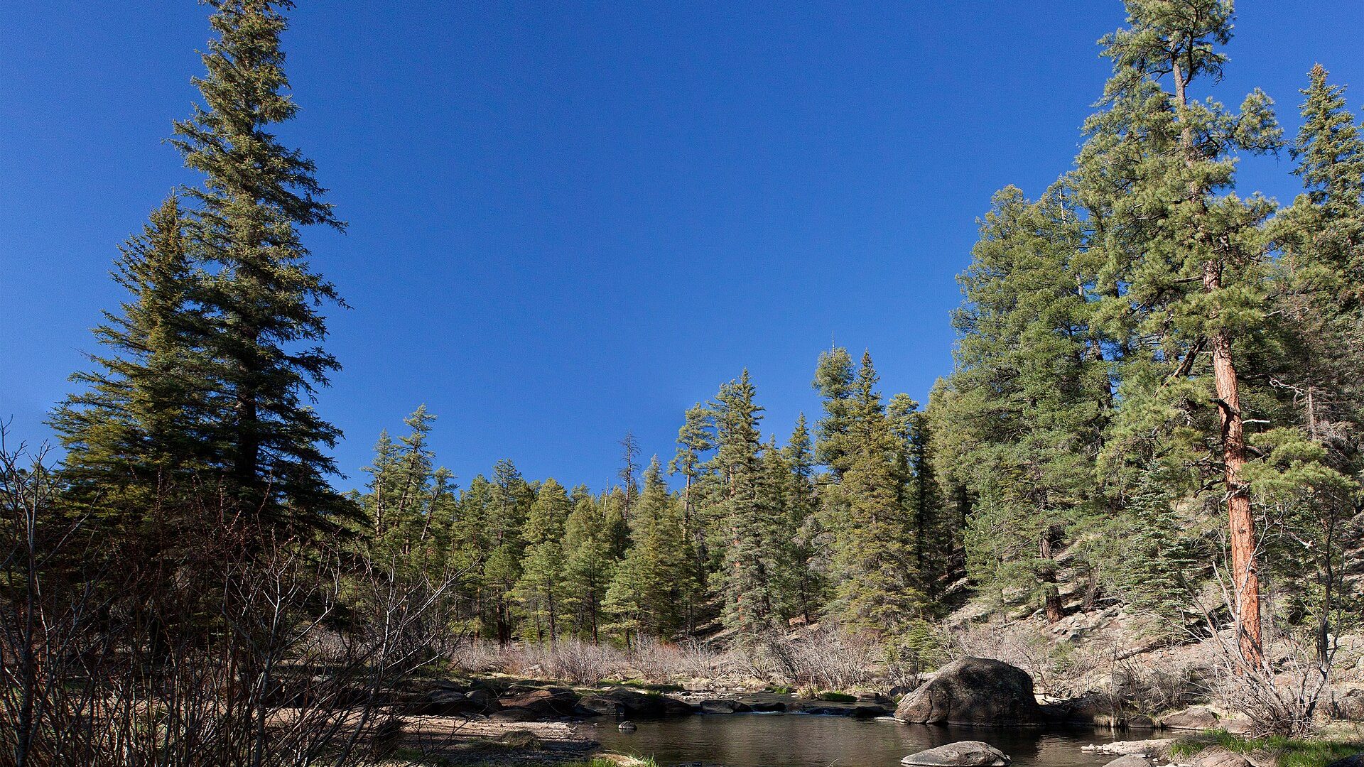
How to fish it
The Black River is one of Arizona's best mountain-stream systems, but it is not a simple roadside report. Flow, monsoon storms, forest roads, reservation boundaries, and special regulations all matter before fly selection.
USGS shows 33 cfs with a stable over about 6 hours trend. Today's flow is unusually low for this date and below the usual low-water marker near 36 cfs. Low water can make fish spooky, warm, pressured, or concentrated; check temperature and handling risk.
The forecast has storm or heavy-precipitation risk, so timing and access matter more than the score alone.
Wade: Wading is in play only where your chosen access has clear footing, legal entry, and no forced crossings.
Early summer: Often a strong trout window before heat and monsoon storms complicate afternoon plans.
The NWS forecast is about 79F with Slight Chance Showers And Thunderstorms.
Read the water
The best Black River days usually come when flows are stable, the water is clear enough for sight or pocket-water fishing, and roads are dry enough for a safe exit. If thunderstorms are building, roads are muddy, or flows are rising, keep the plan conservative.
Use long leaders, smaller dries and nymphs, and careful approaches. Fish shade, undercut banks, and broken riffle texture.
The most flexible window for dry-dropper rigs, pocket-water nymphing, and small streamers through deeper bends.
Leave crossings alone and watch the road home. Fast local rain can move water, debris, and mud through canyon sections.
Carry a thermometer and avoid stressing trout when water temperatures climb. Fish early, shift to shaded water, or stop.
Your trip plan
Use the RiverReports/USGS trend more than a single number. Stable or slowly falling clear water is the best trout window; rising monsoon water, muddy color, or road uncertainty should make the plan conservative.
Skip or scale back when thunderstorms are building, forest roads are muddy, fire or access alerts are active, reservation or permit boundaries are uncertain, water is warm enough to stress trout, or the graph is rising fast.
Pick the reach first. Use Aspen/East Fork for an upper fork plan, Buffalo Crossing or Bear Creek for trail-linked mainstem checks, and only continue toward Wildcat or reservation-boundary water when access and permits are clear.
If the Black River is high, muddy, hot, or permit-limited, compare Canyon Creek, the Little Colorado, or Silver Creek only after checking their current rules, access, and road conditions.
Hatches & flies
 Fly family · report suggests “BWO dries”Blue-Winged Olive PatternsBWO describes a hatch group, not one fly. Nymph, emerger, dry, cripple, and spinner profiles must stay separate because they occupy different parts of the water column.See family guide ↗
 Fly pattern · report suggests “zebra midges”Zebra MidgeLook for a very slim tapered thread body, evenly spaced contrasting wire rib, a small bead, and no tail or wing. The reviewed classic is black with silver wire and a silver bead. Red, olive, brown, glass-bead, jig-hook, resin-coated, or tailed forms must remain labeled variations rather than replacing the classic identity.See photos & how to fish it ↗+ 2 more reviewed guides in the Fly Box
  Fly pattern · report suggests “Elk hair caddis”Elk Hair CaddisLook for a tented elk- or deer-hair wing, clipped hair head, dubbed body, rib, and hackle palmered along the body. The body color should be labeled because tiers often match different natural caddis colors.See photos & how to fish it ↗
 Fly pattern · report suggests “stimulators”StimulatorLook for a hair tail, dubbed abdomen with palmered hackle, tented hair wing, contrasting front hackle, and bright thorax or head. Colors and sizes vary widely and must remain labeled.See photos & how to fish it ↗+ 2 more reviewed guides in the Fly Box
  Fly family · report suggests “Ants”Ant PatternsAnt patterns can be foam, fur-bodied, winged, or sunken. The narrow waist and paired body lobes matter more than one material recipe.See family guide ↗
 Fly family · report suggests “beetles”Beetle PatternsBeetle flies range from simple foam shells to hair-bodied and sunken forms. A rounded back and compact profile distinguish the family from ants and hoppers.See family guide ↗+ 2 more reviewed guides in the Fly Box Fly family · report suggests “Small BWO dries”Blue-Winged Olive PatternsBWO describes a hatch group, not one fly. Nymph, emerger, dry, cripple, and spinner profiles must stay separate because they occupy different parts of the water column.See family guide ↗
 Fly pattern · report suggests “RS2-style emergers”RS2Start with the beadless architecture: two dark-dun Microfibett tails separated behind a slim, tightly twisted and visibly segmented dubbed abdomen; a fuller thorax; and saddle-hackle web clipped into a short angled wing bud. Rim Chung's original-style form uses natural beaver dubbing and hackle web. CDC- or Antron-wing ties, beads, curved hooks, flash, and tailless Avatar-style flies must remain labeled variations.See photos & how to fish it ↗+ 2 more reviewed guides in the Fly Box
  Fly pattern · report suggests “Small buggers”Woolly BuggerThe shared pattern language is a marabou tail, chenille or dubbed body, and palmered hackle. Bead heads, dumbbell eyes, flash, rubber tails, colors, and body materials materially change the tied variation and must be labeled.See photos & how to fish it ↗
 Fly family · report suggests “leeches”Leech PatternsLeech patterns share an elongated moving silhouette, but material, weighting, hook orientation, and retrieve vary. Pine-squirrel, rabbit-strip, balanced, and Woolly Bugger forms remain separately labeled rather than being presented as one recipe.See family guide ↗+ 2 more reviewed guides in the Fly Box
 Pick the reach before choosing flies. The East Fork, West Fork, and mainstem do not all fish or access the same way.
Fish upstream with short casts in the forks. A few clean drifts in each pocket beat repeated false casts over small water.
In the mainstem corridor, cover deeper bends, boulder shade, and undercut banks with nymphs or small streamers.
After monsoon rain, check the road as seriously as the river. Getting out can be harder than getting in.
Keep native-trout handling fast and wet. Photograph only when the fish can stay close to the water.
Rules & closures
Open the agency page to confirm the exact river section, species, season, tackle rules, limits, and emergency closures.
Official links checkedWe checked the state source but did not find a clearly supported exception for this river. Check the official rules for the exact section you plan to fish.
This summary helps with trip planning. The linked agency rule is the one you must follow.
Updates from anglers
Recent observations from general areas of Black River. We review every update before it appears and never publish exact fishing spots, private access details, or photo locations.
You can still use the river plan above. Check back later for recent observations from other anglers.
Where this report comes from
Fishing guidance checked: May 31, 2026
Site check: Jul 14, 2026. We regularly test report links, live scores, flow and weather data, and page loading. The content date changes only when the fishing guidance or its sources change.
Common questions
Yes. It is one of Arizona's important high-country stream systems, with fork water, mainstem canyon water, trout opportunity, and remote access. The best plan depends on flow, roads, permits, and current regulations.
Use USGS 09490500, Black River near Fort Apache, as the official flow fallback. RiverReports also has a Black River at Apache page and chart for quick visual checks.
Possibly. Public national-forest reaches and reservation waters are not the same thing. If your route enters White Mountain Apache or San Carlos Apache lands, confirm the current tribal permit and access rules before fishing.
Carry small caddis and mayfly dries, ants, beetles, small hoppers, pheasant tails, hare's ears, zebra midges, dry-dropper attractors, and a few small streamers.