Wade49/100
Wading is the most sensitive plan today. Use protected edges only, avoid crossings, and downgrade quickly if clarity or current feels wrong.
Fly fishing report · West
A Clark Fork River report for Missoula anglers checking below-town flow, freestone tactics, access, heat restrictions, and current Montana rules.
Check flow & weatherAn Air Quality Alert is active near this forecast point, so the score is capped at caution until smoke and access conditions are checked. NWS alert: Air Quality Alert issued August 2 at 9:12AM MDT by NWS Great Falls MT.
Compare wading, bank fishing, and floating before choosing how you will fish.
Wading is the most sensitive plan today. Use protected edges only, avoid crossings, and downgrade quickly if clarity or current feels wrong.
Bank and edge fishing is the safer default when water is high, pushy, or not fully verified.
A float can fit better than wading only if launches, shuttle, boat skill, wind, and local rules all check out.
Check before you drive
Look at whether the river is rising or falling, then check wind, rain, and storms. These can change both safety and fishing.
Before you rely on this report
Conditions can change quickly. Check these dates before you decide to fish, and open the official source when safety or rules matter.
High confidence in the current score inputs.
6 sources are listed below for you to open.
3 public access records are listed. Private spots are never shown.
Source checked Jul 30, 2026
Plan your access
These are public parking, launch, trail, or recreation areas—not secret fishing spots. We never show an angler's private pins, notes, or photos here.
Area description
Good for quick access, but still requires current, temperature, and courtesy checks.
Montana stream access allows use below ordinary high-water marks, but it does not grant access across private land.
Bridge and town access can be crowded. Park legally and avoid cutting banks or trespassing.
Area description
Primary page flow context after major tributary influence.
Montana stream access allows use below ordinary high-water marks, but it does not grant access across private land.
Bridge and town access can be crowded. Park legally and avoid cutting banks or trespassing.
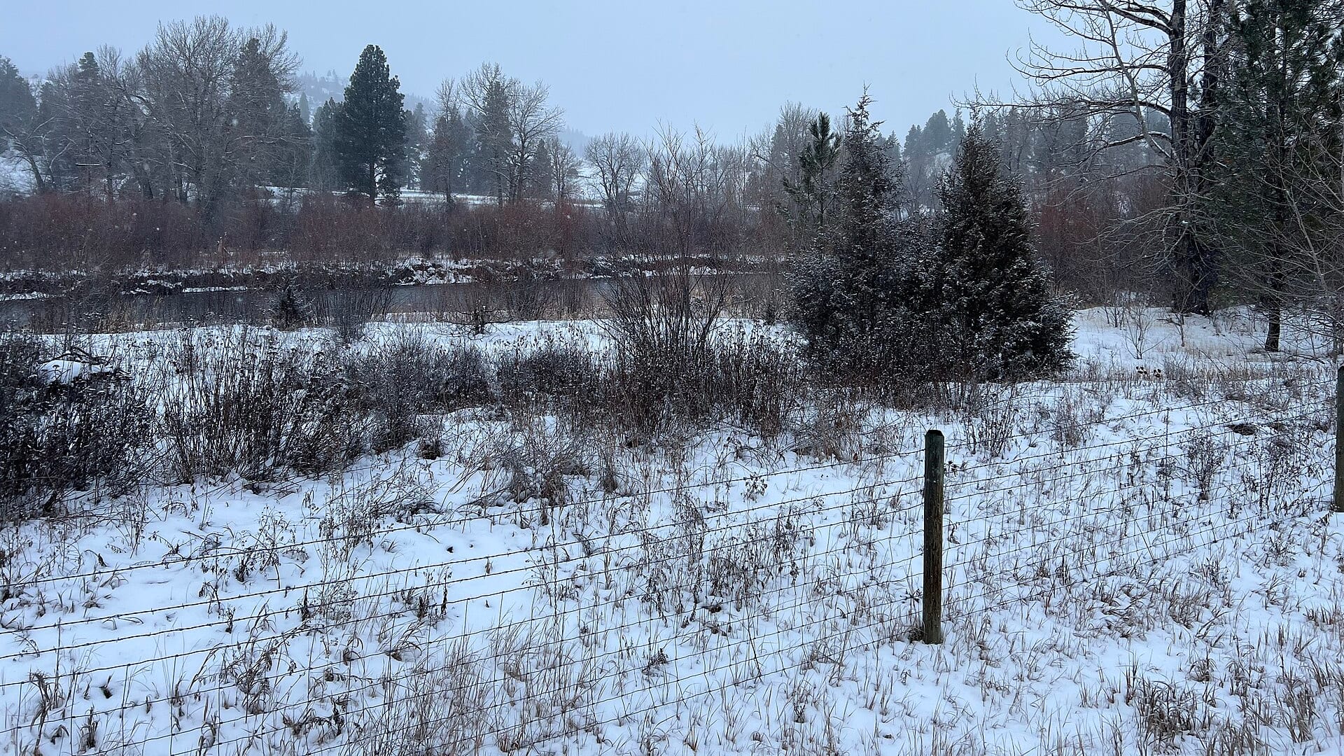
Walk-in / wade
More float- and safety-focused; do not treat it like simple wade water.
Montana stream access allows use below ordinary high-water marks, but it does not grant access across private land.
Bridge and town access can be crowded. Park legally and avoid cutting banks or trespassing.
How to fish it
This page focuses on the Clark Fork through and below Missoula. The river changes quickly after the Blackfoot, Bitterroot, and Rock Creek influences, so check the right gauge and current restrictions before choosing a reach.
An Air Quality Alert is active near this forecast point, so the score is capped at caution until smoke and access conditions are checked. NWS alert: Air Quality Alert issued August 2 at 9:12AM MDT by NWS Great Falls MT.
USGS shows 2,170 cfs with a stable over about 6 hours trend. Today's flow is within the normal seasonal range of 1,780 cfs to 3,310 cfs. Weather, water temperature, and access are the next checks.
Early summer: Runoff drop brings stonefly, caddis, PMD, and streamer opportunities.
The NWS forecast is about 77F with Clear.
Skip or narrow the plan when FWP restrictions are active, tributary color makes the reach unreadable, heat compromises trout handling, or parking and legal river entry are unclear.
Read the water
The Clark Fork is best when flows are stable, clarity is improving, and temperatures stay trout-safe. If the river is big, brown, or warm, move to safer edges or a colder nearby water.
Fish banks, side channels, soft riffles, rubberlegs, and streamers.
Use caddis, PMDs, hoppers, ants, and small droppers through riffles and banks.
Fish edges only if safe and avoid wading pushy crossings.
Check restrictions and switch to early mornings or another river if trout are stressed.
Your trip plan
Use RiverReports and USGS 12353000 below Missoula together. Stable or dropping flow with improving clarity is the better window; big, brown, rising, or warm water should push the plan to softer banks or another river.
Skip or narrow the plan when FWP restrictions are active, tributary color makes the reach unreadable, heat compromises trout handling, or parking and legal river entry are unclear.
Start by choosing town water, below-town water, or a downstream float. Match flies and safety to that reach instead of applying one Clark Fork plan to the whole drainage.
If the Clark Fork is high, dirty, warm, or crowded, compare the Blackfoot for colder freestone water, the Bitterroot for a valley hatch plan, or Rock Creek for a more wade-focused day.
Hatches & flies
 Fly family · report suggests “Skwala dry”Skwala Stonefly PatternsSkwala is an insect and hatch label. Dark olive-brown nymphs and olive adult dries are materially different forms; seasonal timing also varies by watershed.See family guide ↗
 Fly family · report suggests “rubberleg”Stonefly Nymph PatternsStonefly nymph patterns generally emphasize two tails, a broad thorax, segmented abdomen, and bottom contact; rubber legs, biots, beads, and jig hooks define different exact forms.See family guide ↗+ 3 more reviewed guides in the Fly Box
  Fly pattern · report suggests “Chubby Chernobyl”Chubby ChernobylIdentify the construction, not the color: a long foam overbody over a segmented dubbed underside, rubber legs at two tie-in stations, two distinct buoyant synthetic-yarn wing sections, and a short flash tail. The paired wing stations and layered foam-and-dubbing body separate the reviewed Chubby from the original Chernobyl Ant and from generic foam hoppers or beetles.See photos & how to fish it ↗
 Fly pattern · report suggests “Pat's rubber legs”Pat's Rubber LegsThe core Pat's Rubber Legs architecture is a long weighted stonefly nymph with a chenille body, two rubber tails, a pair of antennae, and multiple long flexible legs. Pat Bennett's documented 1995 form used true-brown chenille and true-olive Super Floss; coffee-and-black became a familiar later guide treatment. Beads, jig hooks, thoraxes, wing cases, articulated bodies, white legs, and other colors are explicit variations—not silent parts of one universal recipe.See photos & how to fish it ↗+ 3 more reviewed guides in the Fly Box
  Fly family · report suggests “foam ant”Ant PatternsAnt patterns can be foam, fur-bodied, winged, or sunken. The narrow waist and paired body lobes matter more than one material recipe.See family guide ↗
 Fly family · report suggests “beetle”Beetle PatternsBeetle flies range from simple foam shells to hair-bodied and sunken forms. A rounded back and compact profile distinguish the family from ants and hoppers.See family guide ↗+ 2 more reviewed guides in the Fly Box
  Fly family · report suggests “Mahogany”Isonychia and Mahogany Dun PatternsIsonychia nymphs are active swimmers; emergers, parachute or other dry forms, and spinners occupy different levels. Mahogany Dun can be regional hatch wording, so it does not identify one exact fly recipe.See family guide ↗
 Fly family · report suggests “BWO”Blue-Winged Olive PatternsBWO describes a hatch group, not one fly. Nymph, emerger, dry, cripple, and spinner profiles must stay separate because they occupy different parts of the water column.See family guide ↗+ 3 more reviewed guides in the Fly Box
 Pick a reach first: town, below-town, or downstream float water each fishes differently.
Fish inside bends and soft bank seams before stepping into heavy current.
Use dry-droppers on broken riffles and single dries when pods feed in slicks.
Streamer fish clouds, stain, and deeper bank lines with a controlled swing or strip.
Give other anglers, boats, and town users room around popular bridges and access points.
Rules & closures
Open the agency page to confirm the exact river section, species, season, tackle rules, limits, and emergency closures.
Official links checkedWe checked the state source but did not find a clearly supported exception for this river. Check the official rules for the exact section you plan to fish.
This summary helps with trip planning. The linked agency rule is the one you must follow.
Updates from anglers
Recent observations from general areas of Clark Fork River. We review every update before it appears and never publish exact fishing spots, private access details, or photo locations.
You can still use the river plan above. Check back later for recent observations from other anglers.
Where this report comes from
Fishing guidance checked: May 31, 2026
Site check: Jul 14, 2026. We regularly test report links, live scores, flow and weather data, and page loading. The content date changes only when the fishing guidance or its sources change.
Common questions
Check the below-Missoula gauge, clarity, FWP current restrictions, weather, and your exact access point.
Yes. The Clark Fork has reach-specific rules and current restrictions can change during heat, fire, or emergency events.
Bring the hatch-chart flies, a few confidence nymphs, and a streamer box. Then adjust for water temperature, clarity, and the insects you actually see.
Yes around some public access, but the river is large and pushy. Use official access and avoid crossing private land.
Skip it when flows are unsafe, temperatures stress trout, wildfire or emergency closures are active, or legal access for the reach is not clear.