Wading is the most sensitive plan today. Use protected edges only, avoid crossings, and downgrade quickly if clarity or current feels wrong.

Fly fishing report · Midwest
Upper Manistee River Fly Fishing Report
Check the M-72 flow and water temperature, then choose the exact rule reach. This report covers the Upper Manistee from its headwaters to CCC Bridge.
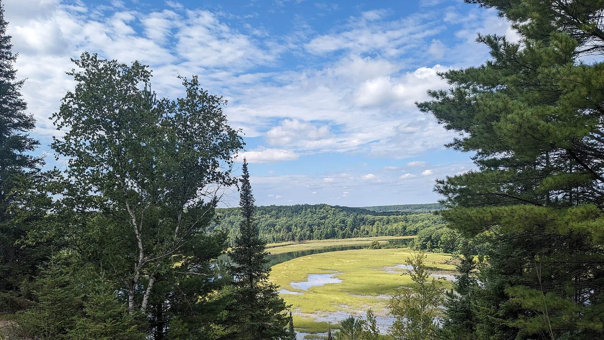
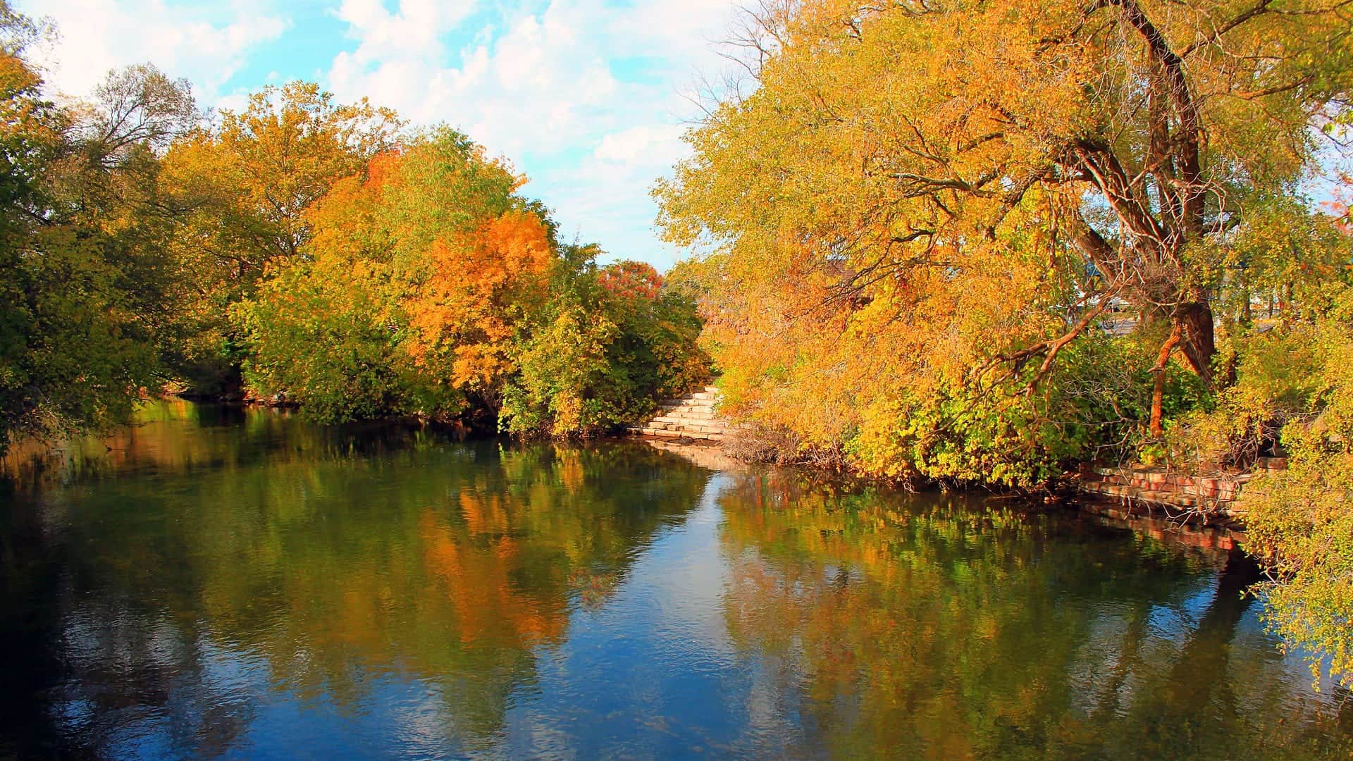
See the M-72 flow chart ↓Generated artwork: BlueStreamFly · Regional illustration; not the exact location.
Fishable with caution. Check the flow and exact reach.
Best option: Bank / edge. USGS 04123500 is near M-72 and does not represent every reach from the headwaters to CCC Bridge. The same-date comparison uses 1943-1973 gauge records; use that older record as context, not a current normal-flow threshold.
See update time and confidence
These scores compare the risks of wading, bank fishing, and floating.
Bank and edge fishing is the safer default when water is high, pushy, or not fully verified.
This report does not recommend floating this reach.
Your plan
A simple Upper Manistee plan.
This report covers the headwaters to CCC Bridge. USGS 04123500 near M-72 is nearby evidence, not a reading for every reach.
- Check
- The M-72 flow and water temperature, then the rule for the reach you want.
- Fish
- Protected edges from a named public site when footing, temperature, and tackle rules fit.
- Leave
- If crossings feel pushy around wood, the water is too warm, or access is unclear.
Live river check
What the river is doing
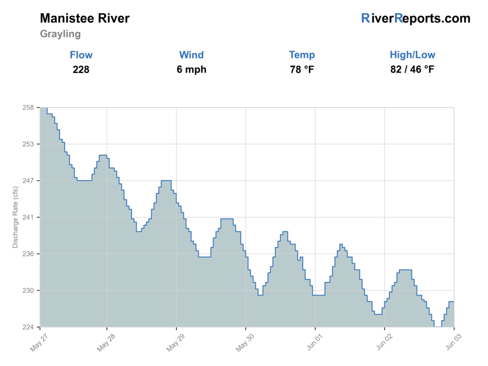
Check the latest flow and weather before you go. A quick change can make the river harder or less safe to fish.
- Flow
- 228 cfs
- From the latest stored river check. Open the official source for the newest reading.Water 59.5°F · 24h high 59.9°F · USGS provisional
- Air now
- 60°F
Current NWS forecast period
- Next 24h high
- 63.0°F
NWS air forecast near
- Rain chance
- 20%
For this forecast period
Slight Chance Rain Showers
- Wind
- 5 mph
- Weather checked
Recent flow chart is loading
The latest stored reading is shown above. Check the official source below if you need the newest value now.
More forecast and source details
Upper Manistee River near Grayling
The National Weather Service forecast is temporarily unavailable.
Where these readings come from
RiverReports gauge: Manistee River at Grayling
How to fish it
The M-72 gauge is one nearby check.
A good day has cool water, manageable edges, an open reach, and confirmed access. Leave if current is pushy around wood or the rule or site status is unclear.
M-72 gauge
Use the latest flow, water temperature, and timestamp as nearby evidence only. USGS may revise those readings.
Elevated for the date
The available same-date comparison ends in 1973. Treat it as old, limited context rather than a fixed threshold.
Wood and current
Wade protected edges. Do not force crossings or pushy, wood-filled water.
Warm water
Carry a thermometer in warm weather and stop before trout handling becomes stressful.
Fishing words used on this page
- U.S. Geological Survey (USGS) gauge
- A USGS gauge is an official river station that measures flow or water height.
- Cubic feet per second (cfs)
- Cubic feet per second, or cfs, shows how much water passes the gauge each second.
- Nymph
- A nymph is a young water insect. Anglers also use the word for a fly that copies it.
- Blue-winged olive (BWO)
- Blue-winged olives, or BWOs, are small mayflies that often hatch in cool or cloudy weather.
- Caddis
- Caddis are small water insects. The adults look a little like tiny moths.
- Emerger
- An emerger copies an insect as it rises from below the water toward the surface.
- Midge
- Midges are tiny flies and a common trout food, especially in cold water.
- River reach
- A reach is one named section of a river or stream.
- Streamer
- A streamer is a fly that looks like a small fish, leech, or other swimming food.
- Terrestrial
- Terrestrials are land insects, such as ants, beetles, and grasshoppers.
Why this call
Why this score
USGS shows 228 cfs. The flow has been stable over about 6 hours. USGS marks this reading provisional and may revise it. USGS records for this date (1943-1973, 31 readings) show a median near 171 cfs and a high-water marker near 200 cfs; today's flow is above that high-water marker. USGS 04123500 is near M-72 and does not represent every reach from the headwaters to CCC Bridge. The same-date comparison uses 1943-1973 gauge records; use that older record as context, not a current normal-flow threshold. Treat this as high-water fishing: wading, clarity, crossings, and boat control need a conservative check.
Bank / edge: Bank and edge fishing is the safer default when water is high, pushy, or not fully verified.
Summer · June through August: All three reaches are in season.
USGS water temperature is about 59.5F, and the rolling 24-hour high did not trigger a heat caution. USGS marks the temperature data provisional and may revise it.
No active NWS alert was returned for this forecast point.
Trip notes
Trip notes
What matters on this reach.
Use the current M-72 flow and water temperature as nearby evidence. No single reading proves every reach is safe or fishable.
Leave when water is too warm, crossings are pushy around wood, a reach is closed, or access is unclear.
Check the M-72 gauge, choose one of the three rule reaches, then start from one named DNR site.
If the Upper Manistee is warm, high, closed, or hard to enter legally, check the Au Sable or Boardman report instead.
Fish on this river
What you can fish for
Brown trout
Primary fishWhen: Reach-specific; see the three-rule table
The main upper-river target. The County Road 612-to-CCC reaches have an 18-inch minimum and a two-trout daily limit.
Brook trout
Also presentWhen: Most relevant toward colder upstream habitat
Do not assume equal numbers throughout the headwaters-to-CCC area.
Rainbow trout
Also presentWhen: Year-round possession downstream of County Road 612
Present at lower density. The two downstream reaches keep a 10-inch minimum.
What to try
Upper Manistee flies through the year.
These four rows cover the full year without overlap. They are a planning calendar, not a live hatch report.
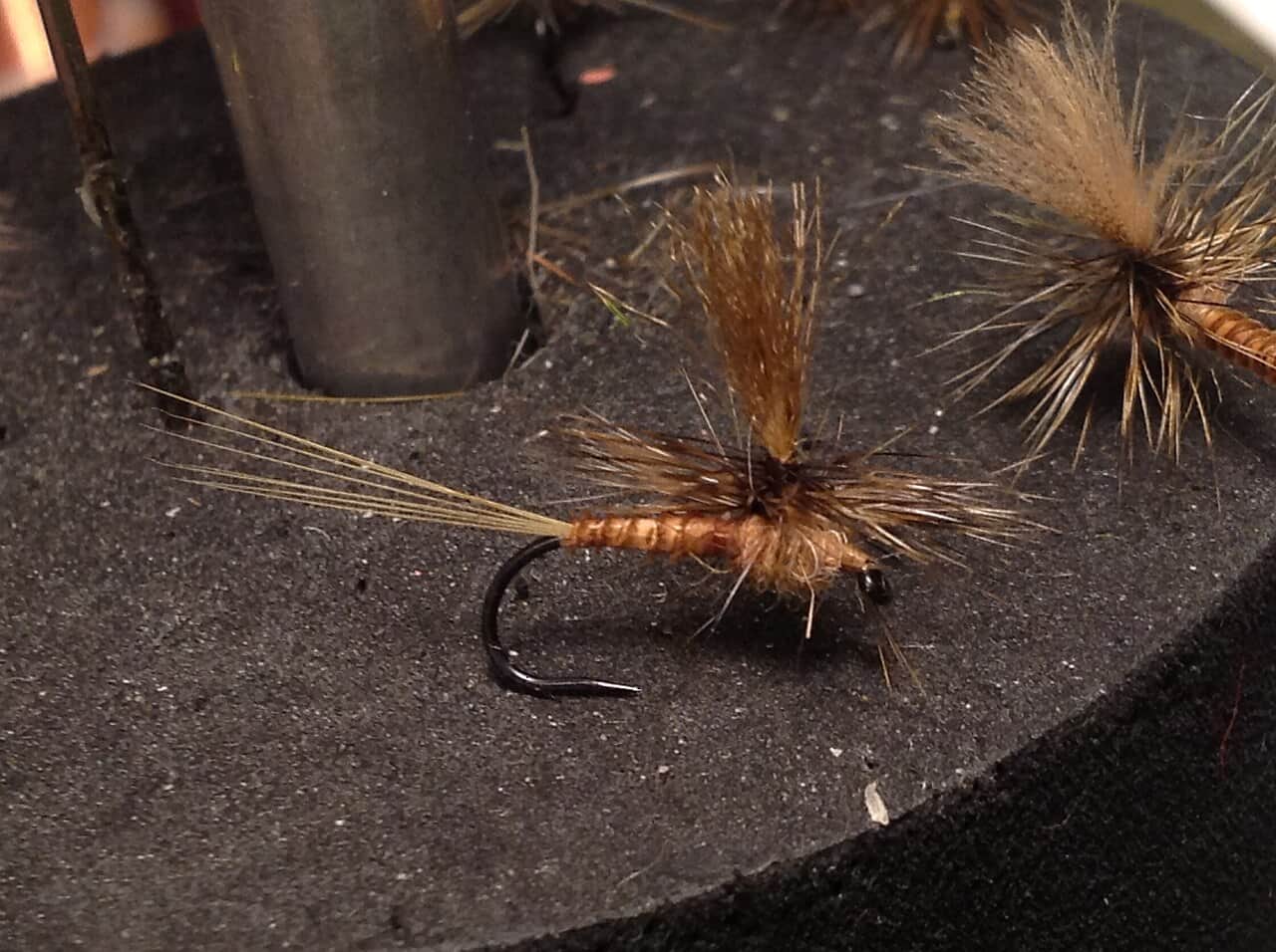
Fly names open their exact Fly Box guides. Some family guides use a clearly identified natural insect reference or reviewed illustration instead of a tied-fly photo.
Access and safety
Choose the reach, then the public access.
This page stops at CCC Bridge. The three reaches have different seasons, tackle rules, and limits. Headwaters to County Road 612 is Type 2. County Road 612 to M-72 is artificial-lures-only. M-72 to CCC Bridge is artificial-flies-only. Use the current digest, FO-200, trout map, and posted signs for the exact season, possession, size, and daily limits.
Choose the rules before the water.
Headwaters to County Road 612
Type 2. Fishing and possession run from the last Saturday in April through September 30. Natural bait and artificial lures are allowed. Daily limit: five trout/salmon total, no more than three at least 15 inches. Minimums are brook 10, brown 12, and rainbow 10 inches.
2026 Michigan Fishing Regulations in a new tabCounty Road 612 to M-72 · 9.2 miles
Fishing is year-round. Brook and brown possession runs from the last Saturday in April through September 30. Rainbow possession is year-round. Artificial lures only. Daily limit: two trout, no more than one at least 18 inches. Minimums are brook 10, brown 18, and rainbow 10 inches.
Michigan Fisheries Order FO-200 in a new tabM-72 to Sunset Trail Road / CCC Bridge · 16.7 miles
Fishing is year-round. Brook and brown possession runs from the last Saturday in April through September 30. Rainbow possession is year-round. Artificial flies only, with no scented material in the water or on shore. Daily limit: two trout, no more than one at least 18 inches. Minimums are brook 10, brown 18, and rainbow 10 inches.
Michigan Fisheries Order FO-200 in a new tabUpper Manistee River State Forest Campground and Canoe Camp
44.750265, -84.839361. Narrow riverside path, central stairs, carry access near site 16, four-vehicle river parking near site 5, and about a 50-yard walk. Recreation Passport required. Open year-round. Road not plowed.
Michigan DNR Upper Manistee access in a new tabGoose Creek State Forest Campground
44.75928, -84.840049. Multiple river-entry points and carry access. Check the road, site status, signs, and exact reach rule.
Michigan DNR Goose Creek access in a new tabManistee River Bridge State Forest Campground at M-72
44.69468216, -84.847495. Two access paths with stairs, about 30 yards to the water, and parking near site 16. This is the tackle-rule boundary.
Michigan DNR M-72 bridge access in a new tabCCC Bridge State Forest Campground
7184 Sunset Trail SE. This is the downstream rule boundary and a named public access anchor. This report does not extend below it.
Michigan DNR CCC Bridge access in a new tabUse a named DNR site, stay inside its public boundary, and never cross private land to reach visible water. Natural River zoning is not blanket fishing access.
The DNR closure page had no Upper Manistee text match on August 22, 2026. That does not prove every road, campground, access, or reach is open. Recheck before travel.
River sources
Checks used for this report.
Flow, temperature, weather, rules, access, and fishery sources were checked August 22, 2026. No field visit is claimed.
How this report was checked
What was checked: BlueStreamFly checked official public flow, water-temperature, rule, access, closure, fishery, and weather sources. This review does not claim a field visit, local residency, or first-hand Upper Manistee fishing experience.
Live measurements and forecasts keep their provider timestamps. Rules, access, and trip guidance use the source-review date shown here. BlueStreamFly planning advice is editorial interpretation, not an agency notice.
First-hand experience: BlueStreamFly does not claim a first-hand visit or local field test for this report unless a real contributor is explicitly named and linked.
Rules and closures
Check what is allowed, where the rule applies, and whether the river is open.
Flow and weather
Check the latest river reading and forecast before you leave.
Access and land
Check public entry points, land rules, and seasonal access changes.
More helpful links
Use these links for stocking, safety, and other local details.
See all 15 checked sources
Rules and closures
Check what is allowed, where the rule applies, and whether the river is open.
What this source covers
Open the current rules and check the river section, season, and special limits.
What this source covers
Open the current rules and check the river section, season, and special limits.
What this source covers
Open the current rules and check the river section, season, and special limits.
Flow and weather
Check the latest river reading and forecast before you leave.
What this source covers
Open this page and check the latest safety advice before your trip.
What this source covers
Open this river reading to check the latest level, flow, and update time.
What this source covers
Open this river reading to check the latest level, flow, and update time.
What this source covers
Open this river reading to check the latest level, flow, and update time.
Access and land
Check public entry points, land rules, and seasonal access changes.
What this source covers
Open the land or access page, then check signs before you park or enter.
What this source covers
Open the land or access page, then check signs before you park or enter.
What this source covers
Open the land or access page, then check signs before you park or enter.
What this source covers
Open the land or access page, then check signs before you park or enter.
What this source covers
Open the land or access page, then check signs before you park or enter.
More helpful links
Use these links for stocking, safety, and other local details.
What this source covers
Open this page and check the latest safety advice before your trip.
What this source covers
Open this page for more river information and check when it was last updated.
What this source covers
Open this page for more river information and check when it was last updated.
Quick answers
A few useful answers.
What part of the Upper Manistee does this report cover?
From the headwaters downstream to Sunset Trail Road / CCC Bridge.
What does the M-72 gauge tell me?
USGS 04123500 gives not yet confirmed flow and water temperature at or just upstream of M-72. It does not describe every reach.
Do Upper Manistee rules change by reach?
Yes. The headwaters are Type 2, County Road 612 to M-72 is artificial-lures-only, and M-72 to CCC Bridge is artificial-flies-only. Seasons and limits also differ.
Can I float the Upper Manistee for fishing?
This report does not verify a fishing float. Confirm a legal route, launch, takeout, shuttle, suitable craft, PFD, water, wood, and weather before considering one.
Is the fly chart a live hatch report?
No. It is a full-year planning calendar. Current flow, water temperature, weather, and insects on the water decide what to fish.