WadeNot advised
Wading is the most sensitive plan today. Use protected edges only, avoid crossings, and downgrade quickly if clarity or current feels wrong.
Fly fishing report · Midwest
A St. Joseph River report for Michigan fly anglers checking Niles flow, lower-river access, salmon and steelhead windows, bass water, and rules.
Check flow & weatherColdwater targets are a poor choice in this heat window, but warmwater targets may still be reasonable where legal and ethical.
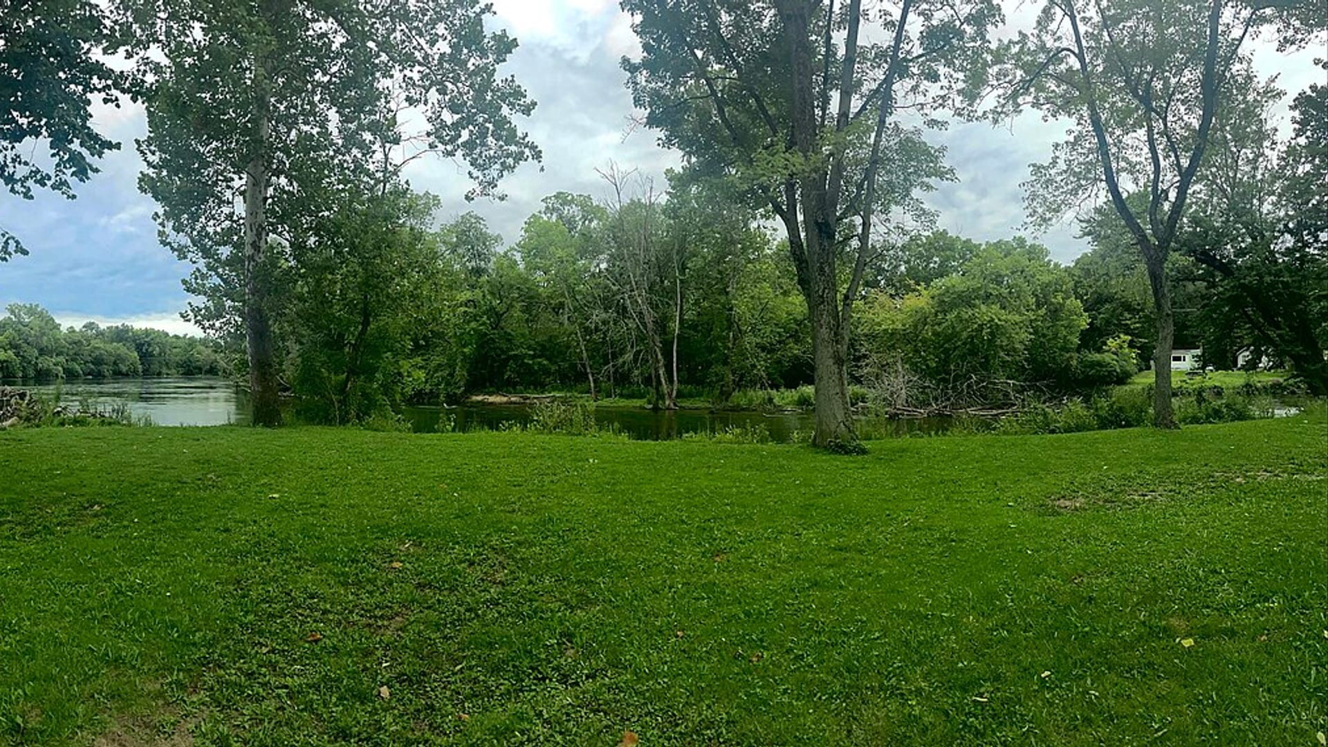
Compare wading, bank fishing, and floating before choosing how you will fish.
Wading is the most sensitive plan today. Use protected edges only, avoid crossings, and downgrade quickly if clarity or current feels wrong.
Bank and edge fishing is the safer default when water is high, pushy, or not fully verified.
A float can fit better than wading only if launches, shuttle, boat skill, wind, and local rules all check out.
Check before you drive
Look at whether the river is rising or falling, then check wind, rain, and storms. These can change both safety and fishing.
Before you rely on this report
Conditions can change quickly. Check these dates before you decide to fish, and open the official source when safety or rules matter.
High confidence in the current score inputs.
6 sources are listed below for you to open.
3 public access records are listed. Private spots are never shown.
Source checked Jul 30, 2026
Plan your access
These are public parking, launch, trail, or recreation areas—not secret fishing spots. We never show an angler's private pins, notes, or photos here.
Area description
Primary gauge and a practical lower-river planning point.
Dams and portages are part of the lower-river plan. Scout legal access and exit points before floating.
Private banks are common. Use public launches, parks, and posted access rather than cutting through yards or industrial areas.
Trailhead
Use for segment planning, launches, and portage awareness.
Dams and portages are part of the lower-river plan. Scout legal access and exit points before floating.
Private banks are common. Use public launches, parks, and posted access rather than cutting through yards or industrial areas.
Area description
Important lower-river access zones with dams, public areas, and crowding considerations.
Dams and portages are part of the lower-river plan. Scout legal access and exit points before floating.
Private banks are common. Use public launches, parks, and posted access rather than cutting through yards or industrial areas.
How to fish it
The Michigan St. Joseph can be a lower-river salmon and steelhead corridor, a warmwater bass river, and a big boating river depending on reach and season. The Niles gauge is the main flow check for this page.
Coldwater targets are a poor choice in this heat window, but warmwater targets may still be reasonable where legal and ethical.
USGS water temperature is about 76F. Do not pressure trout or salmonids in warm water.
An active public alert is in effect near this forecast point, so the score is capped at caution until conditions are checked. NWS alert: Beach Hazards Statement issued August 2 at 3:57PM EDT until August 3 at 8:00AM EDT by NWS Northern Indiana.
Float: A float can fit better than wading only if launches, shuttle, boat skill, wind, and local rules all check out.
USGS shows 2,330 cfs with a rising about 14% over about 6 hours trend. Today's flow is within the normal seasonal range of 1,610 cfs to 2,900 cfs. Weather, water temperature, and access are the next checks.
Read the water
If the lower river is stable and safe, plan around either migratory fish movement or warmwater structure. If flow is high, muddy, or near dam turbulence, choose a safer launch or wait.
Fish seams, current breaks, and dam-influenced soft edges with streamers or nymphs.
Stay out of heavy current and fish edges only where access is legal and safe.
Focus on shade, rock, weed edges, and smaller flies for bass or carp.
Use legal presentation methods and avoid crowded dam areas when safety or ethics are poor.
Your trip plan
Use USGS 04101500 at Niles for the lower-river trend. Stable medium flow is best for reading seams and structure; high or stained water should move the plan to safer banks, public launches, or another river.
Skip or narrow the plan when dam turbulence, high flow, boat traffic, private-bank uncertainty, or current salmon and steelhead rules make the intended reach unclear.
Start with the Niles gauge, then choose one practical mode: migratory-fish lanes, summer smallmouth structure, pike edges, or carp flats. Match the access point and rod weight to that mode before leaving home.
If the St. Joseph is high, crowded, or hard to access safely, compare the Kalamazoo for another southwest Michigan warmwater plan, the Huron for clearer smallmouth-focused water, or the Pere Marquette for a more classic trout and migratory-fish destination.
Hatches & flies
 Fly pattern · report suggests “Small Clouser”Clouser Deep MinnowThe reviewed chartreuse-and-white form uses sparse layered bucktail with flash around lead barbell eyes. The eyes make the fly sink between strips and ride hook point up; color, eye weight, hook, and saltwater materials must remain labeled.See photos & how to fish it ↗
 Fly family · report suggests “crayfish”Crayfish and Crawfish PatternsCrayfish patterns differ in claw size, eye placement, shell profile, leg motion, weighting, hook orientation, and snag resistance. Rust, brown, olive, tan, and pale molting colors remain labeled choices rather than aliases for one recipe.See family guide ↗+ 3 more reviewed guides in the Fly Box
  Fly family · report suggests “Poppers”Bass and Panfish Popper PatternsPoppers may use cupped foam, cork, balsa, deer hair, or pencil-shaped heads. Head face, size, buoyancy, tail, legs, and weed guard determine sound and action; a generic popper label does not identify one fly.See family guide ↗
 Fly family · report suggests “sliders”Warmwater Slider and Diver PatternsA slider has a tapered, flat, or softly shaped head that glides or pushes a small wake with limited noise. A diver has an angled, collared, folded, or otherwise shaped head that pulls below the surface when stripped and rises on the pause. Frog, baitfish, and large-insect profiles can be tied on either idea, so the exact head action, buoyancy, hook orientation, weed guard, and material must stay named.See family guide ↗+ 3 more reviewed guides in the Fly Box
  Fly pattern · report suggests “Game changer”Chocklett's Game ChangerConfirm a connected series of articulated shanks or Fish-Spine sections dressed into one continuous baitfish taper, with the greatest body bulk near the front hook and progressively less material toward the tail. The two photographs show that architecture in large chartreuse-white and gray-white field forms, but they do not establish one universal section count, hook, head, length, material, or sink rate. A single hinge, a two-hook articulated streamer, and any generic jointed swimbait fly are not automatically Chocklett's Game Changers.See photos & how to fish it ↗Fly pattern · report suggests “Clouser”Clouser Deep MinnowThe reviewed chartreuse-and-white form uses sparse layered bucktail with flash around lead barbell eyes. The eyes make the fly sink between strips and ride hook point up; color, eye weight, hook, and saltwater materials must remain labeled.See photos & how to fish it ↗+ 3 more reviewed guides in the Fly Box
  Fly family · report suggests “Slow leech”Leech PatternsLeech patterns share an elongated moving silhouette, but material, weighting, hook orientation, and retrieve vary. Pine-squirrel, rabbit-strip, balanced, and Woolly Bugger forms remain separately labeled rather than being presented as one recipe.See family guide ↗
 Fly family · report suggests “jig streamer”Trout Streamer PatternsStreamer is a method-and-silhouette family, not a recipe. Size, color, weight, and presentation phrases stay visible, while baitfish, leech, sculpin, Woolly Bugger, and articulated identities link to their more specific destinations when known.See family guide ↗+ 1 more reviewed guide in the Fly Box
 For bass, fish rock, wood, bridge shade, and current seams with poppers early and streamers later.
For migratory fish, cover travel lanes and soft holding water with legal nymph or streamer presentations.
Avoid fishing directly in unsafe dam turbulence or crowded spillway zones.
For carp, use long casts, small weighted flies, and slow presentations on visible fish.
When the river is dirty, use darker streamers with vibration near safe bank edges.
Rules & closures
Open the agency page to confirm the exact river section, species, season, tackle rules, limits, and emergency closures.
Official links checkedWe checked the state source but did not find a clearly supported exception for this river. Check the official rules for the exact section you plan to fish.
This summary helps with trip planning. The linked agency rule is the one you must follow.
Updates from anglers
Recent observations from general areas of St. Joseph River. We review every update before it appears and never publish exact fishing spots, private access details, or photo locations.
You can still use the river plan above. Check back later for recent observations from other anglers.
Where this report comes from
Fishing guidance checked: May 31, 2026
Site check: Jul 14, 2026. We regularly test report links, live scores, flow and weather data, and page loading. The content date changes only when the fishing guidance or its sources change.
Common questions
Check the Niles USGS gauge, Michigan rules, water-trail access, dam/portage details, and weather before choosing a lower-river reach.
Yes by species and reach. Salmon, steelhead, bass, and pike rules are not interchangeable, so read current Michigan regulations.
Yes, if you match the reach, season, target species, water temperature, and current access rules. This report is built to help you choose that plan.
Bring the hatch-chart flies, confidence nymphs, and a backup streamer or warmwater box so you can adjust to flow, clarity, and temperature.
Plan access through public launches, water-trail information, and parks. Dams, portages, private banks, and boat traffic matter.