Wade, bank, and floatLimited data
Use the live sources and what you see at the river before choosing an approach.

Fly fishing report · West
A Lower Yuba report focused on Englebright-to-Marysville flow checks, wild trout and steelhead planning, Skwala-to-caddis hatches, and careful access.
Check flow & weatherThe NWS forecast is near 103F and this page does not have live water temperature. Treat trout and salmonid fishing as unsafe unless a stream thermometer proves otherwise.
There is not enough reliable current information to recommend wading, bank fishing, or floating.
Use the live sources and what you see at the river before choosing an approach.
Check before you drive
Look at whether the river is rising or falling, then check wind, rain, and storms. These can change both safety and fishing.
Before you rely on this report
Conditions can change quickly. Check these dates before you decide to fish, and open the official source when safety or rules matter.
High confidence in the current score inputs.
10 sources are listed below for you to open.
4 public access records are listed. Private spots are never shown.
Source checked Jul 30, 2026
Plan your access
These are public parking, launch, trail, or recreation areas—not secret fishing spots. We never show an angler's private pins, notes, or photos here.
Parking
A common planning landmark, but confirm parking, signs, water level, and legal access before fishing.
Public access is limited compared with the amount of visible river.
Yuba Water condition notes are useful because minimum-flow and release changes affect safety.
Area description
Useful for flow reference near the lower river, not a blanket access permission.
Public access is limited compared with the amount of visible river.
Yuba Water condition notes are useful because minimum-flow and release changes affect safety.
Roadside access
Use official access points and respect closures, posted signs, and private boundaries.
Public access is limited compared with the amount of visible river.
Yuba Water condition notes are useful because minimum-flow and release changes affect safety.
Area description
Nearby anadromous water if Yuba flows, access, or clarity are wrong.
Public access is limited compared with the amount of visible river.
Yuba Water condition notes are useful because minimum-flow and release changes affect safety.
How to fish it
The Lower Yuba can be a technical, hatch-driven trout river, but public access is limited and flows can change with upstream management. Check the Marysville gauge and current CDFW rules before choosing a reach.
The NWS forecast is near 103F and this page does not have live water temperature. Treat trout and salmonid fishing as unsafe unless a stream thermometer proves otherwise.
USGS shows 545 cfs with a stable over about 6 hours trend. Today's flow is below the normal seasonal range, which begins near 901 cfs. This is below normal, so edge depth, temperature, and pressure matter.
Summer: Early and late windows are better.
No active NWS alert was returned for this forecast point.
Read the water
The best Lower Yuba days come when flows are stable, clarity is good, and you have a legal access plan. Fish the river like pressured wild trout water: move slowly, change depth often, and match the hatch only after checking the rocks and edges.
Use long leaders, careful approaches, small nymphs, emergers, and low-profile dry flies.
The most flexible window for nymphing riffles, swinging soft hackles, and watching for heads.
Wading can become dangerous fast. Focus on safe edges or wait for a lower trend.
Check temperature, shorten fights, and shift plans if trout handling becomes stressful.
Your trip plan
Use the Marysville gauge and Yuba Water condition notes as a trend tool, not a magic number. Stable or slowly easing releases fish better than abrupt change, and Yuba Water explicitly warns that flows can change rapidly, so a plan that looked fine at breakfast can become a bad wading idea by midday.
Skip the trip when release notices suggest rapid change, when warm-weather fish handling is questionable, when the legal access points are already overloaded, or when you would need to guess about private-boundary crossings to reach the water you want.
Pick the access before the flies: verify the current Yuba Water conditions, decide whether Highway 20, Parks Bar, or another known legal access is your anchor, then fish one reach patiently instead of burning time scouting every visible gravel bar on the river.
If the Lower Yuba is too pushy, crowded, or warm, move to the Feather for a bigger lower-river backup or to the North Yuba if you want a smaller freestone day with different wading and hatch expectations.
Hatches & flies
 Fly family · report suggests “Skwala dry”Skwala Stonefly PatternsSkwala is an insect and hatch label. Dark olive-brown nymphs and olive adult dries are materially different forms; seasonal timing also varies by watershed.See family guide ↗
 Fly family · report suggests “stonefly nymph”Stonefly Nymph PatternsStonefly nymph patterns generally emphasize two tails, a broad thorax, segmented abdomen, and bottom contact; rubber legs, biots, beads, and jig hooks define different exact forms.See family guide ↗+ 2 more reviewed guides in the Fly Box
  Fly family · report suggests “PMD dry”Pale Morning Dun PatternsPMD names an insect group, not one fly. Pale nymphs, trailing-shuck emergers, upright or low-riding duns, cripples, and spent-wing spinners stay visibly separate.See family guide ↗
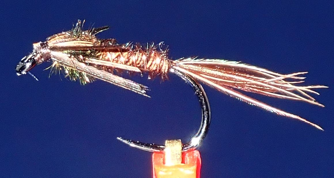 Fly pattern · report suggests “pheasant tail”Pheasant Tail NymphThe pilot page distinguishes the sparse original idea from the bulkier American form. Both use pheasant-tail fibers and copper wire, but bead heads, peacock-herl thoraxes, legs, flashbacks, jig hooks, and soft-hackle collars are variations that must be labeled.See photos & how to fish it ↗+ 2 more reviewed guides in the Fly Box
  Fly pattern · report suggests “Elk hair caddis”Elk Hair CaddisLook for a tented elk- or deer-hair wing, clipped hair head, dubbed body, rib, and hackle palmered along the body. The body color should be labeled because tiers often match different natural caddis colors.See photos & how to fish it ↗
 Fly family · report suggests “ant”Ant PatternsAnt patterns can be foam, fur-bodied, winged, or sunken. The narrow waist and paired body lobes matter more than one material recipe.See family guide ↗+ 2 more reviewed guides in the Fly Box
  Fly family · report suggests “BWO”Blue-Winged Olive PatternsBWO describes a hatch group, not one fly. Nymph, emerger, dry, cripple, and spinner profiles must stay separate because they occupy different parts of the water column.See family guide ↗
 Fly family · report suggests “soft hackle”Soft-Hackle Wet FliesA slim body and sparse webby feather collar define the family. Body material, tail, bead, and insect-specific color create different named patterns.See family guide ↗+ 2 more reviewed guides in the Fly Box
 Check the Marysville gauge before driving and again before wading.
Walk quietly because the clear tailwater can punish sloppy bank movement.
Fish first casts from the bank before stepping into shallow edge water.
Adjust weight and indicator depth often; many Lower Yuba trout feed near the bottom.
Swing soft hackles after nymphing a riffle if bugs are active.
Rules & closures
Open the agency page to confirm the exact river section, species, season, tackle rules, limits, and emergency closures.
Official links checkedWe checked the state source but did not find a clearly supported exception for this river. Check the official rules for the exact section you plan to fish.
This summary helps with trip planning. The linked agency rule is the one you must follow.
Updates from anglers
Recent observations from general areas of Lower Yuba River. We review every update before it appears and never publish exact fishing spots, private access details, or photo locations.
You can still use the river plan above. Check back later for recent observations from other anglers.
Where this report comes from
Fishing guidance checked: Jul 6, 2026
Site check: Jul 14, 2026. We regularly test report links, live scores, flow and weather data, and page loading. The content date changes only when the fishing guidance or its sources change.
Common questions
Use USGS 11421000, Yuba River near Marysville, along with Yuba Water's current river conditions.
No. Access is limited and mixed with private land, so verify legal parking and river entry before fishing.
Bring stoneflies, PMDs, caddis, BWOs, midges, soft hackles, and a few streamers.
Only at appropriate flows and from safe access. The river has slick cobble and can become pushy quickly.