WadeNot advised
Wading is the most sensitive plan today. Use protected edges only, avoid crossings, and downgrade quickly if clarity or current feels wrong.
Fly fishing report · Southeast
A Toccoa River report for upper delayed-harvest water, Blue Ridge tailwater context, RiverReports/USGS flow checks, USFS access, hatches, flies, and private-land cautions.
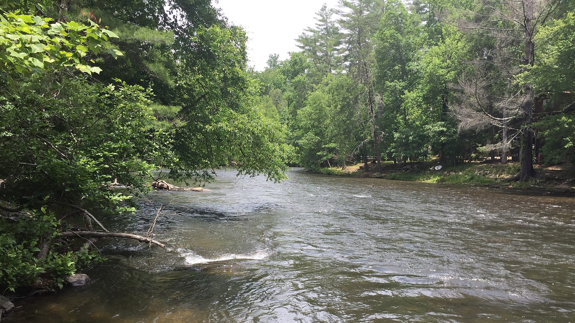
Check flow & weatherCurrent USGS flow is 913 cfs. It has fallen about 40% over the past 6 hours. Today's flow is above the usual high-water marker for this date; the seasonal median is 302 cfs. Treat this as high-water fishing: wading, clarity, crossings, and boat control need a conservative check.
Compare wading, bank fishing, and floating before choosing how you will fish.
Wading is the most sensitive plan today. Use protected edges only, avoid crossings, and downgrade quickly if clarity or current feels wrong.
Bank and edge fishing is the safer default when water is high, pushy, or not fully verified.
A float can fit better than wading only if launches, shuttle, boat skill, wind, and local rules all check out.
Check before you drive
Look at whether the river is rising or falling, then check wind, rain, and storms. These can change both safety and fishing.
Before you rely on this report
Conditions can change quickly. Check these dates before you decide to fish, and open the official source when safety or rules matter.
Priority river · checked more closely for freshness and source changes
High confidence in the current score inputs.
6 sources are listed below for you to open.
3 public access records are listed. Private spots are never shown.
Source checked Jul 30, 2026
Plan your access
These are public parking, launch, trail, or recreation areas—not secret fishing spots. We never show an angler's private pins, notes, or photos here.
Area description
Georgia DNR defines the seasonal catch-and-release artificial-only water by exact landmarks.
USFS warns that fishing, camping, or entering private land without permission is illegal.
Floating does not make every bank public.
Trailhead
USFS access from Deep Hole to Sandy Bottoms, with fees and private-land cautions.
USFS warns that fishing, camping, or entering private land without permission is illegal.
Floating does not make every bank public.
Area description
A separate lower-river plan that depends on dam releases and exact access.
USFS warns that fishing, camping, or entering private land without permission is illegal.
Floating does not make every bank public.
How to fish it
The Toccoa has an upper delayed-harvest trout reach and a lower tailwater below Lake Blue Ridge. This page starts with the upper Dial gauge while reminding anglers to verify the exact reach, rules, and access before fishing.
USGS shows 913 cfs with a falling about 40% over about 6 hours trend. Today's flow is above the usual high-water marker for this date; the seasonal median is 302 cfs. Treat this as high-water fishing: wading, clarity, crossings, and boat control need a conservative check.
Float: A float can fit better than wading only if launches, shuttle, boat skill, wind, and local rules all check out.
Summer: Fish early, watch temperatures, and separate colder tailwater from warmer upper water.
The NWS forecast is about 72F with Partly Cloudy.
No active NWS alert was returned for this forecast point.
Read the water
The Toccoa is best when flow, clarity, and the correct seasonal regulation reach line up. If the upper river is high or muddy, the lower tailwater may be different, but it needs its own release check.
Use stealth, small nymphs, soft hackles, and longer leaders.
Nymphs, woolly buggers, soft hackles, and dry-droppers can cover delayed-harvest water.
Avoid risky wading; fish banks only if safe and legal.
Check Blue Ridge Dam release information separately before fishing below the lake.
Your trip plan
Use RiverReports and USGS 03558000 near Dial for upper-river discharge. Stable or gently falling water is best; high, stained, or storm-driven water should push the day toward banks only, a separate tailwater check, or another river.
Skip the Toccoa plan when the delayed-harvest rule window is unclear, water is rising or muddy, private-land boundaries are uncertain, storms are building, or Blue Ridge Dam releases are the real driver for the reach you intend to fish.
Decide the reach first: upper delayed-harvest water, the canoe-trail corridor, or lower tailwater context. Then confirm flow, legal access, and fly restrictions before choosing rigs.
If Toccoa flow, access, private-land questions, or delayed-harvest rules do not line up, compare the Chattahoochee River for a different Georgia trout plan or the Norfork and Little Red tailwaters for broader Southern options.
Hatches & flies
 Fly pattern · report suggests “Zebra midge”Zebra MidgeLook for a very slim tapered thread body, evenly spaced contrasting wire rib, a small bead, and no tail or wing. The reviewed classic is black with silver wire and a silver bead. Red, olive, brown, glass-bead, jig-hook, resin-coated, or tailed forms must remain labeled variations rather than replacing the classic identity.See photos & how to fish it ↗
 Fly family · report suggests “black stone nymph”Black Stonefly PatternsBlack stonefly wording is a color and insect-group label, not one exact recipe. Size, nymph versus adult stage, wing profile, and weighting must remain explicit.See family guide ↗+ 2 more reviewed guides in the Fly Box
  Fly family · report suggests “Caddis pupa”Caddis Pupa PatternsCaddis pupa is a life-stage family. Curved bodies, wing pads, legs, beads, and soft-hackle collars differ among exact patterns and must be labeled.See family guide ↗
 Fly family · report suggests “BWO emerger”Blue-Winged Olive PatternsBWO describes a hatch group, not one fly. Nymph, emerger, dry, cripple, and spinner profiles must stay separate because they occupy different parts of the water column.See family guide ↗+ 2 more reviewed guides in the Fly Box
  Fly pattern · report suggests “Elk hair caddis”Elk Hair CaddisLook for a tented elk- or deer-hair wing, clipped hair head, dubbed body, rib, and hackle palmered along the body. The body color should be labeled because tiers often match different natural caddis colors.See photos & how to fish it ↗
 Fly family · report suggests “yellow sally”Yellow Sally PatternsYellow Sally names a group of small stoneflies, not one fly. Nymph and adult forms differ sharply, and local size and yellow, cream, or chartreuse tones must be checked.See family guide ↗+ 2 more reviewed guides in the Fly Box Fly family · report suggests “BWO dry”Blue-Winged Olive PatternsBWO describes a hatch group, not one fly. Nymph, emerger, dry, cripple, and spinner profiles must stay separate because they occupy different parts of the water column.See family guide ↗Fly pattern · report suggests “zebra midge”Zebra MidgeLook for a very slim tapered thread body, evenly spaced contrasting wire rib, a small bead, and no tail or wing. The reviewed classic is black with silver wire and a silver bead. Red, olive, brown, glass-bead, jig-hook, resin-coated, or tailed forms must remain labeled variations rather than replacing the classic identity.See photos & how to fish it ↗+ 2 more reviewed guides in the Fly Box
 Confirm whether you are fishing upper delayed-harvest water or the lower tailwater.
Use single-hook artificial flies when delayed-harvest rules require them.
Fish nymphs and soft hackles through riffles before switching to dries.
Avoid anchoring or stepping onto private land without permission.
Check tailwater release information separately if fishing below Blue Ridge Dam.
Rules & closures
Open the agency page to confirm the exact river section, species, season, tackle rules, limits, and emergency closures.
Official links checkedWe checked the state source but did not find a clearly supported exception for this river. Check the official rules for the exact section you plan to fish.
This summary helps with trip planning. The linked agency rule is the one you must follow.
Updates from anglers
Recent observations from general areas of Toccoa River. We review every update before it appears and never publish exact fishing spots, private access details, or photo locations.
You can still use the river plan above. Check back later for recent observations from other anglers.
Where this report comes from
Fishing guidance checked: May 31, 2026
Site check: Jul 14, 2026. We regularly test report links, live scores, flow and weather data, and page loading. The content date changes only when the fishing guidance or its sources change.
Common questions
No. The upper delayed-harvest reach and the lower Blue Ridge tailwater have different access, flow, and rule checks.
Use the Toccoa River near Dial gauge for upper-river and delayed-harvest planning.
Georgia DNR requires release of trout and single-hook artificial lures during the delayed-harvest season; check current wording.
Only where legal and safe. Private-land rules still apply along the river corridor.