RiverReports preview · current series loading
Recent flow
RiverReports gauge
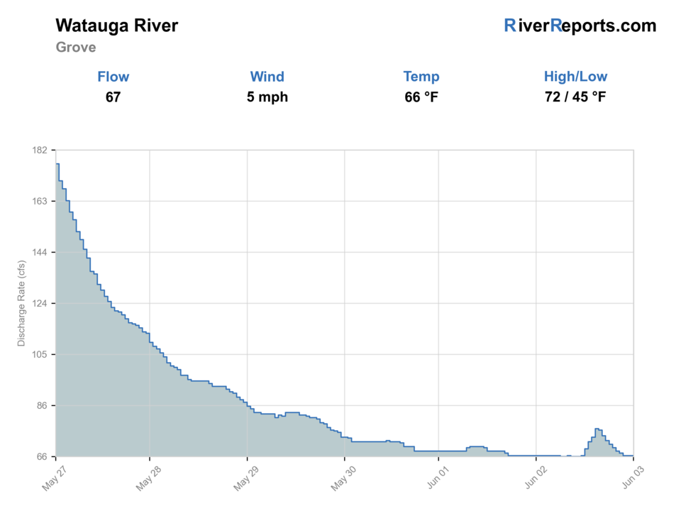
Showing the available RiverReports chart while the current structured flow series loads. Check the chart on RiverReports Opens in a new tab.
Best option: Wading. Wading is in play only where your chosen access has clear footing, legal entry, and no forced crossings.
Rating updatedRiver local time:
USGS shows 83 cfs. The flow has been stable over about 6 hours. USGS marks this reading provisional and may revise it. USGS records for this date (1941-2026, 86 readings) show a typical middle range of 39 cfs to 114 cfs. Flow is within the typical range for this date, so weather, temperature, and access become the next checks.
NWS air forecast near
This is an air forecast, not a river-temperature reading. Check the water with a stream thermometer before fishing in hot weather.
RiverReports gauge
Showing the available RiverReports chart while the current structured flow series loads. Check the chart on RiverReports Opens in a new tab.
Sunny
The National Weather Service forecast is temporarily unavailable.
RiverReports gauge: Watauga River near Sugar Grove
Seasonal starting points, not a live hatch report. Match what you see on the water.
Each fly name opens its matching Fly Box guide.
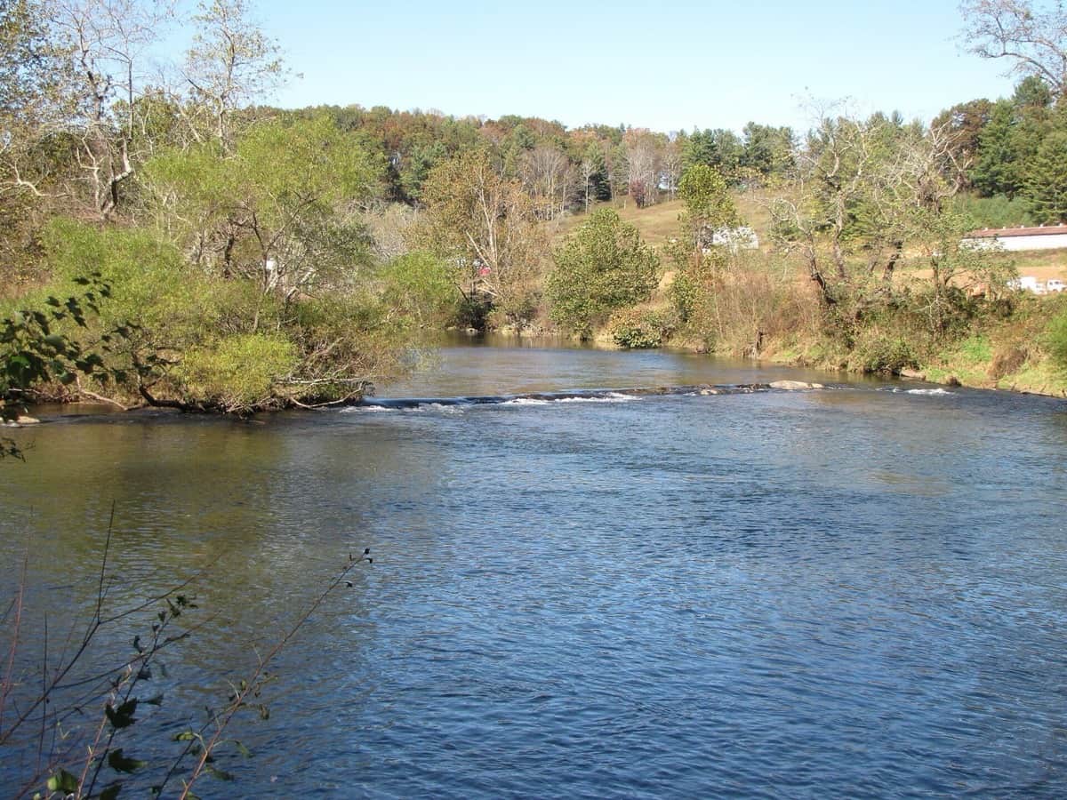
Think of the North Carolina Watauga as a High Country trout day that gets better when you keep the plan simple. Pick one access, stay honest about current speed, and use nymphs, soft hackles, and dry-dropper rigs that fit clear mountain water rather than overpowering the drift.
Go lighter, longer, and more exact with nymphs, soft hackles, and dry-dropper rigs.
Best all-around window for wading and covering several access points in one day.
Fish edges and seams, add a little weight, and stay off fast center current.
Do not force it. The safest decision may be to stay on the bank or fish another High Country river.
These scores compare the risks of wading, bank fishing, and floating.
Wading is in play only where your chosen access has clear footing, legal entry, and no forced crossings.
This report does not recommend bank fishing on this reach.
This report does not recommend floating this reach.
Is Watauga River worth the trip today? Check flow, weather, hatches, access, and rules for North Carolina before you go.
The Watauga's best public trout water fishes cleanest when you treat it as delayed-harvest water until Saturday, June 6, 2026, then match your day to the actual gauge and the access you can safely use. Low clear flow favors precise nymphs and small dries. Higher rain water or push through the gorge should move you toward safer bank angles or a different river.
USGS shows 83 cfs. The flow has been stable over about 6 hours. USGS marks this reading provisional and may revise it. USGS records for this date (1941-2026, 86 readings) show a typical middle range of 39 cfs to 114 cfs. Flow is within the typical range for this date, so weather, temperature, and access become the next checks.
Fall: Lower crowds, fresh stocking weeks, and good dry-dropper conditions can line up well.
The current NWS air forecast is about 47F, and the next 24-hour high reaches about 61F. Sunny.
No active NWS alert was returned for this forecast point.
Skip or downgrade the day when a rain bump muddies the river, the gorge is moving too hard, or you have not confirmed the current delayed-harvest rule date.
Stable low-to-moderate flow that leaves enough depth for trout without turning the public entries into fast pushy current.
Skip or downgrade the day when a rain bump muddies the river, the gorge is moving too hard, or you have not confirmed the current delayed-harvest rule date.
Base in Boone, Valle Crucis, Banner Elk, or Sugar Grove. Choose one access, fish the first clean seam hard, then move only if the water is obviously wrong.
Linville River, New River, and the separate Tennessee Watauga page are better fits when the NC Watauga is too high, too crowded, or not matching the trip style.
Use these places as starting points. Open the access link below and check posted signs before you park or enter.
As of May 26, 2026, treat the delayed-harvest Watauga water as catch-and-release with single-hook artificials until Saturday, June 6, 2026, then recheck NCWRC before assuming harvest rules for your exact section.
A straightforward Watauga County entry for checking family-friendly current and easy public access.
A stronger-current access that deserves extra respect before wading.
A practical Sugar Grove planning landmark when you want the lower valley feel without guessing at parking.
Official agencies and primary river operators come first. Secondary tools are labeled so you know what carries the most weight.
Check what is allowed, where the rule applies, and whether the river is open.
Check the latest river reading and forecast before you leave.
Check public entry points, land rules, and seasonal access changes.
Use these links for stocking, safety, and other local details.
Check what is allowed, where the rule applies, and whether the river is open.
Open the current rules and check the river section, season, and special limits.
Open the current rules and check the river section, season, and special limits.
Check the latest river reading and forecast before you leave.
Open this page and check the latest safety advice before your trip.
Open this river reading to check the latest level, flow, and update time.
Open this river reading to check the latest level, flow, and update time.
Check public entry points, land rules, and seasonal access changes.
Open the land or access page, then check signs before you park or enter.
Open the land or access page, then check signs before you park or enter.
Use these links for stocking, safety, and other local details.
Open this page for more river information and check when it was last updated.
Open this page for more river information and check when it was last updated.
What was checked: This report starts with official regulation, access, flow, weather, and public-land sources, then adds practical planning guidance for fly anglers.
Live measurements and forecasts keep their provider timestamps. Rules, access, and trip guidance use the source-review date shown here. BlueStreamFly planning advice is editorial interpretation, not an agency notice.
First-hand experience: BlueStreamFly does not claim a first-hand visit or local field test for this report unless a real contributor is explicitly named and linked.
No. This page covers the North Carolina Watauga around Valle Crucis and Sugar Grove, not the TVA-controlled tailwater below Wilbur Dam in Tennessee.
Watauga County lists Valle Crucis Community Park, Watauga Gorge, and Guy Ford as the main public river-access points.
As of May 26, 2026, delayed-harvest timing is still the controlling rule set until Saturday, June 6, 2026. Recheck NCWRC before your trip for the exact reach you plan to fish.