Wade49/100
Wading is the most sensitive plan today. Use protected edges only, avoid crossings, and downgrade quickly if clarity or current feels wrong.

Fly fishing report · Midwest
A Sheboygan River report built around DNR shoreline access, steelhead-season public parks, and the lower-river cleanup and fish-consumption cautions anglers still need to respect.
Check flow & weatherAn active public alert is in effect near this forecast point, so the score is capped at caution until conditions are checked. NWS alert: Beach Hazards Statement issued August 2 at 5:20PM CDT until August 3 at 1:00AM CDT by NWS Milwaukee/Sullivan WI.
Compare wading, bank fishing, and floating before choosing how you will fish.
Wading is the most sensitive plan today. Use protected edges only, avoid crossings, and downgrade quickly if clarity or current feels wrong.
Bank and edge fishing is the safer default when water is high, pushy, or not fully verified.
A float can fit better than wading only if launches, shuttle, boat skill, wind, and local rules all check out.
Check before you drive
Look at whether the river is rising or falling, then check wind, rain, and storms. These can change both safety and fishing.
Before you rely on this report
Conditions can change quickly. Check these dates before you decide to fish, and open the official source when safety or rules matter.
High confidence in the current score inputs.
10 sources are listed below for you to open.
4 public access records are listed. Private spots are never shown.
Source checked Jul 30, 2026
Plan your access
These are public parking, launch, trail, or recreation areas—not secret fishing spots. We never show an angler's private pins, notes, or photos here.
Area description
A DNR-listed lower-river public access point for steelhead and brown-trout planning.
This page stays in the lower public corridor because that is where the official access mapping is strongest.
The DNR voluntary public access materials also show upper-basin public access to Sheboygan River farther inland, but this report is centered on the lower urban tributary identity.
Area description
A DNR-listed Indiana Avenue access point with the same lower-river run-season focus.
This page stays in the lower public corridor because that is where the official access mapping is strongest.
The DNR voluntary public access materials also show upper-basin public access to Sheboygan River farther inland, but this report is centered on the lower urban tributary identity.
Boat launch
A DNR-listed lower-river public access point that helps break up crowding.
This page stays in the lower public corridor because that is where the official access mapping is strongest.
The DNR voluntary public access materials also show upper-basin public access to Sheboygan River farther inland, but this report is centered on the lower urban tributary identity.
Boat launch
A tributary-map checkpoint near the lower river when you need another public entry.
This page stays in the lower public corridor because that is where the official access mapping is strongest.
The DNR voluntary public access materials also show upper-basin public access to Sheboygan River farther inland, but this report is centered on the lower urban tributary identity.
How to fish it
The Sheboygan gives anglers one of the more repeatable public-access setups on this part of Wisconsin's Lake Michigan shore. The same official source stack that makes it convenient also forces some honesty: the lower river is still the Area of Concern corridor, and the fish-consumption warnings are not optional background reading. Fish it for the run-season opportunity and access ease, but keep harvest expectations conservative.
An active public alert is in effect near this forecast point, so the score is capped at caution until conditions are checked. NWS alert: Beach Hazards Statement issued August 2 at 5:20PM CDT until August 3 at 1:00AM CDT by NWS Milwaukee/Sullivan WI.
USGS shows 111 cfs with a stable over about 6 hours trend. Today's flow is within the normal seasonal range of 44 cfs to 129 cfs. Weather, water temperature, and access are the next checks.
Summer: A secondary period that should not be oversold compared with the stronger migratory windows.
The NWS forecast is about 69F with Mostly Clear.
Skip dirty surges, ice-slick banks, and any day when contamination and harvest questions dominate the value of the trip.
Read the water
Sheboygan is most useful on cool stable run-season flows when you can work one public park section carefully without guessing about access. It loses value fast when high color, unsafe footing, or lower-river harvest concerns become the entire story.
Best for covering the lower urban-access corridor with eggs, leeches, and short swings.
Sometimes productive if visibility and footing remain manageable from the park accesses.
Not the main reason to fish Sheboygan on fly gear unless you have a very specific lower-river backup plan.
A clear skip signal even if the easy public access makes the river tempting.
Your trip plan
Best when the lower river is cool, steady, and clear enough to read holding lanes without turning every step into a footing fight.
Skip dirty surges, ice-slick banks, and any day when contamination and harvest questions dominate the value of the trip.
Pick one public park access, fish it hard, and move only if another named site gives you a real current or crowding advantage.
Move to Manitowoc or Kewaunee when the Sheboygan lower corridor is too crowded, too dirty, or too advisory-heavy for the kind of day you want.
Hatches & flies
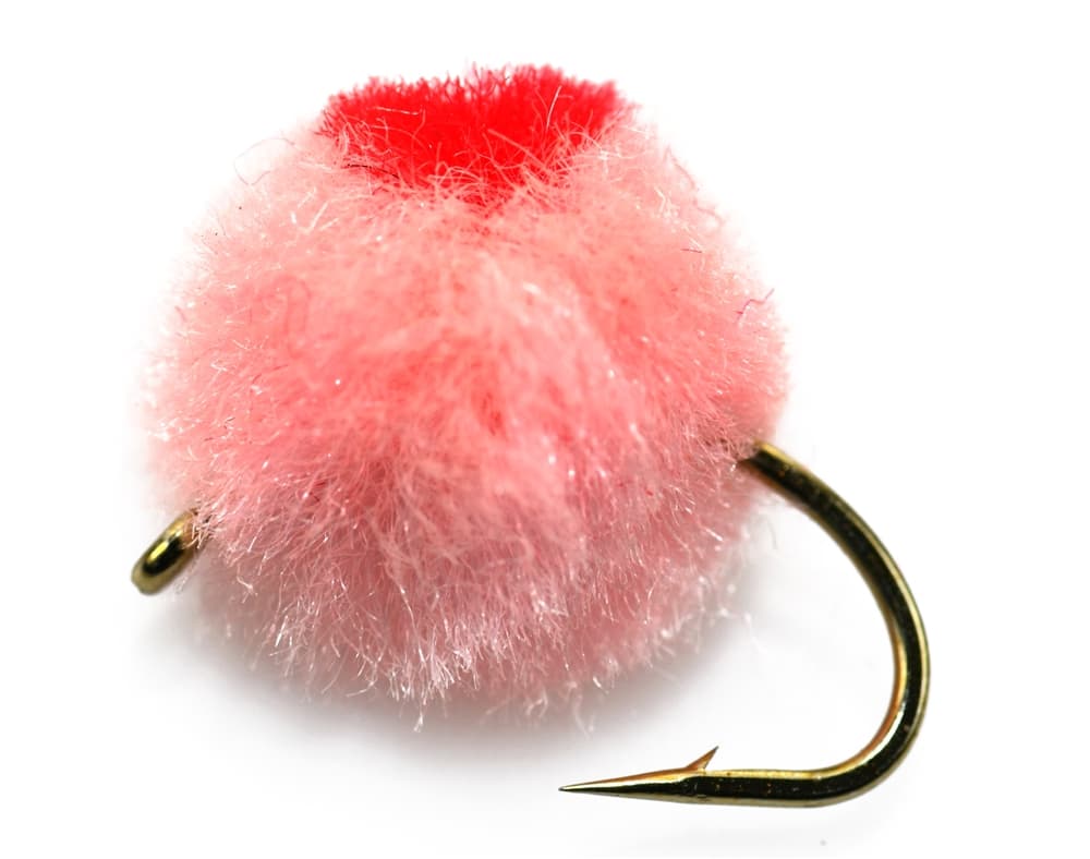 Fly family · report suggests “Egg pattern”Egg Fly PatternsEgg flies are tied to the hook. Round clipped-yarn eggs, sparkly chenille eggs, veiled eggs, single eggs, and clusters differ in material and silhouette; pegged or free-sliding beads are rigs, not fly patterns.See family guide ↗Fly family · report suggests “yarn fly”Egg Fly PatternsEgg flies are tied to the hook. Round clipped-yarn eggs, sparkly chenille eggs, veiled eggs, single eggs, and clusters differ in material and silhouette; pegged or free-sliding beads are rigs, not fly patterns.See family guide ↗+ 3 more reviewed guides in the Fly Box Fly family · report suggests “Egg pattern”Egg Fly PatternsEgg flies are tied to the hook. Round clipped-yarn eggs, sparkly chenille eggs, veiled eggs, single eggs, and clusters differ in material and silhouette; pegged or free-sliding beads are rigs, not fly patterns.See family guide ↗
 Fly pattern · report suggests “woolly bugger”Woolly BuggerThe shared pattern language is a marabou tail, chenille or dubbed body, and palmered hackle. Bead heads, dumbbell eyes, flash, rubber tails, colors, and body materials materially change the tied variation and must be labeled.See photos & how to fish it ↗+ 2 more reviewed guides in the Fly Box
  Fly family · report suggests “Poppers”Bass and Panfish Popper PatternsPoppers may use cupped foam, cork, balsa, deer hair, or pencil-shaped heads. Head face, size, buoyancy, tail, legs, and weed guard determine sound and action; a generic popper label does not identify one fly.See family guide ↗
 Fly pattern · report suggests “Clouser”Clouser Deep MinnowThe reviewed chartreuse-and-white form uses sparse layered bucktail with flash around lead barbell eyes. The eyes make the fly sink between strips and ride hook point up; color, eye weight, hook, and saltwater materials must remain labeled.See photos & how to fish it ↗+ 2 more reviewed guides in the Fly Box Fly family · report suggests “Egg pattern”Egg Fly PatternsEgg flies are tied to the hook. Round clipped-yarn eggs, sparkly chenille eggs, veiled eggs, single eggs, and clusters differ in material and silhouette; pegged or free-sliding beads are rigs, not fly patterns.See family guide ↗
 Fly family · report suggests “midge”Midge Patterns by StageMidge wording can mean a threadlike larva, wing-padded pupa, film emerger, tiny adult, or visible cluster. Those profiles fish at different depths.See family guide ↗+ 2 more reviewed guides in the Fly Box
 Start at one of the named public parks and fish it thoroughly instead of bouncing between urban pull-ins and losing the best light.
During the steelhead windows, lead with eggs, leeches, and compact swing flies around current breaks and softer holding lanes.
Keep your lower-river plan mobile but short. The public access makes it easy to move, but the river still rewards reading one piece well.
If the water looks unsafe or the lower river smells like a harvest question more than a fishing day, leave fish in the river and shorten the trip.
Rules & closures
Open the agency page to confirm the exact river section, species, season, tackle rules, limits, and emergency closures.
Official links checkedWe checked the state source but did not find a clearly supported exception for this river. Check the official rules for the exact section you plan to fish.
This summary helps with trip planning. The linked agency rule is the one you must follow.
Updates from anglers
Recent observations from general areas of Sheboygan River. We review every update before it appears and never publish exact fishing spots, private access details, or photo locations.
You can still use the river plan above. Check back later for recent observations from other anglers.
Where this report comes from
Fishing guidance checked: Jun 3, 2026
Site check: Jul 14, 2026. We regularly test report links, live scores, flow and weather data, and page loading. The content date changes only when the fishing guidance or its sources change.
Common questions
Kiwanis Park, Roy Sebald Natural Area, and Esslingen Park are the cleanest official starts because Wisconsin DNR lists all three as lower-river public access points.
Be very careful. Wisconsin DNR says the lower 14 miles of the river and harbor carry fish-consumption advisories tied to contamination, so review the current advisory before keeping anything.
The best windows are steelhead and shoulder-season trout windows, but the river also supports other lower-river fish and should not be treated like a pure trout stream.
Skip unsafe high color, icy banks, or any day when public access is easy but the actual fishing window is not worth the cold-water and advisory tradeoffs.