RiverReports preview · current series loading
Recent flow
RiverReports gauge
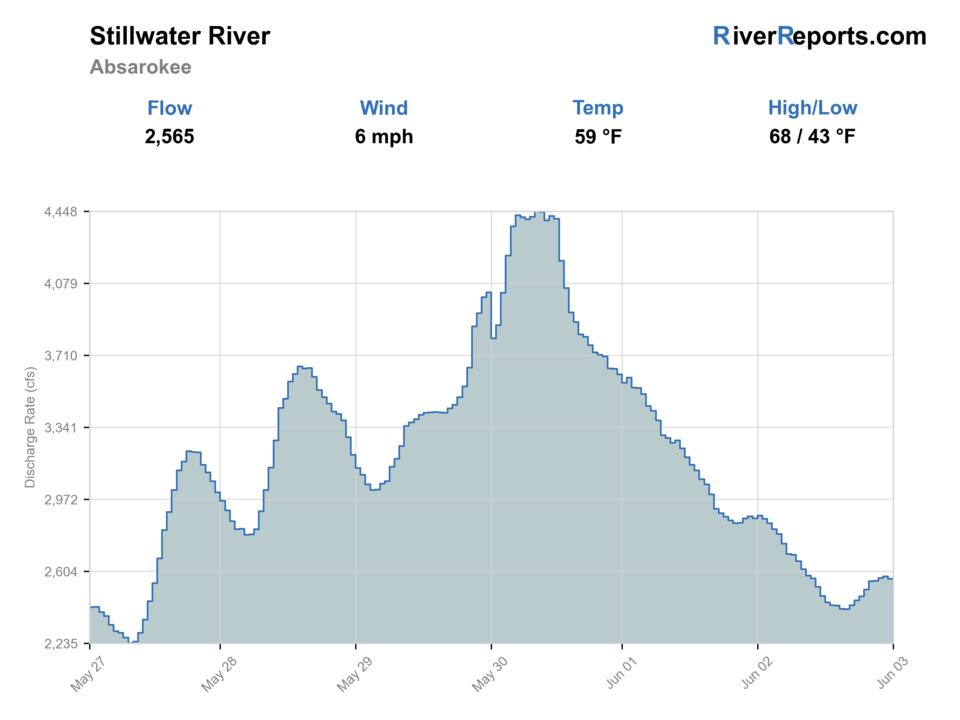
Showing the available RiverReports chart while the current structured flow series loads. Check the chart on RiverReports Opens in a new tab.
Best option: Floating. A float is in play where this report supports boat access and wind, releases, and shuttle logistics are manageable.
Rating updatedRiver local time:
USGS shows 419 cfs. The flow has been stable over about 6 hours. USGS marks this reading provisional and may revise it. USGS records for this date (1936-2026, 90 readings) show a typical middle range of 408 cfs to 585 cfs. Flow is within the typical range for this date, so weather, temperature, and access become the next checks.
NWS air forecast near
This is an air forecast, not a river-temperature reading. Check the water with a stream thermometer before fishing in hot weather.
RiverReports gauge
Showing the available RiverReports chart while the current structured flow series loads. Check the chart on RiverReports Opens in a new tab.
Mostly Cloudy
The National Weather Service forecast is temporarily unavailable.
RiverReports gauge: Stillwater River near Absarokee
Seasonal starting points, not a live hatch report. Match what you see on the water.
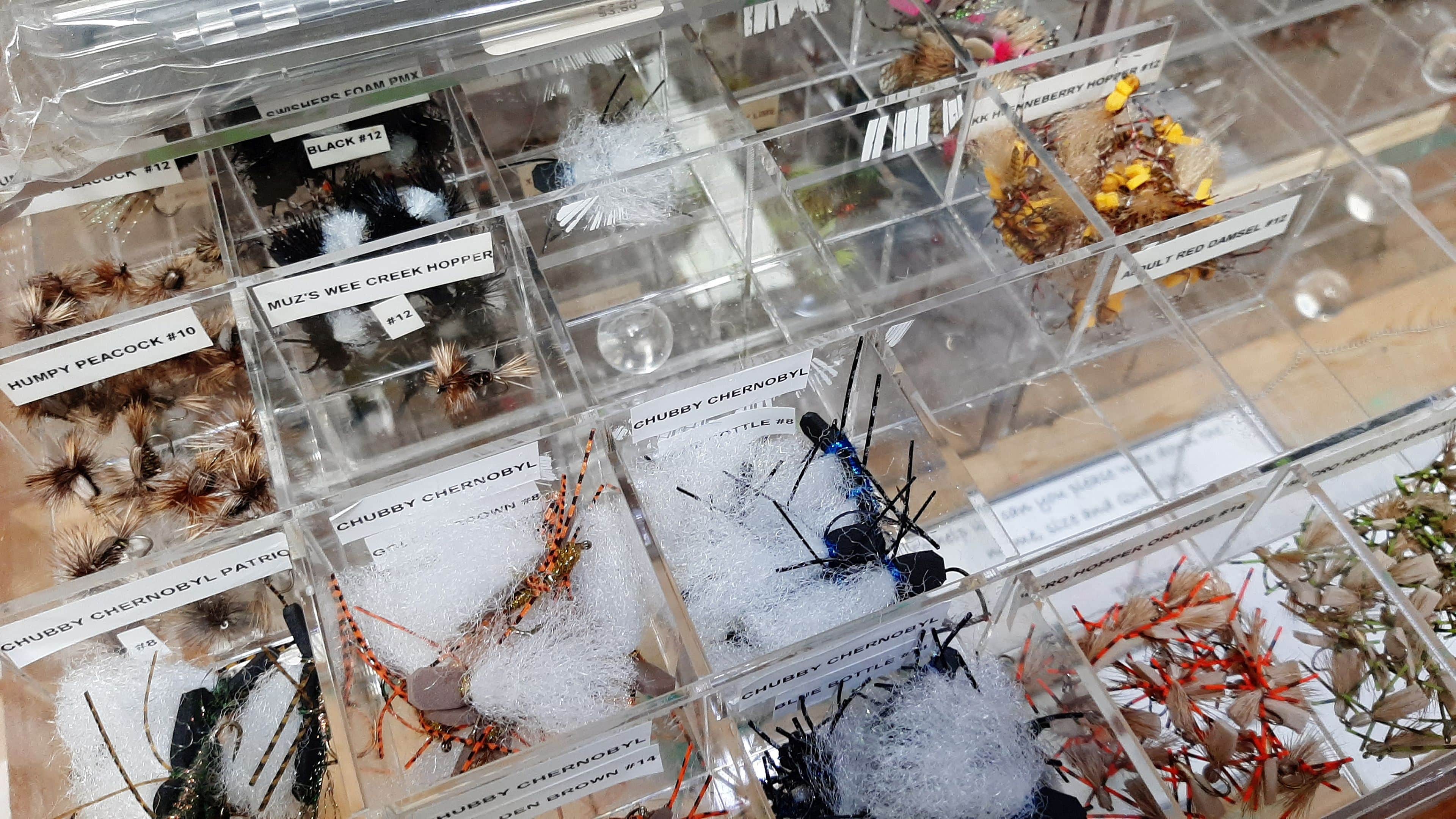
Also try Hopper-dropper
Each fly name opens its matching Fly Box guide.
The Stillwater usually improves after peak runoff when flows remain strong but clearer. Summer mornings, fall streamer days, and post-runoff dry-dropper windows are the main targets. Skip it when the river is too high to wade, too dirty to read, or too warm to handle trout well.
Often the best large-fly and nymph window when clarity returns but the river still has power.
Fish early, use dry-dropper rigs, and watch temperature during bright afternoons.
Usually a safety and clarity problem. Wait for the river to drop and define softer edges.
Good for streamers, baetis, and nymphing deeper slots with less recreational pressure.
These scores compare the risks of wading, bank fishing, and floating.
This report does not recommend wading on this reach.
This report does not recommend bank fishing on this reach.
A float is in play where this report supports boat access and wind, releases, and shuttle logistics are manageable.
Is Stillwater River worth the trip today? Check flow, weather, hatches, access, and rules for Montana before you go.
The Stillwater is a fast, bouldery Yellowstone-smaller stream trout river that rewards good timing. The best days have enough flow to keep fish comfortable, enough clarity to read seams, and enough caution to avoid treating a pushy freestone like an easy park-and-cast creek.
USGS shows 419 cfs. The flow has been stable over about 6 hours. USGS marks this reading provisional and may revise it. USGS records for this date (1936-2026, 90 readings) show a typical middle range of 408 cfs to 585 cfs. Flow is within the typical range for this date, so weather, temperature, and access become the next checks.
Fall: A strong lower-pressure window for streamers, nymphs, and blue-winged olives.
The current NWS air forecast is about 59F, and the next 24-hour high reaches about 66F. Mostly Cloudy.
No active NWS alert was returned for this forecast point.
Skip during heavy runoff, muddy water, dangerous wading, active closures, or hot afternoons that stress trout.
Dropping, clearing flows after runoff and moderate summer levels that leave pocket water readable without warming the river too much.
Skip during heavy runoff, muddy water, dangerous wading, active closures, or hot afternoons that stress trout.
Start with the Absarokee gauge, confirm access-site status, then pick either a short pocket-water wade or a conservative float based on the flow.
Shift to the Yellowstone or another lower-elevation option when Stillwater runoff is too high, or to cooler mountain water when summer heat becomes the limiter.
Use these places as starting points. Open the access link below and check posted signs before you park or enter.
Check Montana fishing rules and current waterbody closures before fishing. The Stillwater can be affected by runoff, warm-water stress, site closures, and changing access conditions.
The best planning anchor for the USGS gauge and lower Stillwater access decisions.
Use the current FWP map and site details because conditions, fees, or repairs can change.
A downstream option when flows and public access line up for a longer float plan.
Official agencies and primary river operators come first. Secondary tools are labeled so you know what carries the most weight.
Check what is allowed, where the rule applies, and whether the river is open.
Check the latest river reading and forecast before you leave.
Check public entry points, land rules, and seasonal access changes.
Use these links for stocking, safety, and other local details.
Check what is allowed, where the rule applies, and whether the river is open.
Open the current rules and check the river section, season, and special limits.
Check the latest river reading and forecast before you leave.
Open this page and check the latest safety advice before your trip.
Open this river reading to check the latest level, flow, and update time.
Open this river reading to check the latest level, flow, and update time.
Check public entry points, land rules, and seasonal access changes.
Open the land or access page, then check signs before you park or enter.
Open the land or access page, then check signs before you park or enter.
Use these links for stocking, safety, and other local details.
Open this page and check the latest safety advice before your trip.
What was checked: This report uses official regulation, flow, weather, access, and public-land sources first, then adds practical planning guidance for fly anglers.
Live measurements and forecasts keep their provider timestamps. Rules, access, and trip guidance use the source-review date shown here. BlueStreamFly planning advice is editorial interpretation, not an agency notice.
First-hand experience: BlueStreamFly does not claim a first-hand visit or local field test for this report unless a real contributor is explicitly named and linked.
It is usually best after runoff drops into shape, during cool summer mornings, and through fall when water temperatures and clarity are favorable.
It can be safe at moderate flows, but it is a fast bouldery freestone. High water, slick rocks, and pushy pockets make wading risky.
Check RiverReports, USGS 06205000 near Absarokee, Montana rules, current closure notices, access site status, and the weather forecast.