RiverReports preview · current series loading
Recent flow
RiverReports gauge
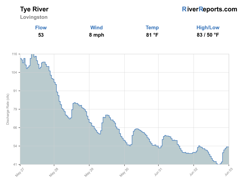
Showing the available RiverReports chart while the current structured flow series loads. Check the chart on RiverReports Opens in a new tab.
No single best way to fish. Wading, Bank fishing, and Floating have the same top score. Use current access, footing, weather, and local rules to choose.
Rating updatedRiver local time:
USGS shows 17 cfs. The flow has been stable over about 6 hours. USGS marks this reading provisional and may revise it. USGS records for this date (1939-2025, 87 readings) show a median near 48 cfs and the lower quartile near 23 cfs; today's flow is below normal for the date. This is below normal, so edge depth, temperature, and pressure matter.
NWS air forecast near
This is an air forecast, not a river-temperature reading.
RiverReports gauge
Showing the available RiverReports chart while the current structured flow series loads. Check the chart on RiverReports Opens in a new tab.
Clear
The National Weather Service forecast is temporarily unavailable.
RiverReports gauge: TYE RIVER NEAR LOVINGSTON, VA
Seasonal starting points, not a live hatch report. Match what you see on the water.
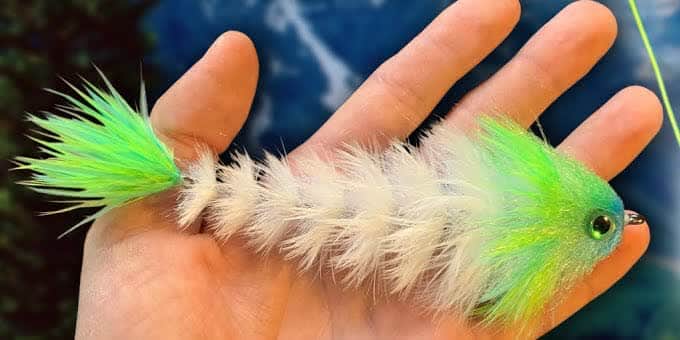
Also try Crayfish, hellgrammite
Each fly name opens its matching Fly Box guide.
The Tye is strongest when the gauge is stable or gently falling and the river is clear enough to show ledges, shade lines, and rock-pocket feeding lanes. Skip the page when storms have the river jumping or when low hot water squeezes fish into obvious stressed holding water.
The best window for wading ledges, drifting nymphs, and fishing streamers or topwater through defined current lanes.
A good reason to wait, because the river gets faster and less readable faster than the long walk makes worth forcing.
Fish early or late and protect any trout you encounter by keeping the day short and handling minimal.
A skip signal for this walk-in page because you lose both wading confidence and fish location clarity.
Wading, Bank fishing, and Floating have the same top score. Use current access, footing, weather, and local rules to choose.
Wading is in play only where your chosen access has clear footing, legal entry, and no forced crossings.
Bank and edge fishing remains a practical low-commitment option if access is legal and footing is safe.
A float is in play where this report supports boat access and wind, releases, and shuttle logistics are manageable.
Is Tye River worth the trip today? Check flow, weather, hatches, access, and rules for Virginia before you go.
Virginia DWR's cleanest public Tye access is the wildlife management area, and that shapes the whole page. This is a smallmouth-first plan with a little trout crossover value, not a broad float guide. Stable flow at the Lovingston gauge and a willingness to hike from the ridgetop parking area matter more here than trying to piece together unofficial bridge pull-offs.
USGS shows 17 cfs. The flow has been stable over about 6 hours. USGS marks this reading provisional and may revise it. USGS records for this date (1939-2025, 87 readings) show a median near 48 cfs and the lower quartile near 23 cfs; today's flow is below normal for the date. This is below normal, so edge depth, temperature, and pressure matter.
Fall: A strong smallmouth streamer season with cleaner water and less pressure around the public reach.
The current NWS air forecast is about 43F, and the next 24-hour high reaches about 70F. Clear.
No active NWS alert was returned for this forecast point.
Skip when water is rising, murky, too hot for the hike, footing is unsafe, private-road temptation enters the plan, or you are not ready for spotty service.
Use the Lovingston gauge with WMA access and recent rain. Stable clear flow is the best smallmouth signal.
Skip when water is rising, murky, too hot for the hike, footing is unsafe, private-road temptation enters the plan, or you are not ready for spotty service.
Start with USGS 02027000, confirm WMA access, then commit to the ridgetop parking walk only if stable water and weather justify it.
Compare Maury River, South River, or a larger smallmouth route when the Tye is rising, muddy, too hot, or access does not fit.
Use these places as starting points. Open the access link below and check posted signs before you park or enter.
Check Virginia freshwater rules and current WMA access requirements before fishing the Tye River. Treat the WMA as the legal public-access spine for this page, and review Virginia fish-consumption advisories if you plan to keep any fish.
Use the official DWR WMA parking area near Norwood as the public starting point. Confirm the required Virginia fishing license, DWR access permit, boat registration, or Restore the Wild membership before entering.
DWR describes the main access road along the ridge as vehicle-open during hunting seasons and otherwise open to users on foot or bikes, so plan the approach as a walk unless the gate status clearly says otherwise.
The WMA fronts roughly two miles of the Tye River, but the fishing plan starts with about a mile-and-a-half walk from the ridgetop to bank and wade water.
DWR says there is no boating access site at the WMA and warns that the gated no-trespassing road off the parking lot crosses private property, so avoid shortcut, shuttle, and float assumptions.
Official agencies and primary river operators come first. Secondary tools are labeled so you know what carries the most weight.
Check what is allowed, where the rule applies, and whether the river is open.
Check the latest river reading and forecast before you leave.
Check public entry points, land rules, and seasonal access changes.
Check what is allowed, where the rule applies, and whether the river is open.
Open the current fish eating advice and check which fish and waters it covers.
Open the current rules and check the river section, season, and special limits.
Open the current rules and check the river section, season, and special limits.
Check the latest river reading and forecast before you leave.
Open this page and check the latest safety advice before your trip.
Open this river reading to check the latest level, flow, and update time.
Open this river reading to check the latest level, flow, and update time.
Check public entry points, land rules, and seasonal access changes.
Open the land or access page, then check signs before you park or enter.
What was checked: This report starts with official regulation, access, flow, weather, and public-water sources, then adds practical planning guidance for fly anglers.
Live measurements and forecasts keep their provider timestamps. Rules, access, and trip guidance use the source-review date shown here. BlueStreamFly planning advice is editorial interpretation, not an agency notice.
First-hand experience: BlueStreamFly does not claim a first-hand visit or local field test for this report unless a real contributor is explicitly named and linked.
Treat it as a smallmouth-first page. Virginia DWR documents trout presence on the WMA, but the official public access and the lower gauge reach line up better with a warmwater bass plan.
Start with the official Tye River WMA parking and plan on the walk to the river. That is the clearest public access path in the current official source stack.
Not as a primary plan. Virginia DWR says there is no boating access site at the WMA, so this page is built for bank and wade fishing.
Skip it when the Lovingston gauge is still rising, when the river is muddy enough to hide structure, or when heat and low water would make a long walk for marginal fish a poor trade.