Wade, bank, and floatLimited data
Use the live sources and what you see at the river before choosing an approach.
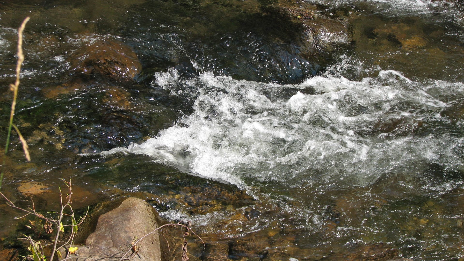
Fly fishing report · Southeast
A Little River above Townsend report for Smokies wild trout, USGS flow, dry-dropper tactics, hatches, access, and NPS/TWRA source checks.
Check flow & weatherCurrent USGS flow is 316 cfs. It has fallen about 18% over the past 6 hours. Today's flow is high for this date; the upper end of the normal range is near 247 cfs. Fishable water may exist, but do not rate it highly without a safe access, clarity, and wading or boat plan.
There is not enough reliable current information to recommend wading, bank fishing, or floating.
Use the live sources and what you see at the river before choosing an approach.
Check before you drive
Look at whether the river is rising or falling, then check wind, rain, and storms. These can change both safety and fishing.
Before you rely on this report
Conditions can change quickly. Check these dates before you decide to fish, and open the official source when safety or rules matter.
High confidence in the current score inputs.
6 sources are listed below for you to open.
3 public access records are listed. Private spots are never shown.
Source checked Jul 30, 2026
Plan your access
These are public parking, launch, trail, or recreation areas—not secret fishing spots. We never show an angler's private pins, notes, or photos here.
Parking
Use official NPS rules, parking, and current road status.
Park water has specific fishing rules and resource-protection expectations.
Do not move rocks, crowd pools, or leave the trail/road plan unclear.
Area description
USGS 03497300 is the core flow check for this report.
Park water has specific fishing rules and resource-protection expectations.
Do not move rocks, crowd pools, or leave the trail/road plan unclear.
Area description
Brook trout and smaller water require extra care and rule checks.
Park water has specific fishing rules and resource-protection expectations.
Do not move rocks, crowd pools, or leave the trail/road plan unclear.
How to fish it
Little River above Townsend is one of the most useful Smokies flow checks for wild trout anglers. USGS 03497300 fits the core report, while lower Maryville water should be treated as a different warmwater plan.
USGS shows 316 cfs with a falling about 18% over about 6 hours trend. Today's flow is high for this date; the upper end of the normal range is near 247 cfs. Fishable water may exist, but do not rate it highly without a safe access, clarity, and wading or boat plan.
Trout and salmonids need extra handling discipline in this temperature window; consider warmwater targets where that matches the river and rules.
USGS water temperature is about 69F. Fish early and stop if handling stress is likely.
The forecast has storm or heavy-precipitation risk, so timing and access matter more than the score alone.
Summer: Fish early and shaded water; monitor temperature closely.
Read the water
Little River is most useful when flows are safe, water is cool, and you fish the pocket water methodically. The best plan is light, mobile, and tied to current park rules.
Use smaller dries, longer tippet, and avoid standing in feeding lanes.
Dry-dropper rigs and high-stick nymphing cover broken water well.
Do not force wading; fish edges only if the river is safe.
Check temperature, fish early, and stop when trout handling becomes risky.
Your trip plan
Use USGS 03497300 above Townsend as the primary mountain-reach trend and safety check, then compare Maryville only for lower-river context. Stable, cool water is best; fast storm rises should narrow or cancel the plan.
Skip or pivot when thunderstorms are building, the Townsend gauge is rising sharply, trout water is too warm, park rules or road status are uncertain, or the intended pullout is crowded beyond safe rotation.
Start with NPS rules, TWRA statewide context, the Townsend gauge, weather, and one legal access or trailhead. Fish short drifts, pocket seams, shaded edges, and dry-dropper rigs before moving far.
If Little River is high, warm, crowded, or stormy, compare Little Pigeon River for another Smokies-to-mainstem option, Tellico River for a Cherokee National Forest freestone plan, or Clinch River for a tailwater backup.
Hatches & flies
 Fly pattern · report suggests “Parachute Adams”Parachute AdamsThe upright light post and horizontal parachute hackle are the defining visual cues. The classic pilot example uses a gray-brown body and divided tail, but color and size variations should be labeled instead of treated as identical.See photos & how to fish it ↗
 Fly family · report suggests “Blue Quill”Blue Quill PatternsBlue Quill is hatch wording rather than one mandatory recipe. The traditional dry is only one adult imitation; subsurface and spent stages need different profiles.See family guide ↗+ 3 more reviewed guides in the Fly Box
  Fly family · report suggests “Yellow Sally”Yellow Sally PatternsYellow Sally names a group of small stoneflies, not one fly. Nymph and adult forms differ sharply, and local size and yellow, cream, or chartreuse tones must be checked.See family guide ↗
 Fly family · report suggests “sulphur dry”Sulphur Mayfly PatternsSulphur is hatch wording. Nymphs, emergers, Comparaduns, parachutes, traditional dries, soft hackles, and spinners have different silhouettes and depths.See family guide ↗+ 2 more reviewed guides in the Fly Box
  Fly family · report suggests “Foam ant”Ant PatternsAnt patterns can be foam, fur-bodied, winged, or sunken. The narrow waist and paired body lobes matter more than one material recipe.See family guide ↗
 Fly family · report suggests “beetle”Beetle PatternsBeetle flies range from simple foam shells to hair-bodied and sunken forms. A rounded back and compact profile distinguish the family from ants and hoppers.See family guide ↗+ 3 more reviewed guides in the Fly Box
  Fly family · report suggests “BWO emerger”Blue-Winged Olive PatternsBWO describes a hatch group, not one fly. Nymph, emerger, dry, cripple, and spinner profiles must stay separate because they occupy different parts of the water column.See family guide ↗
 Fly pattern · report suggests “zebra midge”Zebra MidgeLook for a very slim tapered thread body, evenly spaced contrasting wire rib, a small bead, and no tail or wing. The reviewed classic is black with silver wire and a silver bead. Red, olive, brown, glass-bead, jig-hook, resin-coated, or tailed forms must remain labeled variations rather than replacing the classic identity.See photos & how to fish it ↗+ 3 more reviewed guides in the Fly Box
 Fish upstream with short casts and keep most of the leader off the water.
Use dry-dropper rigs in pocket water and switch to small nymphs in deeper slots.
Target plunge-pool tails, boulder seams, and shaded bank pockets.
Move often, but slow down before each cast so you do not step on fish.
Use small streamers only when rain adds safe color and fish have cover.
Rules & closures
Open the agency page to confirm the exact river section, species, season, tackle rules, limits, and emergency closures.
Official links checkedWe checked the state source but did not find a clearly supported exception for this river. Check the official rules for the exact section you plan to fish.
This summary helps with trip planning. The linked agency rule is the one you must follow.
Updates from anglers
Recent observations from general areas of Little River. We review every update before it appears and never publish exact fishing spots, private access details, or photo locations.
You can still use the river plan above. Check back later for recent observations from other anglers.
Where this report comes from
Fishing guidance checked: Jul 6, 2026
Site check: Jul 14, 2026. We regularly test report links, live scores, flow and weather data, and page loading. The content date changes only when the fishing guidance or its sources change.
Common questions
Check NPS rules, USGS 03497300, NWS weather, road/access status, and water temperature.
Start with the above-Townsend and Little River Road corridor, then match the water to safe flow.
Yes at safe flows, but boulders are slick and storm rises can make crossings dangerous.
Bring the seasonal fly box, then adjust size, weight, and color to water level, clarity, temperature, and fishing pressure.