Wade · Best fit74/100
Wading is in play only where your chosen access has clear footing, legal entry, and no forced crossings.
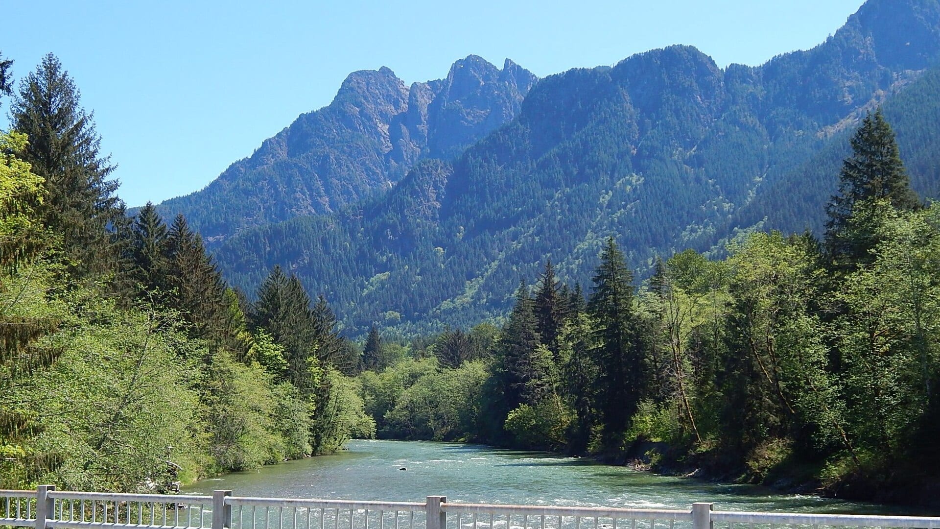
Fly fishing report · Pacific Northwest
A lower Snoqualmie report for flow, rain timing, WDFW rules, coho and gamefish cautions, access, weather, and practical fly choices.
Check flow & weatherCurrent USGS flow is 601 cfs and has been stable for about 6 hours. Today's flow is unusually low for this date and below the usual low-water marker near 717 cfs. Low water can make fish spooky, warm, pressured, or concentrated; check temperature and handling risk.
Compare wading, bank fishing, and floating before choosing how you will fish.
Wading is in play only where your chosen access has clear footing, legal entry, and no forced crossings.
Bank and edge fishing remains a practical low-commitment option if access is legal and footing is safe.
This report does not describe this as a primary mode. Verify legal access, depth, launches, and retreat options before planning around it.
Check before you drive
Look at whether the river is rising or falling, then check wind, rain, and storms. These can change both safety and fishing.
Before you rely on this report
Conditions can change quickly. Check these dates before you decide to fish, and open the official source when safety or rules matter.
High confidence in the current score inputs.
7 sources are listed below for you to open.
3 public access records are listed. Private spots are never shown.
Source checked Jul 30, 2026
Plan your access
These are public parking, launch, trail, or recreation areas—not secret fishing spots. We never show an angler's private pins, notes, or photos here.
Area description
Lower-river access context with rain and private-land awareness.
Lowland private land and soft banks make legal access and safe exits important.
Flood stages and rain rises should override any fly plan.
Area description
Best flow reference for lower-river trend.
Lowland private land and soft banks make legal access and safe exits important.
Flood stages and rain rises should override any fly plan.
Area description
Different rules and character; check separately before fishing.
Lowland private land and soft banks make legal access and safe exits important.
Flood stages and rain rises should override any fly plan.
How to fish it
The Snoqualmie can mean different things to different anglers. This report focuses on lower-river planning below Snoqualmie Falls while reminding anglers that forks, tributaries, coho windows, and gamefish rules may differ.
USGS shows 601 cfs with a stable over about 6 hours trend. Today's flow is unusually low for this date and below the usual low-water marker near 717 cfs. Low water can make fish spooky, warm, pressured, or concentrated; check temperature and handling risk.
Summer: Lower flows can improve access but may reduce trout-safe options.
The NWS forecast is about 70F with Mostly Sunny.
No active NWS alert was returned for this forecast point.
Skip the Snoqualmie when WDFW rules do not clearly support the exact reach and species, when rain pushes the Carnation gauge up quickly, when banks are muddy or undercut, or when the trip depends on applying fork or Tokul Creek assumptions to the lower mainstem.
Read the water
The best lower-river days are stable or dropping after rain, with enough clarity to fish edges and a current rule that supports the target species.
Best time to look for clarity and safer edges.
Skip fishing; lowland banks and wood hazards become serious.
Use stealth, smaller flies, and longer leaders.
Check each fork separately before applying lower-river assumptions.
Your trip plan
Use USGS 12149000 near Carnation as the lower-river trend and USGS 12144500 near Snoqualmie for upstream context. Stable or slowly falling water is the best fit; sharp rain bumps, high water, or poor clarity should move the plan to edge scouting or another river.
Skip the Snoqualmie when WDFW rules do not clearly support the exact reach and species, when rain pushes the Carnation gauge up quickly, when banks are muddy or undercut, or when the trip depends on applying fork or Tokul Creek assumptions to the lower mainstem.
Pick the reach first: Carnation and lower-valley water for the main report, Snoqualmie-area water for upstream context, or the forks only after a separate rule and access check. Then match the fly plan to clarity and legal species.
If the Snoqualmie is high, off-color, crowded, or legally unclear, compare the Skykomish for another Snohomish-system rule check, the Sauk for a North Cascades plan, or the Yakima for a more dependable trout-centered day.
Hatches & flies
 Fly family · report suggests “BWO emerger”Blue-Winged Olive PatternsBWO describes a hatch group, not one fly. Nymph, emerger, dry, cripple, and spinner profiles must stay separate because they occupy different parts of the water column.See family guide ↗
 Fly pattern · report suggests “zebra midge”Zebra MidgeLook for a very slim tapered thread body, evenly spaced contrasting wire rib, a small bead, and no tail or wing. The reviewed classic is black with silver wire and a silver bead. Red, olive, brown, glass-bead, jig-hook, resin-coated, or tailed forms must remain labeled variations rather than replacing the classic identity.See photos & how to fish it ↗+ 3 more reviewed guides in the Fly Box
  Fly pattern · report suggests “Elk hair caddis”Elk Hair CaddisLook for a tented elk- or deer-hair wing, clipped hair head, dubbed body, rib, and hackle palmered along the body. The body color should be labeled because tiers often match different natural caddis colors.See photos & how to fish it ↗
 Fly family · report suggests “PMD emerger”Pale Morning Dun PatternsPMD names an insect group, not one fly. Pale nymphs, trailing-shuck emergers, upright or low-riding duns, cripples, and spent-wing spinners stay visibly separate.See family guide ↗+ 3 more reviewed guides in the Fly Box
  Fly family · report suggests “Foam hopper”Grasshopper PatternsHopper patterns share a substantial body and long rear-leg impression, but foam, deer hair, wing construction, and waterline differ widely among named patterns.See family guide ↗
 Fly family · report suggests “ant”Ant PatternsAnt patterns can be foam, fur-bodied, winged, or sunken. The narrow waist and paired body lobes matter more than one material recipe.See family guide ↗+ 4 more reviewed guides in the Fly Box
  Fly family · report suggests “October caddis”October Caddis PatternsOctober Caddis names a hatch group. Amber or orange pupae, soft-hackle or wet forms, and large tent-wing adults fish at different levels.See family guide ↗Fly family · report suggests “BWO emerger”Blue-Winged Olive PatternsBWO describes a hatch group, not one fly. Nymph, emerger, dry, cripple, and spinner profiles must stay separate because they occupy different parts of the water column.See family guide ↗+ 3 more reviewed guides in the Fly Box
 Decide whether you are fishing the lower river or a fork before choosing flies.
Use streamers and soft hackles along edges when clarity is limited but legal fishing is open.
In clearer water, fish smaller nymphs and dries along softer seams.
Avoid side channels with spawning salmonids or redds.
Watch the hydrograph during the day if heavy rain is forecast.
Rules & closures
Open the agency page to confirm the exact river section, species, season, tackle rules, limits, and emergency closures.
Official links checkedWe checked the state source but did not find a clearly supported exception for this river. Check the official rules for the exact section you plan to fish.
This summary helps with trip planning. The linked agency rule is the one you must follow.
Updates from anglers
Recent observations from general areas of Snoqualmie River. We review every update before it appears and never publish exact fishing spots, private access details, or photo locations.
You can still use the river plan above. Check back later for recent observations from other anglers.
Where this report comes from
Fishing guidance checked: Jun 1, 2026
Site check: Jul 14, 2026. We regularly test report links, live scores, flow and weather data, and page loading. The content date changes only when the fishing guidance or its sources change.
Common questions
WDFW emergency rules, Carnation flow, forks versus lower river, coho/gamefish status, rain, and access
Use USGS 12149000 Snoqualmie River near Carnation for lower-river trend and flood context.
Start by choosing lower river or fork water, then use public parks, bridges, and WDFW rules to confirm a legal plan.
Sometimes on low stable edges, but rain rises, soft banks, and wood make aggressive wading a bad idea.