Menu
West · 33 river reports
Idaho fly fishing reports
Idaho has a broad trout mix in the current inventory: spring creek style water, desert tailwaters, mountain freestones, big western rivers, and technical Henry's Fork style fishing.
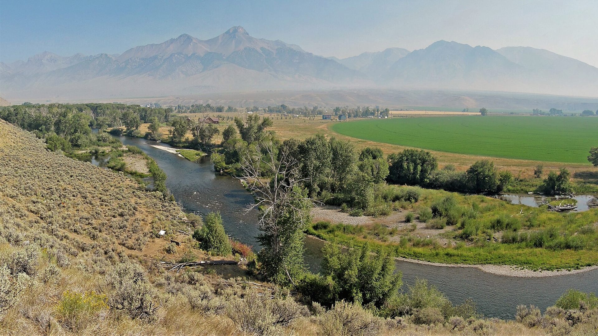
Compare riversBig Lost River · Photo: BLMIdaho · CC BY 2.5 · Cropped for display; not current conditions.
Fishability now
Start with the strongest current read.
Scores combine current flow, weather, access, and season. Open a river to see which live data came back and how sure we are about today's call.
Boise River
Boise River looks fishable right now.
Fishing-rating confidence: High · Score calculated Oct 23, 4:00 PM UTCPortneuf River
Portneuf River looks fishable right now.
Fishing-rating confidence: High · Score calculated Oct 23, 3:42 PM UTCSalmon River at Salmon
Salmon River at Salmon looks fishable right now.
Fishing-rating confidence: High · Score calculated Oct 23, 3:42 PM UTCChoose the right water
How to fish Idaho.
Idaho has a broad trout mix in the current inventory: spring creek style water, desert tailwaters, mountain freestones, big western rivers, and technical Henry's Fork style fishing.
The state hub should help anglers sort the trip by water type first. Silver Creek, the Henry's Fork, the South Fork of the Snake, the Big Lost, and the Boise River all ask different questions before you rig a rod.
Check Idaho Fish and Game regulations, closures, and reach-specific rules before fishing.
Use flow and temperature checks carefully on desert tailwaters and summer freestones.
Respect private property, preserve rules, boat ramp etiquette, and special access requirements.
Expect hatch timing and tactics to vary sharply between spring creeks, tailwaters, and freestones.
All Idaho reports
Find your river.
Alphabetical for fast scanning. The current score stays visible so you can compare before opening the full report.
Big Lost River
A Big Lost River report for the Mackay tailwater and valley access, RiverReports/USGS flow checks, IDFG rules, whitefish protection, hatches, flies, and dewatering cautions.
Big Lost River is a cautious call right now.
Big Wood River
A Big Wood River report for Ketchum and the Wood River Valley, RiverReports/USGS flow checks, IDFG reach rules, hatches, flies, Highway 75 access, and spring-closure planning.
Big Wood River does not look like a strong choice right now.
Boise River
A Boise River report for the Greenbelt and lower Boise corridor, RiverReports/USGS Glenwood flows, IDFG rules, access etiquette, hatches, flies, and high-water cautions.
Boise River looks fishable right now.
Clearwater River
A Clearwater River report for Orofino-area flows, lower-river steelhead planning, trout and cutthroat rules, US-12 access, hatches, flies, and source-checked safety.
Clearwater River looks fishable right now.
Coeur d'Alene River
A Coeur d'Alene River report that separates lower main-river access from North Fork trout water, with RiverReports/USGS flows, cutthroat rules, hatches, flies, and access cautions.
Coeur d'Alene River is a cautious call right now.
Deadwood River
A Lowman-focused Deadwood River planning page built around dam-influenced flows, Boise National Forest access, and remote-canyon trout water that rewards realistic logistics.
Deadwood River looks fishable right now.
Henry's Fork
An Ashton-focused Henry's Fork planning page built around the classic ranch and reservoir-to-river corridor, strict section-by-section rules, and flow-aware dry-fly timing.
Henry's Fork does not look like a strong choice right now.
Henry's Fork
A lower Henry's Fork planning page for the St. Anthony-to-Menan corridor, built around float access, lower-river rules, and realistic decisions about wind, weeds, and side channels.
Henry's Fork does not look like a strong choice right now.
Henry's Fork of the Snake River
A Henry's Fork report for Island Park, Box Canyon, Harriman Ranch, and lower reach planning, with RiverReports/USGS flows, IDFG rules, hatches, flies, and access notes.
Henry's Fork of the Snake River is a cautious call right now.
Little Salmon River
A Little Salmon River report for Riggins-area flows, trout, steelhead and salmon rule checks, Highway 95 access, private-bank cautions, hatches, flies, and weather.
Little Salmon River looks fishable right now.
Little Wood River
A Carey-area Little Wood River planning page built around Bear Tracks Williams access, irrigation-shaped summer flows, and a realistic walk-and-wade approach for one of south-central Idaho's quieter trout options.
Little Wood River does not look like a strong choice right now.
Lochsa River
Current Lowell flow, trout rules, Highway 12 access, and flies for the Lochsa River.
Lochsa River is a cautious call right now.
Mores Creek
A Highway 21 Mores Creek planning page built around close-to-Boise access, stocked-rainbow expectations, and honest calls about low summer water and traffic pressure.
Mores Creek does not look like a strong choice right now.
Payette River
A Highway 55 North Fork Payette planning page built around big canyon current, roadside campground access, and honest trout expectations on a rafting-famous river.
Payette River does not look like a strong choice right now.
Payette River
A practical Payette River planning page for the Garden Valley and Banks corridor, built around accessible public pull-ins, mixed float-and-wade decisions, and honest expectations about where trout water begins to feel warm, busy, or boat-heavy.
Payette River does not look like a strong choice right now.
Portneuf River
A practical Portneuf River planning page for the Pocatello and Lava Hot Springs corridor, where winter rules, mixed public access, and a broad range of river character matter more than chasing a single magic reach.
Portneuf River looks fishable right now.
Salmon River
A lower-canyon Salmon River page for anglers deciding whether the White Bird reach fits a bank session, jet-boat plan, or a backup stop on the Highway 95 corridor.
Salmon River looks fishable right now.
Salmon River at Salmon
A focused upper Salmon River report for the Salmon-to-North Fork corridor, built around flow checks, public access, trout tactics, and clear anadromous-fish guardrails.
Salmon River at Salmon looks fishable right now.
Silver Creek
A Silver Creek Idaho report for Picabo and the preserve area, with RiverReports/USGS flows, TNC and BLM access, IDFG rules, spring-creek hatches, flies, and etiquette.
Silver Creek does not look like a strong choice right now.
Snake River below American Falls Dam
A reach-specific Snake River page for the American Falls to Neeley corridor, where dam releases, reservoir conditions, access, and species rules shape the day.
Snake River below American Falls Dam is a cautious call right now.
South Fork Clearwater River
A Highway 14 corridor planning page for anglers deciding whether the South Fork Clearwater has the right mix of legal opportunity, Stites flow shape, and public access for a worthwhile day.
South Fork Clearwater River looks fishable right now.
South Fork of the Boise River
A South Fork Boise River report for the Anderson Ranch tailwater, Neal Bridge rules, canyon access, RiverReports/USGS flows, hatches, flies, and safe wading planning.
South Fork of the Boise River does not look like a strong choice right now.
South Fork of the Snake River
A South Fork Snake River report for Palisades, Swan Valley, Conant, Heise, and lower floats, with RiverReports/USGS flows, IDFG rules, access, hatches, flies, and boat-safety notes.
South Fork of the Snake River is a cautious call right now.
South Fork Payette River
A South Fork Payette planning page centered on the Lowman-to-Garden Valley corridor, where cold gradient, public camp-and-access sites, and strong current make section choice more important than trying to fish every visible run.
South Fork Payette River does not look like a strong choice right now.
South Fork Snake River at Lorenzo
A lower South Fork Snake planning page centered on Byington, Lorenzo, and Menan access, where downstream float length, wind, and the Lorenzo gauge matter more than famous upper-river hype.
South Fork Snake River at Lorenzo does not look like a strong choice right now.
South Teton River near Rexburg
A reach-specific South Teton report for anglers who need tributary rules, flow context, small-water tactics, and realistic access expectations near Rexburg.
South Teton River near Rexburg does not look like a strong choice right now.
St. Joe River
A St. Joe River report for Calder flows, lower road access, upper Wild and Scenic water, cutthroat rules, hatches, dry flies, road planning, and source-checked safety.
St. Joe River looks fishable right now.
Teton River
A valley-wide Teton River planning page for anglers who need to connect Driggs-area trout water, lower-valley access, and the main-stem rule set before committing to a float or long wade day.
Teton River does not look like a strong choice right now.
Teton River
A Driggs-focused Teton River planning page for anglers who care more about upper-valley meadow cutthroat water, bridge access rhythm, and the South Leigh Creek gauge than about the lower basin.
Teton River looks fishable right now.
Trail Creek
A Trail Creek planning page for anglers deciding whether Ketchum's small Big Wood tributary has enough post-runoff shape for a short technical session or whether it is better left as a quick stop and a backup option.
Trail Creek does not look like a strong choice right now.
Trail Creek
A reach-focused Trail Creek page for anglers deciding whether the Sun Valley side still has enough cold flow, cover, and public pull-off access for a worthwhile small-stream session.
Trail Creek is a cautious call right now.
Upper Lost River Drainage
An Upper Lost River Drainage report for Copper Basin, Howell Ranch, East Fork and North Fork context, with USGS flows, IDFG rules, remote access, hatches, flies, and safety.
Upper Lost River Drainage looks fishable right now.
Warm Springs Creek
A practical Warm Springs Creek page for anglers weighing Ketchum convenience against flow, heat, stocking timing, and the limited windows when this Big Wood tributary still fishes well.
Warm Springs Creek needs a live-condition check before you commit.
This state fits
Who should fish Idaho.
Idaho state content should connect source links with water type. Good SEO value comes from explaining why each river requires a different planning path.
Technical trout anglers comparing spring creek and tailwater conditions
Big-river float planning on Snake River systems
Mountain and high-desert anglers checking access, flows, and temperature
Readers deciding between close-to-town access and destination trout water
Explore beyond Idaho